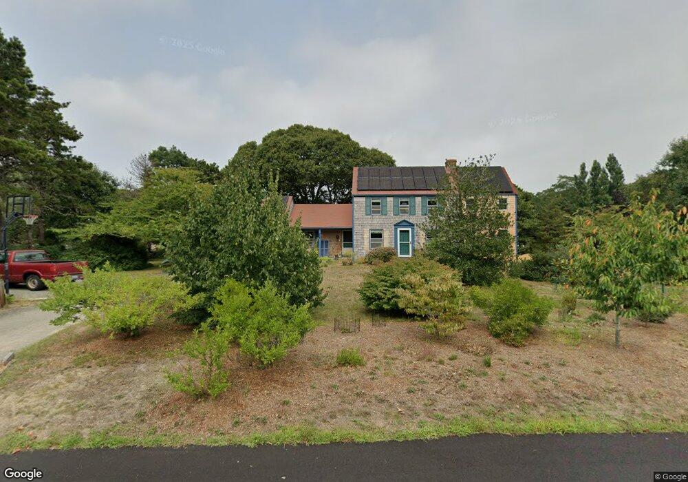
255 Quail Cover Ln Eastham, MA 02642
Estimated Value: $765,586 - $894,000
3
Beds
2
Baths
1,550
Sq Ft
$550/Sq Ft
Est. Value
About This Home
This home is located at 255 Quail Cover Ln, Eastham, MA 02642 and is currently estimated at $852,397, approximately $549 per square foot. 255 Quail Cover Ln is a home located in Barnstable County with nearby schools including Eastham Elementary School, Nauset Regional Middle School, and Nauset Regional High School.
Ownership History
Date
Name
Owned For
Owner Type
Purchase Details
Closed on
Feb 22, 2010
Sold by
Duff Michael Cumming and Brady Miriam Judith
Bought by
Mechling Jessie S and Blanco-Roman Adela M
Current Estimated Value
Home Financials for this Owner
Home Financials are based on the most recent Mortgage that was taken out on this home.
Original Mortgage
$228,000
Outstanding Balance
$151,951
Interest Rate
5.17%
Mortgage Type
Purchase Money Mortgage
Estimated Equity
$700,446
Purchase Details
Closed on
Mar 10, 2009
Sold by
Duff Mary E
Bought by
Duff Karen and Duff Kenneth John
Create a Home Valuation Report for This Property
The Home Valuation Report is an in-depth analysis detailing your home's value as well as a comparison with similar homes in the area
Home Values in the Area
Average Home Value in this Area
Purchase History
| Date | Buyer | Sale Price | Title Company |
|---|---|---|---|
| Mechling Jessie S | $378,000 | -- | |
| Duff Karen | -- | -- |
Source: Public Records
Mortgage History
| Date | Status | Borrower | Loan Amount |
|---|---|---|---|
| Open | Mechling Jessie S | $228,000 |
Source: Public Records
Tax History Compared to Growth
Tax History
| Year | Tax Paid | Tax Assessment Tax Assessment Total Assessment is a certain percentage of the fair market value that is determined by local assessors to be the total taxable value of land and additions on the property. | Land | Improvement |
|---|---|---|---|---|
| 2025 | $4,614 | $598,500 | $270,400 | $328,100 |
| 2024 | $4,074 | $581,100 | $262,500 | $318,600 |
| 2023 | $3,768 | $520,500 | $243,100 | $277,400 |
| 2022 | $3,557 | $414,600 | $217,000 | $197,600 |
| 2021 | $3,460 | $376,900 | $197,300 | $179,600 |
| 2020 | $3,220 | $369,300 | $201,300 | $168,000 |
| 2019 | $2,959 | $358,700 | $195,500 | $163,200 |
| 2018 | $2,908 | $348,300 | $189,800 | $158,500 |
| 2017 | $2,716 | $343,800 | $186,100 | $157,700 |
| 2016 | $2,390 | $321,200 | $158,200 | $163,000 |
| 2015 | $2,200 | $309,900 | $155,100 | $154,800 |
Source: Public Records
Map
Nearby Homes
- 5 Striper Ave
- 95 Toland Dr
- 160 Toland Dr
- 125 Wamsutta Rd
- 5470 State Hwy
- 495 Aspinet Rd
- 100 Gigi Ln
- 1460 Massasoit Rd
- 1285 Massasoit Rd
- 140 Harvest Rd
- 25 Massasoit Trail
- 11 Whelpley Rd
- 115 Sparrowhawk Ln
- 230 Massasoit Trail
- 675 N Sunken Meadow Rd
- 176 Village Ln
- 35 Old County Rd Unit 1
- 210 West Rd Unit B9
- 210 West Rd Unit M-16
- 60 Turnip Field Rd
- 235 Quail Cover Ln
- 115 Leeward Way
- 250 Quail Cover Ln
- 90 Leeward Way
- 230 Quail Cover Ln
- 60 Leeward Way
- 120 Leeward Way
- 205 Quail Cover Ln
- 35 Leeward Way
- 125 Leeward Way
- 210 Quail Cover Ln
- 25 Quail Cover Ln
- 190 Aspinet Rd
- 30 Leeward Way
- 65 Wilson Ave
- 5365-R State Hwy
- 45 Quail Cover Ln
- 35 Wilson Ave
- 20 N Sunken Meadow Rd
- 175 Quail Cover Ln