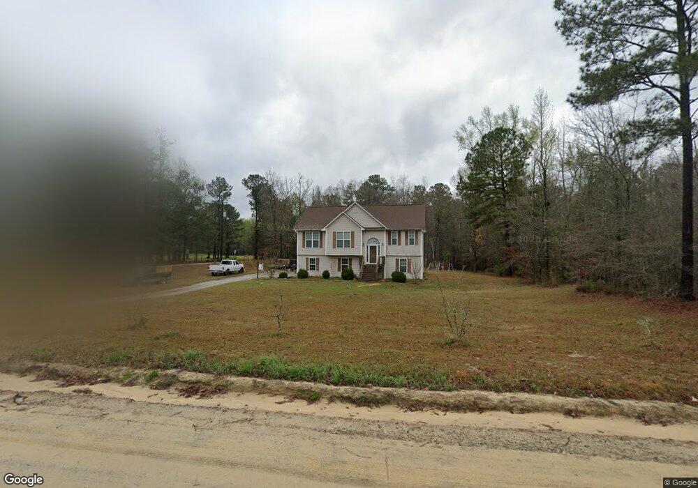
255 Sandy Ln Brooks, GA 30205
Spalding County NeighborhoodEstimated Value: $318,365 - $377,000
3
Beds
3
Baths
1,878
Sq Ft
$181/Sq Ft
Est. Value
About This Home
This home is located at 255 Sandy Ln, Brooks, GA 30205 and is currently estimated at $340,841, approximately $181 per square foot. 255 Sandy Ln is a home located in Spalding County with nearby schools including Moreland Road Elementary School, Carver Road Middle School, and Griffin High School.
Ownership History
Date
Name
Owned For
Owner Type
Purchase Details
Closed on
May 15, 2017
Sold by
Munro David A
Bought by
Wooten Johnny R and Wooten Libertad L
Current Estimated Value
Home Financials for this Owner
Home Financials are based on the most recent Mortgage that was taken out on this home.
Original Mortgage
$167,676
Outstanding Balance
$138,360
Interest Rate
4.08%
Mortgage Type
New Conventional
Estimated Equity
$202,481
Purchase Details
Closed on
Mar 11, 2009
Sold by
Hsbc Bank Usa Na 2006-Fm2
Bought by
Munro David A
Home Financials for this Owner
Home Financials are based on the most recent Mortgage that was taken out on this home.
Original Mortgage
$106,200
Interest Rate
5.29%
Mortgage Type
New Conventional
Purchase Details
Closed on
Oct 7, 2008
Sold by
Bowman George A and Bowman Kandyce L
Bought by
Hsbc Bk Usa Na Series 2006-Fm2
Purchase Details
Closed on
May 30, 2006
Sold by
Mccever Elisha J
Bought by
Brown George A and Brown Kandyce L
Home Financials for this Owner
Home Financials are based on the most recent Mortgage that was taken out on this home.
Original Mortgage
$121,200
Interest Rate
8.4%
Mortgage Type
New Conventional
Purchase Details
Closed on
Jul 14, 2004
Sold by
Mark Woods Props Ltd
Bought by
Mcever Elisha J
Home Financials for this Owner
Home Financials are based on the most recent Mortgage that was taken out on this home.
Original Mortgage
$108,000
Interest Rate
6.25%
Mortgage Type
New Conventional
Purchase Details
Closed on
Feb 12, 2004
Sold by
Mobley Alan R
Bought by
Mark Wood Props Ltd
Home Financials for this Owner
Home Financials are based on the most recent Mortgage that was taken out on this home.
Original Mortgage
$101,250
Interest Rate
5.87%
Purchase Details
Closed on
Aug 1, 1984
Sold by
Drewry Sally M Etal
Bought by
Balchuck Mike and Balchuck Cheryl
Purchase Details
Closed on
Oct 10, 1983
Sold by
Drewry Sally M Etal
Bought by
Balchuck Mike and Balchuck Cheryl
Create a Home Valuation Report for This Property
The Home Valuation Report is an in-depth analysis detailing your home's value as well as a comparison with similar homes in the area
Home Values in the Area
Average Home Value in this Area
Purchase History
| Date | Buyer | Sale Price | Title Company |
|---|---|---|---|
| Wooten Johnny R | $166,000 | -- | |
| Munro David A | $118,000 | -- | |
| Hsbc Bk Usa Na Series 2006-Fm2 | $112,624 | -- | |
| Brown George A | $151,500 | -- | |
| Mcever Elisha J | $135,000 | -- | |
| Mark Wood Props Ltd | $30,000 | -- | |
| Balchuck Mike | -- | -- | |
| Balchuck Mike | $3,400 | -- |
Source: Public Records
Mortgage History
| Date | Status | Borrower | Loan Amount |
|---|---|---|---|
| Open | Wooten Johnny R | $167,676 | |
| Previous Owner | Munro David A | $106,200 | |
| Previous Owner | Brown George A | $121,200 | |
| Previous Owner | Mcever Elisha J | $108,000 | |
| Previous Owner | Mark Wood Props Ltd | $101,250 |
Source: Public Records
Tax History
| Year | Tax Paid | Tax Assessment Tax Assessment Total Assessment is a certain percentage of the fair market value that is determined by local assessors to be the total taxable value of land and additions on the property. | Land | Improvement |
|---|---|---|---|---|
| 2025 | $4,196 | $117,296 | $13,200 | $104,096 |
| 2024 | $4,150 | $106,887 | $13,200 | $93,687 |
| 2023 | $3,824 | $106,887 | $13,200 | $93,687 |
| 2022 | $3,529 | $97,058 | $10,560 | $86,498 |
| 2021 | $2,839 | $78,070 | $10,560 | $67,510 |
| 2020 | $2,356 | $64,568 | $10,560 | $54,008 |
| 2019 | $2,403 | $64,568 | $10,560 | $54,008 |
| 2018 | $2,270 | $59,418 | $10,560 | $48,858 |
| 2017 | $2,142 | $59,418 | $10,560 | $48,858 |
| 2016 | $2,180 | $59,418 | $10,560 | $48,858 |
| 2015 | $2,246 | $59,418 | $10,560 | $48,858 |
| 2014 | $2,291 | $59,418 | $10,560 | $48,858 |
Source: Public Records
Map
Nearby Homes
- 210 Mockingbird Ln
- 161 Mockingbird Ln
- 240 Avalee Rd
- 100 Fairview Rd
- 6475 Newnan Rd
- LOT 7 Mask Road - Hanner's Farm S
- LOT 8 Mask Road - Hanner's Farm S
- LOT 5 Mask Road - Hanner's Farm N
- LOT 3 Mask Road - Hanner's Farm N
- 460 Mask Rd
- LOT 4 Mask Road - Hanner's Farm N
- LOT 6 Mask Road - Hanner's Farm N
- 9902 Highway 16
- 30 Ashwood Ct
- 190 Carl Williams Rd
- 160 Carrington Ln
- 152 Carson Rd
- 295 Staffin Dr
- 315 Staffin Dr
- 275 Staffin Dr
- 243 Sandy Ln
- 269 Sandy Ln
- 245 Mockingbird Ln
- 215 Pine Cedar Cir
- 219 Mockingbird Ln
- 218 Pine Cedar Cir
- 155 Sandy Ln
- 123 Sandy Ln
- 212 Pine Cedar Cir
- 143 Sandy Ln
- 205 Mockingbird Ln
- 120 Sandy Ln
- 200 Pine Cedar Cir
- 217 Mockingbird Ln Unit 19
- 217 Mockingbird Ln
- 214 Sandy Ln
- 216 Mockingbird Ln
- 218 Mockingbird Ln
- 155 Pine Cedar Cir
- TRACT 1 Pine Cedar Cir
Your Personal Tour Guide
Ask me questions while you tour the home.