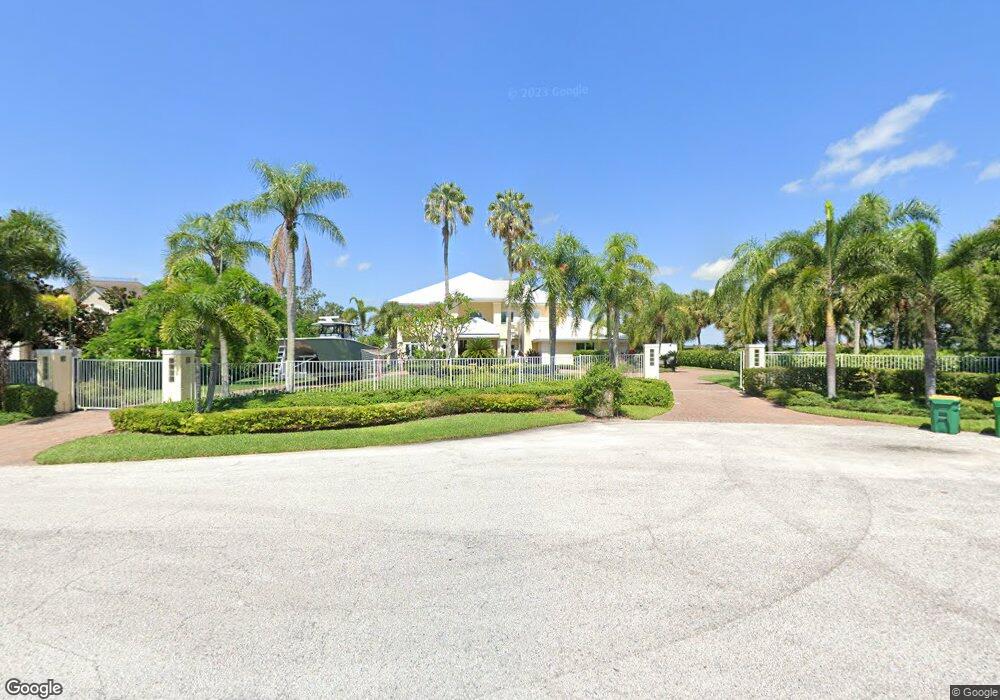
255 Stewart Dr Merritt Island, FL 32952
Estimated Value: $1,978,491 - $2,414,000
4
Beds
5
Baths
5,648
Sq Ft
$386/Sq Ft
Est. Value
About This Home
This home is located at 255 Stewart Dr, Merritt Island, FL 32952 and is currently estimated at $2,182,497, approximately $386 per square foot. 255 Stewart Dr is a home located in Brevard County with nearby schools including Tropical Elementary School, Thomas Jefferson Middle School, and Merritt Island High School.
Ownership History
Date
Name
Owned For
Owner Type
Purchase Details
Closed on
May 1, 2019
Sold by
Venzara Frank X and Venzara Cheryl A
Bought by
Venzara Frank X and Venzara Juliet L
Current Estimated Value
Home Financials for this Owner
Home Financials are based on the most recent Mortgage that was taken out on this home.
Original Mortgage
$1,450,000
Outstanding Balance
$941,326
Interest Rate
4%
Mortgage Type
Purchase Money Mortgage
Estimated Equity
$1,241,171
Purchase Details
Closed on
Nov 13, 2018
Sold by
Venzara Frank X and Venzara Cheryl A
Bought by
Venzara Cheryl A and Venzara Frank X
Create a Home Valuation Report for This Property
The Home Valuation Report is an in-depth analysis detailing your home's value as well as a comparison with similar homes in the area
Home Values in the Area
Average Home Value in this Area
Purchase History
| Date | Buyer | Sale Price | Title Company |
|---|---|---|---|
| Venzara Frank X | $1,450,000 | Attorney | |
| Venzara Cheryl A | -- | Attorney |
Source: Public Records
Mortgage History
| Date | Status | Borrower | Loan Amount |
|---|---|---|---|
| Open | Venzara Frank X | $1,450,000 |
Source: Public Records
Tax History Compared to Growth
Tax History
| Year | Tax Paid | Tax Assessment Tax Assessment Total Assessment is a certain percentage of the fair market value that is determined by local assessors to be the total taxable value of land and additions on the property. | Land | Improvement |
|---|---|---|---|---|
| 2025 | $16,200 | $1,371,080 | -- | -- |
| 2024 | $16,160 | $1,332,440 | -- | -- |
| 2023 | $16,160 | $1,293,640 | $0 | $0 |
| 2022 | $15,137 | $1,255,970 | $0 | $0 |
| 2021 | $16,110 | $1,219,390 | $0 | $0 |
| 2020 | $16,199 | $1,202,560 | $490,000 | $712,560 |
| 2019 | $11,311 | $815,910 | $0 | $0 |
| 2018 | $11,398 | $800,700 | $0 | $0 |
| 2017 | $11,615 | $784,240 | $0 | $0 |
| 2016 | $11,895 | $768,110 | $430,000 | $338,110 |
| 2015 | $12,328 | $762,780 | $430,000 | $332,780 |
| 2014 | $12,414 | $754,760 | $430,000 | $324,760 |
Source: Public Records
Map
Nearby Homes
- 190 Stewart Dr
- 5160 Del Sol Dr
- 5140 Del Sol Dr
- 155 Hacienda Dr
- 5180 Calmes Way
- 4760 Honeyridge Ln
- 4395 Crooked Mile Rd
- 4320 Crooked Mile Rd
- 4385 Stillwaters Dr
- 4250 Blossom Cir
- 735 Pilot Ln Unit 314
- 735 Pilot Ln Unit 812
- 735 Pilot Ln Unit 408
- 735 Pilot Ln Unit 603
- 735 Pilot Ln Unit 614
- 735 Pilot Ln Unit 611
- 735 Pilot Ln Unit 908
- 735 Pilot Ln Unit 606
- 735 Pilot Ln Unit 1004
- 735 Pilot Ln Unit 510
- 245 Stewart Dr
- 235 Stewart Dr
- 265 Stewart Dr
- 240 Stewart Dr
- 225 Stewart Dr
- 210 Stewart Dr
- 215 Stewart Dr
- 200 Stewart Dr
- 215 Hacienda Dr
- 205 Stewart Dr
- 220 Hacienda Dr
- 285 Stewart Dr
- 180 Stewart Dr
- 0 Del Sol Unit 671406
- 200 Hacienda Dr
- 205 Hacienda Dr
- 185 Stewart Dr
- 170 Stewart Dr
- 5040 Valle Collina Ln
- 5155 Del Sol Dr