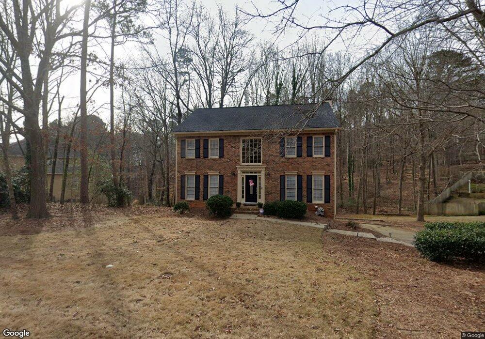
2550 Ashbourne Dr Unit 1 Lawrenceville, GA 30043
Estimated Value: $462,058 - $507,000
3
Beds
3
Baths
2,720
Sq Ft
$182/Sq Ft
Est. Value
About This Home
This home is located at 2550 Ashbourne Dr Unit 1, Lawrenceville, GA 30043 and is currently estimated at $495,015, approximately $181 per square foot. 2550 Ashbourne Dr Unit 1 is a home located in Gwinnett County with nearby schools including Rock Springs Elementary School, Creekland Middle School, and Collins Hill High School.
Ownership History
Date
Name
Owned For
Owner Type
Purchase Details
Closed on
Dec 22, 2016
Sold by
Scf Homes Llc
Bought by
Eubanks Loyd A and Eubanks Lisa M
Current Estimated Value
Home Financials for this Owner
Home Financials are based on the most recent Mortgage that was taken out on this home.
Original Mortgage
$237,405
Outstanding Balance
$194,657
Interest Rate
4.03%
Mortgage Type
New Conventional
Estimated Equity
$300,358
Purchase Details
Closed on
Nov 6, 2015
Sold by
Us Bank National Association Trustee
Bought by
Scf Homes Llc
Purchase Details
Closed on
Sep 1, 2015
Sold by
Fuller Scott B
Bought by
Us Bank National Association Trustee
Purchase Details
Closed on
Jul 22, 1994
Sold by
Mayer Peter M Diane E
Bought by
Fuller Scott B Diane C
Create a Home Valuation Report for This Property
The Home Valuation Report is an in-depth analysis detailing your home's value as well as a comparison with similar homes in the area
Home Values in the Area
Average Home Value in this Area
Purchase History
| Date | Buyer | Sale Price | Title Company |
|---|---|---|---|
| Eubanks Loyd A | $249,900 | -- | |
| Scf Homes Llc | $164,000 | -- | |
| Us Bank National Association Trustee | $184,500 | -- | |
| Fuller Scott B Diane C | $158,900 | -- |
Source: Public Records
Mortgage History
| Date | Status | Borrower | Loan Amount |
|---|---|---|---|
| Open | Eubanks Loyd A | $237,405 | |
| Closed | Fuller Scott B Diane C | -- |
Source: Public Records
Tax History Compared to Growth
Tax History
| Year | Tax Paid | Tax Assessment Tax Assessment Total Assessment is a certain percentage of the fair market value that is determined by local assessors to be the total taxable value of land and additions on the property. | Land | Improvement |
|---|---|---|---|---|
| 2024 | $4,781 | $175,120 | $44,800 | $130,320 |
| 2023 | $4,781 | $161,120 | $37,600 | $123,520 |
| 2022 | $4,137 | $145,480 | $37,600 | $107,880 |
| 2021 | $3,660 | $119,720 | $29,800 | $89,920 |
| 2020 | $3,580 | $114,760 | $29,800 | $84,960 |
| 2019 | $3,493 | $114,760 | $29,800 | $84,960 |
| 2018 | $3,498 | $114,760 | $29,800 | $84,960 |
| 2016 | $2,654 | $65,600 | $21,320 | $44,280 |
| 2015 | $2,851 | $81,240 | $19,600 | $61,640 |
| 2014 | -- | $81,240 | $19,600 | $61,640 |
Source: Public Records
Map
Nearby Homes
- 2530 Ashbourne Dr
- 2500 Ashbourne Dr
- 2615 Ashbourne Dr NE
- 262 Ashbourne Trail
- 2542 Ashridge Ct
- 218 Oakmoor Ct
- 2723 Herndon Rd NW
- 2723 Herndon Rd
- 2637 Forest Meadow Ln Unit 8
- 420 Woodbrook Way Unit 7
- 500 Meadowmeade Ln
- 2359 Meadow Isle Ln Unit 6
- 465 Woodbrook Way
- 2501 Caray Ct
- 283 Heron Lake Ct Unit 16
- 279 Collins View Ct
- 2724 Still Farms Place
- 760 Woodrow Dr
- 2550 Ashbourne Dr
- 2550 Ashbourne Dr NE
- 2580 Ashbourne Dr
- 2540 Ashbourne Dr
- 2540 Ashbourne Dr Unit 10
- 2540 Ashbourne Dr NE Unit 10
- 2540 Ashbourne Dr NE
- 2565 Ashbourne Dr
- 2590 Ashbourne Dr
- 2590 Ashbourne Dr Unit 7
- 2555 Ashbourne Dr
- 2575 Ashbourne Dr
- 2585 Ashbourne Dr
- 2535 Ashbourne Dr Unit 1
- 2600 Ashbourne Dr
- 2600 Ashbourne Dr Unit 1
- 2600 Ashbourne Dr NE
- 2520 Ashbourne Dr Unit 1
- 2595 Ashbourne Dr
- 260 Trowbridge Ln