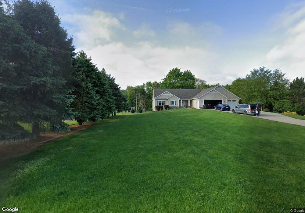
2550 Ranchland Dr SW Byron Center, MI 49315
Estimated Value: $531,000 - $841,000
--
Bed
--
Bath
--
Sq Ft
6.23
Acres
About This Home
This home is located at 2550 Ranchland Dr SW, Byron Center, MI 49315 and is currently estimated at $641,084. 2550 Ranchland Dr SW is a home located in Kent County with nearby schools including Marshall Elementary School, Robert L. Nickels Intermediate School, and Byron Center West Middle School.
Ownership History
Date
Name
Owned For
Owner Type
Purchase Details
Closed on
Dec 11, 2020
Sold by
Henry Mast Greenhouses Inc
Bought by
Estelle Daniel and Estelle Rebecca
Current Estimated Value
Home Financials for this Owner
Home Financials are based on the most recent Mortgage that was taken out on this home.
Original Mortgage
$427,500
Outstanding Balance
$380,603
Interest Rate
2.7%
Mortgage Type
New Conventional
Estimated Equity
$260,482
Purchase Details
Closed on
Oct 7, 2020
Sold by
Miling Steve and Miling Michael J
Bought by
Henry Mast Greenhouses Inc
Purchase Details
Closed on
Sep 7, 2016
Sold by
Dewitt Suzanne K
Bought by
Smith Andy and Smith Ann
Purchase Details
Closed on
Dec 27, 2006
Sold by
Dewitt Suzanne K and Miling Suzanne C
Bought by
Dewitt Suzanne K and The Suzanne K Dewitt Trust
Create a Home Valuation Report for This Property
The Home Valuation Report is an in-depth analysis detailing your home's value as well as a comparison with similar homes in the area
Home Values in the Area
Average Home Value in this Area
Purchase History
| Date | Buyer | Sale Price | Title Company |
|---|---|---|---|
| Estelle Daniel | $450,000 | Denali T&E Agcy Inc | |
| Henry Mast Greenhouses Inc | $575,000 | Denall T&E Agcy Inc | |
| Smith Andy | $82,000 | First American Title Ins Co | |
| Dewitt Suzanne K | -- | None Available |
Source: Public Records
Mortgage History
| Date | Status | Borrower | Loan Amount |
|---|---|---|---|
| Open | Estelle Daniel | $427,500 |
Source: Public Records
Tax History Compared to Growth
Tax History
| Year | Tax Paid | Tax Assessment Tax Assessment Total Assessment is a certain percentage of the fair market value that is determined by local assessors to be the total taxable value of land and additions on the property. | Land | Improvement |
|---|---|---|---|---|
| 2025 | $4,101 | $325,200 | $0 | $0 |
| 2024 | $4,101 | $312,100 | $0 | $0 |
| 2023 | $3,922 | $280,400 | $0 | $0 |
| 2022 | $5,387 | $237,900 | $0 | $0 |
| 2021 | $4,198 | $192,500 | $0 | $0 |
| 2017 | $1,377 | $169,400 | $0 | $0 |
| 2016 | $3,096 | $161,500 | $0 | $0 |
Source: Public Records
Map
Nearby Homes
- 2245 Pleasant Pond Dr SW
- 6458 Pleasant Valley Dr SW
- 2581 Ravines Trail Dr SW
- 2569 Ravines Trail Dr SW
- 2567 Ravines Trail Dr SW
- 2553 Ravines Trail Dr SW
- 1969 Northfield Ct SW
- 1901 Northfield Ct SW
- 1839 Northfield Ct SW
- Whitby Plan at Kuiper's Meadow - Cottage Series
- Pentwater Plan at Kuiper's Meadow - Landmark Series
- Harbor Springs Plan at Kuiper's Meadow - Landmark Series
- Sequoia Plan at Kuiper's Meadow - Woodland Series
- Bay Harbor Plan at Kuiper's Meadow - Landmark Series
- Elmwood Plan at Kuiper's Meadow - Woodland Series
- Maplewood Plan at Kuiper's Meadow - Woodland Series
- Camden Plan at Kuiper's Meadow - Cottage Series
- Cedarwood Plan at Kuiper's Meadow - Woodland Series
- Sycamore Plan at Kuiper's Meadow - Woodland Series
- Redwood Plan at Kuiper's Meadow - Woodland Series
- 2500 Ranchland Dr SW
- 2579 Ranchland Dr SW
- 2563 Ranchland Dr SW
- 2470 Ranchland Dr SW
- 2545 Ranchland Dr SW
- 2499 Ranchland Dr SW
- 2450 Ranchland Dr SW
- 6628 Sunflower Dr SW
- 2465 Ranchland Dr SW
- 2424 Ranchland Dr SW
- 6614 Sunflower Dr SW
- 6635 Sunflower Dr SW
- 2449 Ranchland Dr SW
- 6683 Byron Center Ave SW
- 6600 Sunflower Dr SW
- 6739 Byron Center Ave SW
- 6727 Byron Center Ave SW
- 6715 Byron Center Ave SW
- 6615 Sunflower Dr SW
- 6835 Byron Center Ave SW