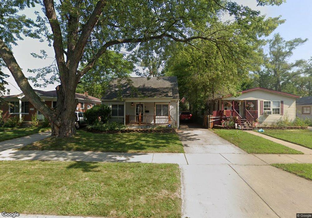
25502 McDonald St Unit Bldg-Unit Dearborn Heights, MI 48125
Estimated Value: $148,000 - $158,000
--
Bed
1
Bath
956
Sq Ft
$157/Sq Ft
Est. Value
About This Home
This home is located at 25502 McDonald St Unit Bldg-Unit, Dearborn Heights, MI 48125 and is currently estimated at $150,510, approximately $157 per square foot. 25502 McDonald St Unit Bldg-Unit is a home located in Wayne County with nearby schools including West Village Academy, Quest Charter Academy, and Peterson-Warren Academy.
Ownership History
Date
Name
Owned For
Owner Type
Purchase Details
Closed on
Jun 21, 2019
Sold by
Halley Shawn and Halley Raelene
Bought by
Kubera Enterprises Llc
Current Estimated Value
Purchase Details
Closed on
Nov 9, 2006
Sold by
Mullas Halley Raelene and Mullas Halley Raelene
Bought by
Halley Shawn
Purchase Details
Closed on
Feb 12, 1998
Sold by
Michael R Walsh Trust & and Trust Michael R
Bought by
Mullas Raelene
Purchase Details
Closed on
Dec 8, 1997
Sold by
John Umbenhowa Beverly and John Umbenhowa
Bought by
Michael R Walsh Trust
Create a Home Valuation Report for This Property
The Home Valuation Report is an in-depth analysis detailing your home's value as well as a comparison with similar homes in the area
Home Values in the Area
Average Home Value in this Area
Purchase History
| Date | Buyer | Sale Price | Title Company |
|---|---|---|---|
| Kubera Enterprises Llc | $66,500 | None Available | |
| Halley Shawn | -- | Great Lakes Title Of Mi | |
| Halley Raelene Mullas | $56,000 | Great Lakes Title | |
| Mullas Raelene | $56,000 | -- | |
| Michael R Walsh Trust | $25,000 | -- |
Source: Public Records
Tax History Compared to Growth
Tax History
| Year | Tax Paid | Tax Assessment Tax Assessment Total Assessment is a certain percentage of the fair market value that is determined by local assessors to be the total taxable value of land and additions on the property. | Land | Improvement |
|---|---|---|---|---|
| 2025 | $4,233 | $59,300 | $0 | $0 |
| 2024 | $4,233 | $49,000 | $0 | $0 |
| 2023 | $1,373 | $42,000 | $0 | $0 |
| 2022 | $2,019 | $35,400 | $0 | $0 |
| 2021 | $2,004 | $31,200 | $0 | $0 |
| 2019 | $1,080 | $24,300 | $0 | $0 |
| 2018 | $756 | $23,000 | $0 | $0 |
| 2017 | $596 | $22,500 | $0 | $0 |
| 2016 | $1,029 | $22,800 | $0 | $0 |
| 2015 | $2,120 | $21,200 | $0 | $0 |
| 2013 | $2,280 | $23,800 | $0 | $0 |
| 2010 | -- | $27,200 | $0 | $0 |
Source: Public Records
Map
Nearby Homes
- 25474 McDonald St
- 5118 Michael St
- 25243 Lehigh St
- 25628 Powers Ave
- 25212 Lehigh St
- 25895 Annapolis St
- 25118 Lehigh St
- 4856 Carolee Ln
- 25926 Powers Ave
- 24754 Annapolis St
- 25085 Colgate St
- 24727 Hopkins St
- 4147 Westlake St
- 25965 Currier St
- 25866 Andover St
- 26225 McDonald St
- 26159 Stanford St
- 5842 Janet St
- 24635 Stanford St
- 5845 Beech Daly Rd
- 25508 McDonald St
- 25440 McDonald St
- 25514 McDonald St
- 25432 McDonald St
- 25522 McDonald St
- 25501 Annapolis St
- 25513 Annapolis St
- 25447 Annapolis St
- 25523 Annapolis St
- 25501 McDonald St
- 25435 Annapolis St
- 25433 McDonald St
- 25507 McDonald St
- 25536 McDonald St
- 4644 S Gulley Rd
- 4652 S Gulley Rd
- 4636 S Gulley Rd
- 25521 McDonald St
- 25421 Annapolis St
- 25544 McDonald St