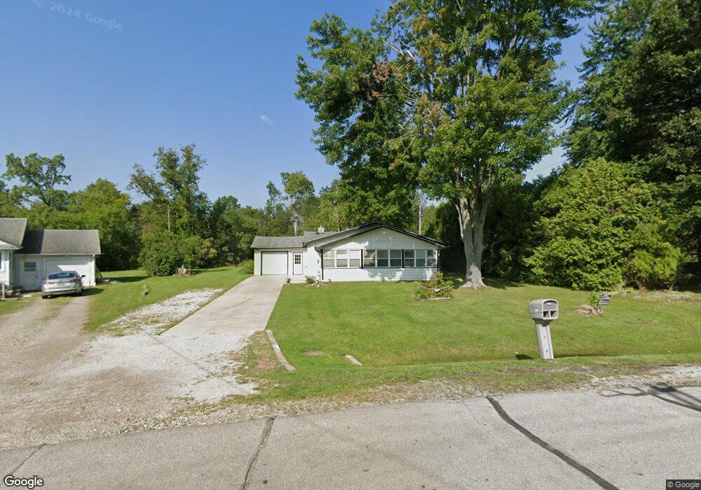
2551 Alger Rd Port Huron, MI 48060
Estimated Value: $132,000 - $182,000
--
Bed
--
Bath
1,368
Sq Ft
$114/Sq Ft
Est. Value
About This Home
This home is located at 2551 Alger Rd, Port Huron, MI 48060 and is currently estimated at $156,400, approximately $114 per square foot. 2551 Alger Rd is a home located in St. Clair County with nearby schools including Michigamme Elementary School, Central Middle School, and Port Huron High School.
Ownership History
Date
Name
Owned For
Owner Type
Purchase Details
Closed on
Sep 28, 2023
Sold by
Waun Constance J and Sharrard Douglas N
Bought by
Sharrard Darlene A
Current Estimated Value
Purchase Details
Closed on
Jan 18, 2006
Sold by
Sharrard Elaine and Sharrard Charles
Bought by
Sharrard Elaine and Waun Constance J
Create a Home Valuation Report for This Property
The Home Valuation Report is an in-depth analysis detailing your home's value as well as a comparison with similar homes in the area
Home Values in the Area
Average Home Value in this Area
Purchase History
| Date | Buyer | Sale Price | Title Company |
|---|---|---|---|
| Sharrard Darlene A | $80,000 | None Listed On Document | |
| Sharrard Darlene A | $80,000 | None Listed On Document | |
| Sharrard Elaine | -- | None Available |
Source: Public Records
Tax History Compared to Growth
Tax History
| Year | Tax Paid | Tax Assessment Tax Assessment Total Assessment is a certain percentage of the fair market value that is determined by local assessors to be the total taxable value of land and additions on the property. | Land | Improvement |
|---|---|---|---|---|
| 2025 | $1,381 | $64,700 | $0 | $0 |
| 2024 | $726 | $54,500 | $0 | $0 |
| 2023 | $670 | $53,600 | $0 | $0 |
| 2022 | $1,239 | $53,500 | $0 | $0 |
| 2021 | $1,134 | $40,400 | $0 | $0 |
| 2020 | $1,134 | $43,200 | $43,200 | $0 |
| 2019 | $1,113 | $34,800 | $0 | $0 |
| 2018 | $1,087 | $34,800 | $0 | $0 |
| 2017 | $1,063 | $31,900 | $0 | $0 |
| 2016 | $550 | $31,900 | $0 | $0 |
| 2015 | -- | $33,700 | $33,700 | $0 |
| 2014 | -- | $31,000 | $31,000 | $0 |
| 2013 | -- | $30,500 | $0 | $0 |
Source: Public Records
Map
Nearby Homes
- 2650 Alger Rd
- 4380 Lapeer Rd
- 2863 Beach Rd
- 0 Wall Rd Unit 50185999
- 0000 W Water St
- 2566 Lewis Dr
- 2940 Westland Dr
- 3255 Harrington Rd
- 3152 Spruce Dr
- 3115 Spruce Dr
- 0000 Range Rd
- 3335 W Water St
- 0 Lapeer Rd Unit 50137357
- 2636 Locust St
- 3408 N Burwick Dr
- 4224 Atkins Rd
- 3409 Ancient Dr
- 0000 Henry St
- 4608 Huntington Dr
- 0000 Manuel St