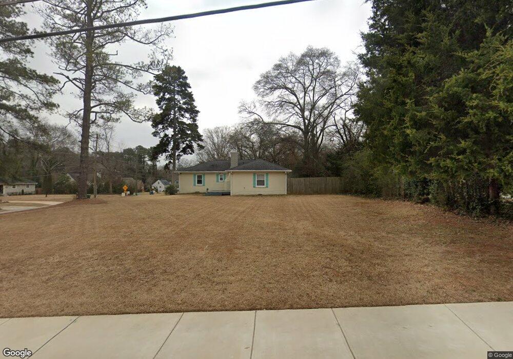
2551 Mcafee Rd Unit 1 Decatur, GA 30032
Estimated Value: $340,000 - $434,000
3
Beds
2
Baths
1,425
Sq Ft
$268/Sq Ft
Est. Value
About This Home
This home is located at 2551 Mcafee Rd Unit 1, Decatur, GA 30032 and is currently estimated at $381,196, approximately $267 per square foot. 2551 Mcafee Rd Unit 1 is a home located in DeKalb County with nearby schools including Toney Elementary School, Columbia Middle School, and Columbia High School.
Ownership History
Date
Name
Owned For
Owner Type
Purchase Details
Closed on
Nov 12, 2021
Sold by
Peck Steve
Bought by
Wallace Janaee Ariel Sasha
Current Estimated Value
Purchase Details
Closed on
Aug 4, 2020
Sold by
Bashaw Philip A
Bought by
Peck Steve
Purchase Details
Closed on
Apr 30, 2015
Sold by
Williams Sonja Smith
Bought by
Bashaw Philip Alan
Home Financials for this Owner
Home Financials are based on the most recent Mortgage that was taken out on this home.
Original Mortgage
$56,929
Interest Rate
3.75%
Mortgage Type
FHA
Create a Home Valuation Report for This Property
The Home Valuation Report is an in-depth analysis detailing your home's value as well as a comparison with similar homes in the area
Home Values in the Area
Average Home Value in this Area
Purchase History
| Date | Buyer | Sale Price | Title Company |
|---|---|---|---|
| Wallace Janaee Ariel Sasha | $350,000 | -- | |
| Wallace Janaee Ariel Sasha | $350,000 | -- | |
| Peck Steve | $184,500 | -- | |
| Peck Steve | $184,500 | -- | |
| Bashaw Philip Alan | $58,000 | -- | |
| Bashaw Philip Alan | $58,000 | -- |
Source: Public Records
Mortgage History
| Date | Status | Borrower | Loan Amount |
|---|---|---|---|
| Previous Owner | Bashaw Philip Alan | $56,929 |
Source: Public Records
Tax History Compared to Growth
Tax History
| Year | Tax Paid | Tax Assessment Tax Assessment Total Assessment is a certain percentage of the fair market value that is determined by local assessors to be the total taxable value of land and additions on the property. | Land | Improvement |
|---|---|---|---|---|
| 2025 | $5,184 | $162,760 | $32,600 | $130,160 |
| 2024 | $5,332 | $159,720 | $21,920 | $137,800 |
| 2023 | $5,332 | $152,440 | $21,920 | $130,520 |
| 2022 | $6,589 | $140,000 | $4,560 | $135,440 |
| 2021 | $3,683 | $73,800 | $4,280 | $69,520 |
| 2020 | $3,185 | $62,440 | $5,160 | $57,280 |
| 2019 | $2,180 | $39,560 | $3,480 | $36,080 |
| 2018 | $1,328 | $33,960 | $3,480 | $30,480 |
| 2017 | $1,793 | $30,600 | $3,480 | $27,120 |
| 2016 | $1,468 | $23,168 | $3,328 | $19,840 |
| 2014 | $821 | $22,320 | $3,480 | $18,840 |
Source: Public Records
Map
Nearby Homes
- 2076 Windy Hill Rd
- 2505 Mellville Ave
- 2671 Tilson Rd
- 2653 Tilson Rd
- 2425 Mellville Ave
- 2453 Mellville Ave
- 2623 Northview Ave
- 2616 Northview Ave
- 2628 Northview Ave
- 2554 Brentwood Rd
- 2564 Brentwood Rd
- 1902 Canterbury St
- 2665 Northview Ave
- 2490 Brentwood Rd
- 2196 Knoll Dr
- 2203 Knoll Dr
- 2390 Mellville Ave
- 1937 Don Juan Ln
- 1968 Don Juan Ln
- 2728 Mcafee Rd
- 2551 Mcafee Rd
- 2543 Mcafee Rd
- 2535 Mcafee Rd
- 2036 Windy Hill Rd
- 2028 Windy Hill Rd
- 0 Windy Hill Rd Unit 8399064
- 2020 Windy Hill Rd
- 2044 Windy Hill Rd
- 2538 Mcafee Rd
- 2049 Windy Hill Rd
- 2540 Mcafee Rd
- 2533 Mcafee Rd
- 2523 Mcafee Rd
- 2536 Mcafee Rd
- 2052 Windy Hill Rd
- 2530 Mcafee Rd
- 2519 Mcafee Rd
- 2061 Windy Hill Rd
- 2061 Windy Hill Rd
- 2060 Windy Hill Rd