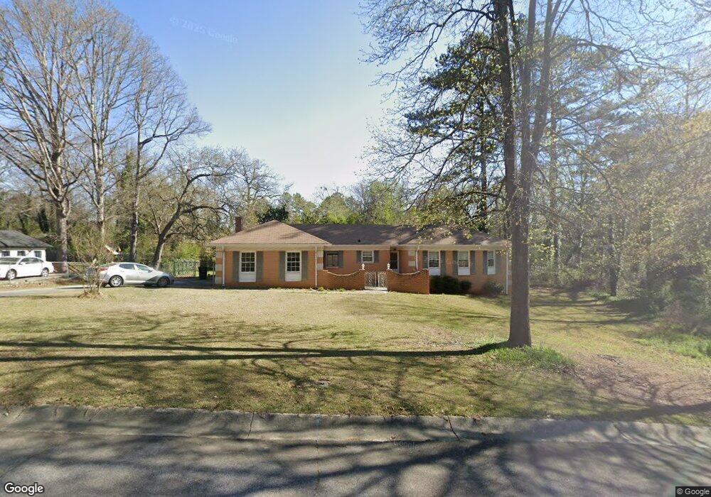
2553 Wall St Jonesboro, GA 30236
Estimated Value: $225,891 - $286,000
3
Beds
3
Baths
1,757
Sq Ft
$140/Sq Ft
Est. Value
About This Home
This home is located at 2553 Wall St, Jonesboro, GA 30236 and is currently estimated at $246,473, approximately $140 per square foot. 2553 Wall St is a home located in Clayton County with nearby schools including James Jackson Elementary School, M. D. Roberts Middle School, and Mount Zion High School.
Ownership History
Date
Name
Owned For
Owner Type
Purchase Details
Closed on
Aug 21, 2012
Sold by
Colwell Charles E
Bought by
Wade Tyrus L
Current Estimated Value
Home Financials for this Owner
Home Financials are based on the most recent Mortgage that was taken out on this home.
Original Mortgage
$70,000
Outstanding Balance
$48,172
Interest Rate
3.53%
Mortgage Type
New Conventional
Estimated Equity
$198,301
Purchase Details
Closed on
Mar 23, 2012
Sold by
Dorsett E Ruth
Bought by
Colwell Charles E and Colwell Betty R
Create a Home Valuation Report for This Property
The Home Valuation Report is an in-depth analysis detailing your home's value as well as a comparison with similar homes in the area
Home Values in the Area
Average Home Value in this Area
Purchase History
| Date | Buyer | Sale Price | Title Company |
|---|---|---|---|
| Wade Tyrus L | $85,000 | -- | |
| Colwell Charles E | $54,450 | -- |
Source: Public Records
Mortgage History
| Date | Status | Borrower | Loan Amount |
|---|---|---|---|
| Open | Wade Tyrus L | $70,000 |
Source: Public Records
Tax History Compared to Growth
Tax History
| Year | Tax Paid | Tax Assessment Tax Assessment Total Assessment is a certain percentage of the fair market value that is determined by local assessors to be the total taxable value of land and additions on the property. | Land | Improvement |
|---|---|---|---|---|
| 2024 | $2,389 | $70,040 | $8,000 | $62,040 |
| 2023 | $2,373 | $65,720 | $8,000 | $57,720 |
| 2022 | $2,177 | $64,280 | $8,000 | $56,280 |
| 2021 | $1,767 | $53,560 | $8,000 | $45,560 |
| 2020 | $1,919 | $56,809 | $8,000 | $48,809 |
| 2019 | $1,686 | $50,375 | $7,600 | $42,775 |
| 2018 | $1,564 | $47,379 | $7,600 | $39,779 |
| 2017 | $1,403 | $43,316 | $7,600 | $35,716 |
| 2016 | $1,424 | $43,842 | $7,600 | $36,242 |
| 2015 | $1,422 | $0 | $0 | $0 |
| 2014 | $1,375 | $43,378 | $7,600 | $35,778 |
Source: Public Records
Map
Nearby Homes
- 7519 Conkle Rd Unit 2
- 7595 Teton Ct
- 7475 Danielle Ct
- 2809 Highway 138 E
- 2254 Lisbon Ln
- 7455 Page Ct
- 7436 Fielder Rd
- 2884 Kevin Ln Unit 2
- 2282 Tiffany Ct
- 7326 Leland Ln
- 7942 Rand Rd
- 2115 Logan Dr
- 7940 Rand Rd
- 2846 Highway 138 E
- 2919 Cushing Ct Unit 2
- 2238 Danver Ct
- 2312 Coach Way
- 0 Highway 138 E Unit 10460006
- 0 Highway 138 E Unit 10650191
- 0 Highway 138 E Unit 10638505
- 2493 Wall St
- 2561 Wall St
- 2545 Wall St
- 7556 Fielder Rd
- 2503 Lois Ln
- 2537 Wall St
- 2522 Wall St
- 2569 Wall St
- 7643 Green Springs Dr
- 7638 Chad's Cir
- 7647 Green Springs Dr Unit 8
- 2495 Lois Ln
- 2529 Wall St
- 7639 Green Springs Dr
- 7655 Green Springs Dr Unit 8
- 7296 Chads Cir
- 7304 Chads Cir
- 2498 Lois Ln
- 7560 Chads Cir
- 7567 Fielder Rd