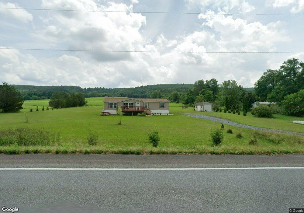
2555 Blakeslee Boulevard Dr W Lehighton, PA 18235
Estimated Value: $81,438 - $85,000
3
Beds
2
Baths
1,400
Sq Ft
$59/Sq Ft
Est. Value
About This Home
This home is located at 2555 Blakeslee Boulevard Dr W, Lehighton, PA 18235 and is currently estimated at $83,219, approximately $59 per square foot. 2555 Blakeslee Boulevard Dr W is a home located in Carbon County with nearby schools including Lehighton Area High School.
Ownership History
Date
Name
Owned For
Owner Type
Purchase Details
Closed on
Oct 8, 2021
Sold by
Hutchinson Darrel D
Bought by
Snoddy F Thomas
Current Estimated Value
Home Financials for this Owner
Home Financials are based on the most recent Mortgage that was taken out on this home.
Original Mortgage
$40,950
Outstanding Balance
$37,343
Interest Rate
2.8%
Mortgage Type
Purchase Money Mortgage
Estimated Equity
$45,876
Purchase Details
Closed on
Dec 14, 2005
Sold by
Becker Richard C and Becker Naomi J
Bought by
Hutchinson Darrel D
Create a Home Valuation Report for This Property
The Home Valuation Report is an in-depth analysis detailing your home's value as well as a comparison with similar homes in the area
Home Values in the Area
Average Home Value in this Area
Purchase History
| Date | Buyer | Sale Price | Title Company |
|---|---|---|---|
| Snoddy F Thomas | $63,000 | Carbon Search & Stlmt Svcs I | |
| Hutchinson Darrel D | -- | None Available |
Source: Public Records
Mortgage History
| Date | Status | Borrower | Loan Amount |
|---|---|---|---|
| Open | Snoddy F Thomas | $40,950 |
Source: Public Records
Tax History Compared to Growth
Tax History
| Year | Tax Paid | Tax Assessment Tax Assessment Total Assessment is a certain percentage of the fair market value that is determined by local assessors to be the total taxable value of land and additions on the property. | Land | Improvement |
|---|---|---|---|---|
| 2025 | $1,148 | $15,000 | $15,000 | $0 |
| 2024 | $1,103 | $15,000 | $15,000 | $0 |
| 2023 | $1,092 | $15,000 | $15,000 | $0 |
| 2022 | $1,077 | $15,000 | $15,000 | $0 |
| 2021 | $1,045 | $15,000 | $15,000 | $0 |
| 2020 | $1,018 | $15,000 | $15,000 | $0 |
| 2019 | $966 | $15,000 | $15,000 | $0 |
| 2018 | $954 | $15,000 | $15,000 | $0 |
| 2017 | $954 | $15,000 | $15,000 | $0 |
| 2016 | -- | $15,000 | $15,000 | $0 |
| 2015 | -- | $15,000 | $15,000 | $0 |
| 2014 | -- | $15,000 | $15,000 | $0 |
Source: Public Records
Map
Nearby Homes
- 437 Chapel Dr
- 2530 Mahoning Dr W
- 265 Mill Rd
- 141 Church Hill Rd
- 1772 Mahoning Dr W
- 2609 Municipal Rd
- TBD Heron Ct
- 134 Huron Dr
- 0 Huron Ct Unit Lot 06
- 0 Pleasant View Dr Unit Lot 02 758864
- 0 Pleasant View Dr Unit Lot 73
- 0 Pleasant View Dr Unit Lot 67 765248
- 0 Beacon Pointe Plan at Summit Ridge
- 0 Blue Ridge Plan at Summit Ridge Unit PACC2005476
- 0 Georgia Mae Plan at Summit Ridge Unit PACC2005482
- Abbey Plan at Summit Ridge
- Beacon Pointe Plan at Summit Ridge
- White Oak Plan at Summit Ridge
- Black Cherry Plan at Summit Ridge
- Blue Ridge Plan at Summit Ridge
- 2505 Blakeslee Boulevard Dr W
- 0 Blakeslee Boulevard Dr W
- 2606 Blakeslee Boulevard Dr W
- 641 Spring House Rd
- 2681 Blakeslee Boulevard Dr W
- 2606 W Blakleslee Blvd
- 2478 Blakeslee Boulevard Dr W
- 576 Spring House Rd
- 2696 Blakeslee Boulevard Dr W
- 2740 Blakeslee Boulevard Dr W
- 547 Spring House Rd
- 2763 Blakeslee Boulevard Dr W
- 544 Springhouse Rd
- 0 Winter Mountain Rd Unit 614851
- 0 Winter Mountain Rd Unit 625559
- 0 Winter Mountain Rd Unit 650769
- 0 Winter Mountain Rd Unit 664779
- 0 Winter Mountain Rd
- 0 Winter Mountain Rd Unit PM-81798
- 0 Winter Mountain Rd Unit PM-78779