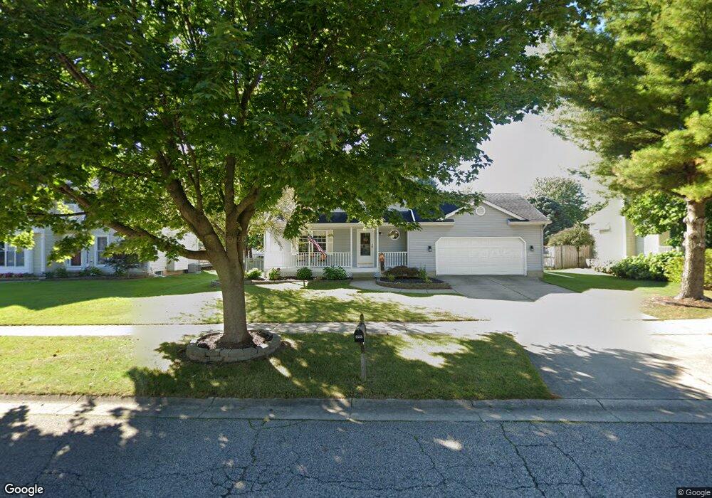
2555 Brookview Ln Dewitt, MI 48820
Estimated Value: $329,000 - $402,000
3
Beds
3
Baths
1,864
Sq Ft
$194/Sq Ft
Est. Value
About This Home
This home is located at 2555 Brookview Ln, Dewitt, MI 48820 and is currently estimated at $361,443, approximately $193 per square foot. 2555 Brookview Ln is a home located in Clinton County with nearby schools including Schavey Road Elementary School, Scott Elementary School, and Herbison Woods Elementary School.
Ownership History
Date
Name
Owned For
Owner Type
Purchase Details
Closed on
Aug 10, 2010
Sold by
Feldpausch Lynne A and Mcattee Lynne A
Bought by
Freel Daniel P and Freel Judith L
Current Estimated Value
Home Financials for this Owner
Home Financials are based on the most recent Mortgage that was taken out on this home.
Original Mortgage
$135,500
Outstanding Balance
$89,985
Interest Rate
4.63%
Mortgage Type
Purchase Money Mortgage
Estimated Equity
$271,458
Purchase Details
Closed on
Jul 31, 2003
Sold by
Tanke Richard L and Tanke Christine R
Bought by
Mcattee Lynne A
Home Financials for this Owner
Home Financials are based on the most recent Mortgage that was taken out on this home.
Original Mortgage
$169,000
Interest Rate
4.75%
Mortgage Type
Purchase Money Mortgage
Create a Home Valuation Report for This Property
The Home Valuation Report is an in-depth analysis detailing your home's value as well as a comparison with similar homes in the area
Home Values in the Area
Average Home Value in this Area
Purchase History
| Date | Buyer | Sale Price | Title Company |
|---|---|---|---|
| Freel Daniel P | $159,500 | None Available | |
| Mcattee Lynne A | $178,000 | Transnation Title |
Source: Public Records
Mortgage History
| Date | Status | Borrower | Loan Amount |
|---|---|---|---|
| Open | Freel Daniel P | $135,500 | |
| Previous Owner | Mcattee Lynne A | $169,000 |
Source: Public Records
Tax History
| Year | Tax Paid | Tax Assessment Tax Assessment Total Assessment is a certain percentage of the fair market value that is determined by local assessors to be the total taxable value of land and additions on the property. | Land | Improvement |
|---|---|---|---|---|
| 2025 | $3,886 | $148,200 | $29,100 | $119,100 |
| 2024 | $21 | $133,400 | $27,600 | $105,800 |
| 2023 | $2,304 | $124,200 | $0 | $0 |
| 2022 | $3,505 | $114,100 | $23,500 | $90,600 |
| 2021 | $3,409 | $109,200 | $22,200 | $87,000 |
| 2020 | $3,320 | $105,500 | $21,600 | $83,900 |
| 2019 | $3,195 | $98,000 | $20,000 | $78,000 |
| 2018 | $3,047 | $94,100 | $18,700 | $75,400 |
| 2017 | $3,006 | $91,900 | $18,300 | $73,600 |
| 2016 | $2,978 | $86,200 | $16,900 | $69,300 |
| 2015 | $2,975 | $82,200 | $0 | $0 |
| 2011 | -- | $79,600 | $0 | $0 |
Source: Public Records
Map
Nearby Homes
- 513 N Scott St
- 603 Cherry St
- 3343 Silverspring Dr
- 14013 Ambrosia Ave
- 3535 Stanwood Dr
- 11740 Kalamata Dr
- 1605 Stauffer Ln
- 12359 Mission Hills Dr
- 1226 S Geneva Dr
- 12441 Oakland Hills Dr
- 11549 S Us Highway 27
- 1306 Schavey Rd
- 1448 Primrose Ln
- 12719 Houghton Dr
- 1465 Primrose Ln
- 12565 McKouen Dr
- 12719 Ontonagon Dr
- 3783 Wisteria Ln
- 3893 Sage Ln
- 3421 Hawthorne Woods Pkwy
- 2543 Brookview Ln
- 2573 Brookview Ln
- 406 W Brunswick Dr
- 1002 Wilson St
- 2527 Brookview Ln
- 404 W Brunswick Dr
- 2562 Brookview Ln
- 2548 Brookview Ln
- 2576 Brookview Ln
- 2532 Brookview Ln
- 402 W Brunswick Dr
- 2511 Brookview Ln
- 502 W Brunswick Dr
- 11430 Wilson St
- 2516 Brookview Ln
- 11414 Wilson St
- 405 W Brunswick Dr
- 306 W Brunswick Dr
- 2561 Julie Way
- 11400 Wilson St
Your Personal Tour Guide
Ask me questions while you tour the home.