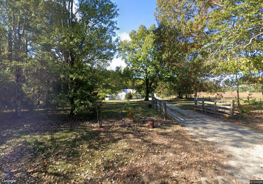
2555 Forest Rd Stovall, GA 30222
Estimated Value: $108,383 - $244,000
3
Beds
2
Baths
1,456
Sq Ft
$113/Sq Ft
Est. Value
About This Home
This home is located at 2555 Forest Rd, Stovall, GA 30222 and is currently estimated at $164,596, approximately $113 per square foot. 2555 Forest Rd is a home located in Meriwether County with nearby schools including George E. Washington Elementary School.
Ownership History
Date
Name
Owned For
Owner Type
Purchase Details
Closed on
Nov 7, 2018
Sold by
Williams Kimberly Kay
Bought by
Bradford Adventures Llc
Current Estimated Value
Purchase Details
Closed on
Mar 5, 2007
Sold by
Williams Alfer B
Bought by
Williams Kimberly Kaye
Purchase Details
Closed on
Dec 7, 2006
Sold by
Alfred B Williams
Bought by
Williams Alfred B
Purchase Details
Closed on
Jan 1, 1949
Sold by
Cousins Mrs Lucy Pb
Bought by
Williams Mary Cousin
Create a Home Valuation Report for This Property
The Home Valuation Report is an in-depth analysis detailing your home's value as well as a comparison with similar homes in the area
Home Values in the Area
Average Home Value in this Area
Purchase History
| Date | Buyer | Sale Price | Title Company |
|---|---|---|---|
| Bradford Adventures Llc | $49,900 | -- | |
| Williams Kimberly Kaye | -- | -- | |
| Williams Alfred B | -- | -- | |
| Williams Mary Cousin | -- | -- |
Source: Public Records
Tax History Compared to Growth
Tax History
| Year | Tax Paid | Tax Assessment Tax Assessment Total Assessment is a certain percentage of the fair market value that is determined by local assessors to be the total taxable value of land and additions on the property. | Land | Improvement |
|---|---|---|---|---|
| 2024 | $719 | $21,640 | $18,560 | $3,080 |
| 2023 | $747 | $21,640 | $18,560 | $3,080 |
| 2022 | $747 | $21,640 | $18,560 | $3,080 |
| 2021 | $759 | $21,640 | $18,560 | $3,080 |
| 2020 | $765 | $21,640 | $18,560 | $3,080 |
| 2019 | $707 | $21,640 | $18,560 | $3,080 |
| 2018 | $950 | $26,560 | $20,600 | $5,960 |
| 2017 | $961 | $26,560 | $20,600 | $5,960 |
| 2016 | $874 | $26,560 | $20,600 | $5,960 |
| 2015 | $876 | $26,560 | $20,600 | $5,960 |
| 2014 | $876 | $26,560 | $20,600 | $5,960 |
| 2013 | -- | $26,560 | $20,600 | $5,960 |
Source: Public Records
Map
Nearby Homes
- 3535 Forrest Rd
- 1511 Forrest Rd
- 964 Forrest Rd
- 6608 Highway 100
- 865 Forrest Rd
- 98.81 Ellis Rd
- 5582 Georgia 100
- 0 Amanda Ct Unit 10552958
- 0 Amanda Ct Unit 7604243
- 209 Hannah Ct
- 95 Amanda Ct
- 5418 Forrest Rd
- 2638 Jarrell Rd
- 1479 Primrose Rd
- 2114 Allie Rd
- 500 Todd Rd
- The Millie Plan at Primrose Road
- The Bradford Plan at Primrose Road
- 441 Evelyn Dr Unit LOT 16
- 1314 Tenny Nelson Rd
- 2555 Forest Rd
- 2733 Forest Rd
- 2733 Forest Rd
- 2355 Forrest Rd
- 2355 Forest Rd
- 0 Montgomery Rd Unit TRACT A 2989866
- 0 Montgomery Rd Unit 7502580
- 0 Montgomery Rd Unit 7563382
- 0 Montgomery Rd Unit 5579789
- 0 Montgomery Rd Unit 5627602
- 0 Montgomery Rd
- 0 Montgomery Rd Unit 9026268
- 0 Montgomery Rd Unit 9055925
- 0 Montgomery Rd Unit 8754049
- 0 Montgomery Rd Unit 7254447
- 0 Montgomery Rd Unit 7559030
- 0 Montgomery Rd Unit 8682227
- 0 Cousins Rd Unit 2702192
- 0 Cousins Rd Unit 2904390
- 0 Cousins Rd Unit 2904365