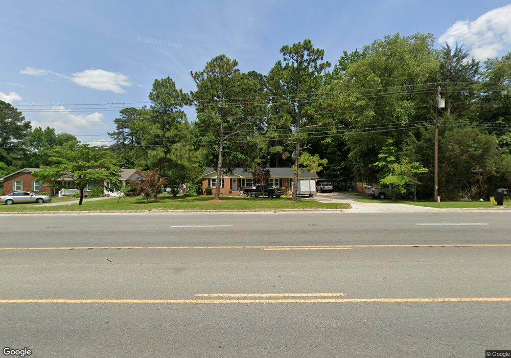
2555 Us Highway 258 N Kinston, NC 28504
Estimated Value: $170,000 - $247,244
3
Beds
2
Baths
1,736
Sq Ft
$126/Sq Ft
Est. Value
About This Home
This home is located at 2555 Us Highway 258 N, Kinston, NC 28504 and is currently estimated at $218,811, approximately $126 per square foot. 2555 Us Highway 258 N is a home located in Lenoir County with nearby schools including Banks Elementary School, E.B. Frink Middle School, and North Lenoir High School.
Ownership History
Date
Name
Owned For
Owner Type
Purchase Details
Closed on
Mar 28, 2022
Sold by
Tanya Sutton
Bought by
Barnes Austin and Barnes Emma
Current Estimated Value
Home Financials for this Owner
Home Financials are based on the most recent Mortgage that was taken out on this home.
Original Mortgage
$205,000
Outstanding Balance
$193,720
Interest Rate
5%
Mortgage Type
VA
Estimated Equity
$25,091
Purchase Details
Closed on
Oct 26, 2021
Sold by
Rhodes Harriet Pope and Rhodes Kenneth Merle
Bought by
Sutton Tanya
Create a Home Valuation Report for This Property
The Home Valuation Report is an in-depth analysis detailing your home's value as well as a comparison with similar homes in the area
Home Values in the Area
Average Home Value in this Area
Purchase History
| Date | Buyer | Sale Price | Title Company |
|---|---|---|---|
| Barnes Austin | $205,000 | Swindell Law Firm | |
| Sutton Tanya | $59,500 | Tiago Natl Ttl Fayetteville |
Source: Public Records
Mortgage History
| Date | Status | Borrower | Loan Amount |
|---|---|---|---|
| Open | Barnes Austin | $205,000 |
Source: Public Records
Tax History Compared to Growth
Tax History
| Year | Tax Paid | Tax Assessment Tax Assessment Total Assessment is a certain percentage of the fair market value that is determined by local assessors to be the total taxable value of land and additions on the property. | Land | Improvement |
|---|---|---|---|---|
| 2025 | $1,251 | $172,716 | $12,724 | $159,992 |
| 2024 | $785 | $87,033 | $14,000 | $73,033 |
| 2023 | $875 | $87,033 | $14,000 | $73,033 |
| 2022 | $875 | $87,033 | $14,000 | $73,033 |
| 2021 | $873 | $87,033 | $14,000 | $73,033 |
| 2020 | $873 | $87,033 | $14,000 | $73,033 |
| 2019 | $875 | $87,033 | $14,000 | $73,033 |
| 2018 | $862 | $87,033 | $14,000 | $73,033 |
| 2017 | $861 | $87,033 | $14,000 | $73,033 |
| 2014 | $1,026 | $107,051 | $14,000 | $93,051 |
| 2013 | $1,026 | $107,051 | $14,000 | $93,051 |
| 2011 | -- | $107,051 | $14,000 | $93,051 |
Source: Public Records
Map
Nearby Homes
- 0 Hwy 258 N Unit LotWP001 22409279
- 58 Old English Ln
- 1957 Country Squire Rd
- 2100 Hwy 258 N
- 2443 Creekside Rd
- Lot 2 Branchwood Dr
- 2193 Dogwood Ln
- 3178 Alton Phillips Rd
- 1846 Crestview St
- 2321 Fred Everett Rd
- 2886 Fox Run Cir
- 3807 Random Rd
- 1955 Banks School Rd
- 2277 Hull Rd
- 2912 Fox Run Cir
- 2544 Dogwood Ln
- 1535 Memory Ln
- 3128 Kelly Rd
- 2445 Tammy Dr
- 3100 Wheat Swamp Rd
- 2555 Hwy 258 N
- 2559 Us Highway 258 N
- 2543 Us Highway 258 N
- 2575 Hwy 258 N
- 2575 Us Highway 258 N
- 2020 Hullwood Dr
- 2236 Old Oak Rd
- 2010 Hullwood Dr
- 2246 Old Oak Rd
- 2581 Hwy 258
- 2581 Us Highway 258 N
- 2542 Us Highway 258 N
- 2216 Old Oak Rd
- 2254 Old Oak Rd
- 2226 Old Oak Rd
- 2021 Hullwood Dr
- 3543 Dobbs Farm Rd
- 1982 Hullwood Dr
- 2233 Old Oak Rd
- 2223 Old Oak Rd