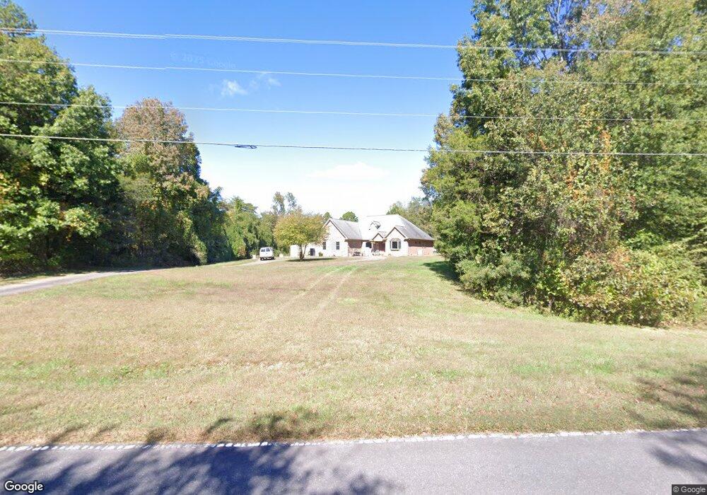
2555 Williams Rd Lewisville, NC 27023
Estimated Value: $602,731 - $719,000
3
Beds
3
Baths
2,680
Sq Ft
$243/Sq Ft
Est. Value
About This Home
This home is located at 2555 Williams Rd, Lewisville, NC 27023 and is currently estimated at $651,433, approximately $243 per square foot. 2555 Williams Rd is a home located in Forsyth County with nearby schools including Lewisville Elementary School, Meadowlark Middle School, and West Forsyth High.
Ownership History
Date
Name
Owned For
Owner Type
Purchase Details
Closed on
Sep 2, 2014
Sold by
Shoaf Sherrie Lynn and Williams Sherrie Lynn
Bought by
Williams Zebulon Vance
Current Estimated Value
Home Financials for this Owner
Home Financials are based on the most recent Mortgage that was taken out on this home.
Original Mortgage
$280,000
Outstanding Balance
$214,136
Interest Rate
4.19%
Mortgage Type
New Conventional
Estimated Equity
$437,297
Purchase Details
Closed on
Feb 20, 2001
Sold by
Hauser Williams Jr Zebulon Vance and Hauser Williams Donna
Bought by
Williams Zebulon Vance and Williams Sherrie Lynn
Create a Home Valuation Report for This Property
The Home Valuation Report is an in-depth analysis detailing your home's value as well as a comparison with similar homes in the area
Home Values in the Area
Average Home Value in this Area
Purchase History
| Date | Buyer | Sale Price | Title Company |
|---|---|---|---|
| Williams Zebulon Vance | -- | None Available | |
| Williams Zebulon Vance | -- | -- |
Source: Public Records
Mortgage History
| Date | Status | Borrower | Loan Amount |
|---|---|---|---|
| Open | Williams Zebulon Vance | $280,000 |
Source: Public Records
Tax History Compared to Growth
Tax History
| Year | Tax Paid | Tax Assessment Tax Assessment Total Assessment is a certain percentage of the fair market value that is determined by local assessors to be the total taxable value of land and additions on the property. | Land | Improvement |
|---|---|---|---|---|
| 2025 | $3,260 | $739,900 | $103,000 | $636,900 |
| 2024 | $3,239 | $422,400 | $76,700 | $345,700 |
| 2023 | $3,239 | $422,400 | $76,700 | $345,700 |
| 2022 | $2,000 | $422,400 | $76,700 | $345,700 |
| 2021 | $3,217 | $422,400 | $76,700 | $345,700 |
| 2020 | $2,747 | $330,600 | $70,800 | $259,800 |
| 2019 | $2,780 | $330,600 | $70,800 | $259,800 |
| 2018 | $2,668 | $330,600 | $70,800 | $259,800 |
| 2016 | $2,652 | $327,010 | $73,633 | $253,377 |
| 2015 | $2,652 | $327,010 | $73,633 | $253,377 |
| 2014 | -- | $327,010 | $73,633 | $253,377 |
Source: Public Records
Map
Nearby Homes
- 0 Hauser Rd
- 1099 Cresthaven Rd
- 1839 Songbird Ln
- Heritage Bridge Plan at Adams Estates
- Roller Mill II Plan at Adams Estates
- Birch Haven Courtyard Plan at Adams Estates
- Roller Mill Plan at Adams Estates
- Oak Crest Plan at Adams Estates
- 4011 Estate Dr
- 4029 Estate Dr
- 1570 Williams Rd
- 1762 Canopy Trail
- 1492 Williams Rd
- 1430 Messick Oaks Trail
- 9105 Concord Church Rd
- 1208 Pebble Meadows Dr
- 1317 Creek Knoll Dr
- 1329 Creek Knoll Dr
- 1335 Creek Knoll Dr
- 937 Montrachet Ct
- 2495 Williams Rd
- 2675 Williams Rd
- 2112 Hauser Rd
- 2100 Hauser Rd
- 0-1 Williams Rd
- 2090 Hauser Rd
- 3005 Williams Rd
- 3011 Williams Rd
- 2345 Williams Rd
- 2111 Hauser Rd
- 2101 Hauser Rd
- 1942 Hauser Rd
- 00 Hauser Rd
- 2001 Hauser Rd
- 1953 Hauser Rd
- 1046 Cresthaven Rd
- 1050 Cresthaven Rd
- 1054 Cresthaven Rd
- 2031 Hauser Rd
- 1001 Woodville Rd