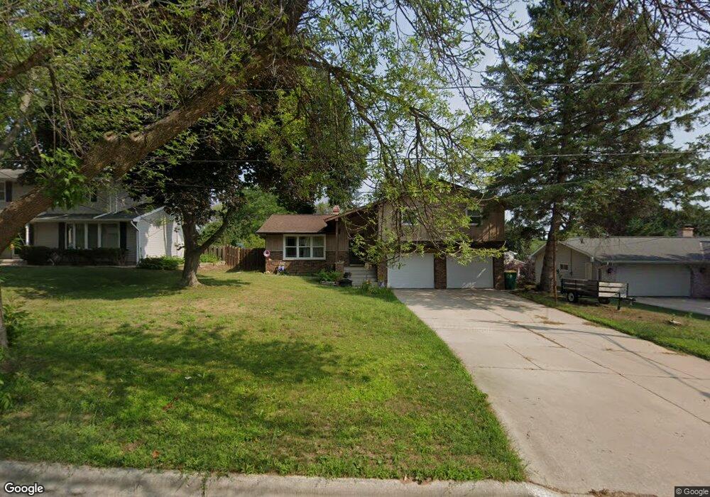
2556 Oakwood Dr Green Bay, WI 54304
MacArthur Heights NeighborhoodEstimated Value: $269,655 - $331,000
--
Bed
--
Bath
--
Sq Ft
10,367
Sq Ft Lot
About This Home
This home is located at 2556 Oakwood Dr, Green Bay, WI 54304 and is currently estimated at $315,164. 2556 Oakwood Dr is a home located in Brown County with nearby schools including MacArthur Elementary School, Lombardi Middle School, and Southwest High School.
Ownership History
Date
Name
Owned For
Owner Type
Purchase Details
Closed on
Jul 14, 2021
Sold by
Stephens Gregg A and Stephens Mary E
Bought by
Wisniewski Kyle and Steshetz Ashley M
Current Estimated Value
Home Financials for this Owner
Home Financials are based on the most recent Mortgage that was taken out on this home.
Original Mortgage
$121,250
Outstanding Balance
$110,016
Interest Rate
2.9%
Mortgage Type
New Conventional
Estimated Equity
$205,148
Create a Home Valuation Report for This Property
The Home Valuation Report is an in-depth analysis detailing your home's value as well as a comparison with similar homes in the area
Home Values in the Area
Average Home Value in this Area
Purchase History
| Date | Buyer | Sale Price | Title Company |
|---|---|---|---|
| Wisniewski Kyle | $125,000 | Liberty Title |
Source: Public Records
Mortgage History
| Date | Status | Borrower | Loan Amount |
|---|---|---|---|
| Open | Wisniewski Kyle | $121,250 |
Source: Public Records
Tax History Compared to Growth
Tax History
| Year | Tax Paid | Tax Assessment Tax Assessment Total Assessment is a certain percentage of the fair market value that is determined by local assessors to be the total taxable value of land and additions on the property. | Land | Improvement |
|---|---|---|---|---|
| 2024 | $3,996 | $215,300 | $38,900 | $176,400 |
| 2023 | $3,813 | $215,300 | $38,900 | $176,400 |
| 2022 | $3,731 | $215,300 | $38,900 | $176,400 |
| 2021 | $2,767 | $124,000 | $33,300 | $90,700 |
| 2020 | $2,814 | $124,000 | $33,300 | $90,700 |
| 2019 | $2,718 | $124,000 | $33,300 | $90,700 |
| 2018 | $2,659 | $124,000 | $33,300 | $90,700 |
| 2017 | $2,637 | $124,000 | $33,300 | $90,700 |
| 2016 | $2,593 | $124,000 | $33,300 | $90,700 |
| 2015 | $2,698 | $124,000 | $33,300 | $90,700 |
| 2014 | $2,761 | $124,000 | $33,300 | $90,700 |
| 2013 | $2,761 | $124,000 | $33,300 | $90,700 |
Source: Public Records
Map
Nearby Homes
- 2550 He Nis Ra Ln
- 2640 He Nis Ra Ln
- 2441 Matchwood Ln
- 2439 W Point Rd
- 2466 Parkwood Dr
- 2044 Ann Ln
- 2060 Wintergreen Ct
- 2060 Trissino Way
- 1433 Baumgart Rd Unit 1435
- 1973 Knotty Pine Dr
- 1514 Ashley Ct
- 1570 Mesa Dr
- 1921 Beech Tree Dr
- 1471 Parkway Dr
- 1450 Woodmont Way
- 2031 Bradbury Ln
- 1680 Cormier Rd
- 2768 Independence Dr
- 1306 Nelson St Unit 1308
- 1779 9th St
- 2560 Oakwood Dr
- 2557 Forestville Dr
- 2551 Forestville Dr
- 2566 Oakwood Dr
- 2544 Oakwood Dr
- 2565 Forestville Dr
- 2565 Oakwood Dr
- 2551 Oakwood Dr
- 2574 Oakwood Dr
- 2536 Oakwood Dr
- 1908 Belmont Dr
- 2571 Forestville Dr
- 2535 Forestville Dr Unit 2537
- 2580 Oakwood Dr
- 2556 Forestville Dr
- 2530 Oakwood Dr
- 2560 Woodridge Ln
- 2556 Woodridge Ln Unit 2558
- 1721 Saint Robert Dr
- 2550 Forestville Dr