Estimated Value: $569,000 - $637,000
3
Beds
3
Baths
2,653
Sq Ft
$223/Sq Ft
Est. Value
About This Home
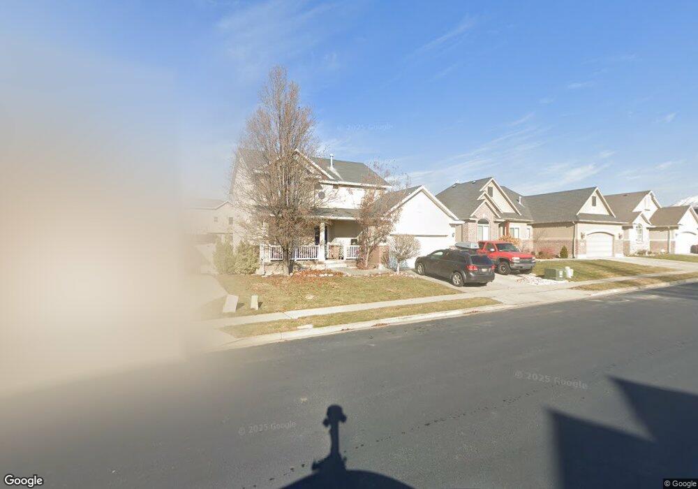
This home is located at 2556 W 2300 N, Lehi, UT 84043 and is currently estimated at $592,506, approximately $223 per square foot. 2556 W 2300 N is a home located in Utah County with nearby schools including Liberty Hills Elementary School, Skyridge High School, and Ascent Academies of Utah - Lehi Campus.
Ownership History
Date
Name
Owned For
Owner Type
Purchase Details
Closed on
Jun 11, 2015
Sold by
Watkins Brian
Bought by
Johnstone Beverly and Kenney Christopher
Current Estimated Value
Home Financials for this Owner
Home Financials are based on the most recent Mortgage that was taken out on this home.
Original Mortgage
$271,000
Outstanding Balance
$208,918
Interest Rate
3.62%
Mortgage Type
FHA
Estimated Equity
$383,588
Purchase Details
Closed on
Feb 20, 2013
Sold by
Watkins Lara
Bought by
Watkins Brian
Home Financials for this Owner
Home Financials are based on the most recent Mortgage that was taken out on this home.
Original Mortgage
$263,987
Interest Rate
3.37%
Mortgage Type
FHA
Purchase Details
Closed on
Apr 4, 2008
Sold by
Ivory Homes Ltd
Bought by
Watkins Brian and Watkins Lara
Home Financials for this Owner
Home Financials are based on the most recent Mortgage that was taken out on this home.
Original Mortgage
$281,480
Interest Rate
6.04%
Mortgage Type
FHA
Create a Home Valuation Report for This Property
The Home Valuation Report is an in-depth analysis detailing your home's value as well as a comparison with similar homes in the area
Home Values in the Area
Average Home Value in this Area
Purchase History
| Date | Buyer | Sale Price | Title Company |
|---|---|---|---|
| Johnstone Beverly | -- | Metro National Title | |
| Watkins Brian | -- | Title One | |
| Watkins Brian | -- | Cottonwood Title Insurance | |
| Ivory Homes Ltd | -- | Cottonwood Title Insurance |
Source: Public Records
Mortgage History
| Date | Status | Borrower | Loan Amount |
|---|---|---|---|
| Open | Johnstone Beverly | $271,000 | |
| Previous Owner | Watkins Brian | $263,987 | |
| Previous Owner | Watkins Brian | $281,480 |
Source: Public Records
Tax History Compared to Growth
Tax History
| Year | Tax Paid | Tax Assessment Tax Assessment Total Assessment is a certain percentage of the fair market value that is determined by local assessors to be the total taxable value of land and additions on the property. | Land | Improvement |
|---|---|---|---|---|
| 2025 | $2,258 | $275,605 | $211,400 | $289,700 |
| 2024 | $2,258 | $264,275 | $0 | $0 |
| 2023 | $2,140 | $271,920 | $0 | $0 |
| 2022 | $2,206 | $271,700 | $0 | $0 |
| 2021 | $1,962 | $365,400 | $122,300 | $243,100 |
| 2020 | $1,849 | $340,400 | $113,200 | $227,200 |
| 2019 | $1,746 | $334,200 | $113,200 | $221,000 |
| 2018 | $1,701 | $307,800 | $106,700 | $201,100 |
| 2017 | $1,601 | $154,000 | $0 | $0 |
| 2016 | $1,626 | $145,090 | $0 | $0 |
| 2015 | $1,660 | $140,635 | $0 | $0 |
| 2014 | $1,605 | $135,190 | $0 | $0 |
Source: Public Records
Map
Nearby Homes
- 2189 N 2600 W
- 2464 W 2250 N
- 2196 N 2350 W
- Huntington Plan at Pioneer Meadows
- Silver Lake Plan at Pioneer Meadows
- Summit Plan at Pioneer Meadows
- Palisade Plan at Pioneer Meadows
- 1968 N 2040 W Unit 40
- 1969 N 2040 St W
- 2013 N 2040 W
- 1990 N 2040 W
- 1990 N 2040 W Unit 41
- 2419 N 3130 W
- 1970 N 2090 St W
- 3199 W 2450 N
- 1854 N 2230 W
- 2673 N Double Eagle Dr
- 1842 N 2230 W
- 1870 N 2230 W
- 1870 N 2230 W Unit 23