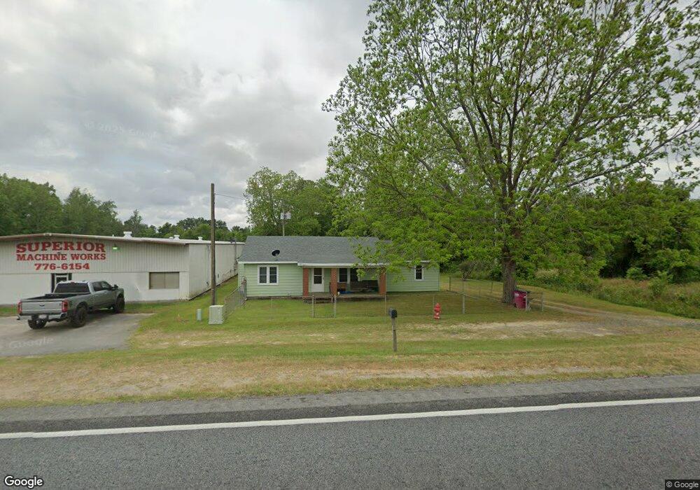
2557 Us Highway 82 W Sylvester, GA 31791
Estimated Value: $128,309 - $232,000
2
Beds
1
Bath
1,260
Sq Ft
$147/Sq Ft
Est. Value
About This Home
This home is located at 2557 Us Highway 82 W, Sylvester, GA 31791 and is currently estimated at $185,077, approximately $146 per square foot. 2557 Us Highway 82 W is a home located in Worth County with nearby schools including Worth County Primary School, Worth County Elementary School, and Worth County Middle School.
Ownership History
Date
Name
Owned For
Owner Type
Purchase Details
Closed on
Mar 20, 2019
Sold by
Wwp Properties Llc
Bought by
Haralson Marcus W and Haralson Vickey D
Current Estimated Value
Purchase Details
Closed on
Jun 29, 2001
Sold by
Jordan Agnes and Jordan Others
Bought by
Irvin Patricia
Purchase Details
Closed on
Jul 6, 1990
Bought by
Jordan Agnes and Jordan Others
Purchase Details
Closed on
Apr 1, 1986
Bought by
Paramore Charles
Create a Home Valuation Report for This Property
The Home Valuation Report is an in-depth analysis detailing your home's value as well as a comparison with similar homes in the area
Home Values in the Area
Average Home Value in this Area
Purchase History
| Date | Buyer | Sale Price | Title Company |
|---|---|---|---|
| Haralson Marcus W | $250,000 | -- | |
| Irvin Patricia | $1,500 | -- | |
| Jordan Agnes | -- | -- | |
| Paramore Charles | -- | -- |
Source: Public Records
Tax History Compared to Growth
Tax History
| Year | Tax Paid | Tax Assessment Tax Assessment Total Assessment is a certain percentage of the fair market value that is determined by local assessors to be the total taxable value of land and additions on the property. | Land | Improvement |
|---|---|---|---|---|
| 2024 | $626 | $14,630 | $1,030 | $13,600 |
| 2023 | $626 | $14,630 | $1,030 | $13,600 |
| 2022 | $604 | $13,870 | $1,030 | $12,840 |
| 2021 | $581 | $13,870 | $1,030 | $12,840 |
| 2020 | $581 | $13,870 | $1,030 | $12,840 |
| 2019 | $581 | $13,870 | $1,030 | $12,840 |
| 2018 | $397 | $13,870 | $1,030 | $12,840 |
| 2017 | $397 | $13,870 | $1,030 | $12,840 |
| 2016 | $341 | $13,870 | $1,030 | $12,840 |
| 2015 | $342 | $13,870 | $1,030 | $12,840 |
| 2014 | $342 | $13,870 | $1,030 | $12,840 |
| 2013 | -- | $13,870 | $1,030 | $12,840 |
| 2012 | -- | $13,870 | $1,029 | $12,840 |
Source: Public Records
Map
Nearby Homes
- 107 Gardner Rd
- 103 N Ayers St
- 128 Airport Rd
- 0 W Pinson St Unit 10582366
- 101 Elm St
- 801 N Washington St
- 1011 N Washington St
- 1102 N Washington St
- 1007 N Isabella St
- 0 N Isabella St Unit 161570
- 701 N Isabella St
- 307 E Pope St
- 710 S Jefferson St
- 1432 S Ga Hwy 33s
- 203 E Pinson St
- 100 Carriage Ln
- 316 Bell Rd
- 202 N Westberry St
- 402 N McPhaul St
- 0 Ga Hwy 82 Unit 913408
- 2545 Us Highway 82 W
- 2541 Us Highway 82 W
- 2533 Us Highway 82 W
- 2602 Us Highway 82 W
- 2651 Us Highway 82 W
- 0 Us Hwy 82 W Tract 4 Unit 134431
- 0 Us Hwy 82 W Tract 5 Unit 134430
- 2638 Us Highway 82 W
- 742 Massey Airport Rd
- 652 Massey Airport Rd
- 646 Massey Airport Rd
- 628 Massey Airport Rd
- 759 Massey Airport Rd
- 2661 Us Highway 82 W
- 135 Youngblood Rd
- 141 Youngblood Rd
- 2704 Us Highway 82 W
- 119 Pritchard Rd
- 514 Massey Airport Rd
- 108 Silver Lake Cir