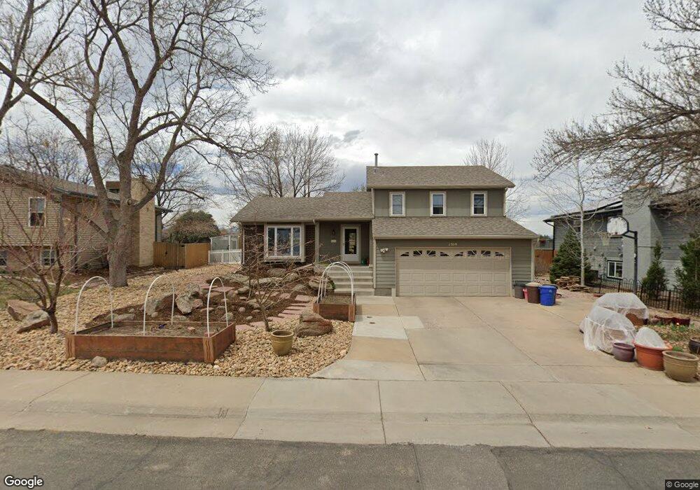
2559 N Franklin Ave Louisville, CO 80027
Estimated Value: $710,000 - $888,000
3
Beds
3
Baths
1,284
Sq Ft
$623/Sq Ft
Est. Value
About This Home
This home is located at 2559 N Franklin Ave, Louisville, CO 80027 and is currently estimated at $800,469, approximately $623 per square foot. 2559 N Franklin Ave is a home located in Boulder County with nearby schools including Coal Creek Elementary School, Louisville Middle School, and Monarch High School.
Ownership History
Date
Name
Owned For
Owner Type
Purchase Details
Closed on
Apr 12, 2013
Sold by
Schweikert Marla Jean and Schweikert Marla J
Bought by
Pendergraft John H
Current Estimated Value
Home Financials for this Owner
Home Financials are based on the most recent Mortgage that was taken out on this home.
Original Mortgage
$332,800
Outstanding Balance
$235,761
Interest Rate
3.55%
Mortgage Type
New Conventional
Estimated Equity
$564,708
Purchase Details
Closed on
Jan 18, 2012
Sold by
Schweikert Ronald L
Bought by
Schweikert Marla J
Create a Home Valuation Report for This Property
The Home Valuation Report is an in-depth analysis detailing your home's value as well as a comparison with similar homes in the area
Home Values in the Area
Average Home Value in this Area
Purchase History
| Date | Buyer | Sale Price | Title Company |
|---|---|---|---|
| Pendergraft John H | $416,000 | Fidelity National Title Insu | |
| Schweikert Marla J | -- | None Available |
Source: Public Records
Mortgage History
| Date | Status | Borrower | Loan Amount |
|---|---|---|---|
| Open | Pendergraft John H | $332,800 |
Source: Public Records
Tax History Compared to Growth
Tax History
| Year | Tax Paid | Tax Assessment Tax Assessment Total Assessment is a certain percentage of the fair market value that is determined by local assessors to be the total taxable value of land and additions on the property. | Land | Improvement |
|---|---|---|---|---|
| 2025 | $3,999 | $57,094 | $28,731 | $28,363 |
| 2024 | $3,999 | $57,094 | $28,731 | $28,363 |
| 2023 | $4,523 | $51,188 | $34,378 | $20,495 |
| 2022 | $4,439 | $46,127 | $27,216 | $18,911 |
| 2021 | $4,395 | $47,454 | $27,999 | $19,455 |
| 2020 | $4,022 | $42,972 | $22,022 | $20,950 |
| 2019 | $3,964 | $42,972 | $22,022 | $20,950 |
| 2018 | $3,371 | $37,728 | $11,376 | $26,352 |
| 2017 | $3,304 | $43,024 | $12,577 | $30,447 |
| 2016 | $2,915 | $33,130 | $13,930 | $19,200 |
| 2015 | $2,763 | $27,303 | $11,701 | $15,602 |
| 2014 | $2,334 | $27,303 | $11,701 | $15,602 |
Source: Public Records
Map
Nearby Homes
- 215 Sunland St
- 9224 Baseline Rd
- 419 Centennial Dr
- 2849 Crater Lake Ln
- 253 W Cedar Way
- 142 Pheasant Run
- 313 Caribou Pass Cir
- 152 Pheasant Run
- 2758 Meadow Mountain Trail
- 1919 Quail Ct
- 338 Pheasant Run
- 187 Rendezvous Dr
- 714 Skywalker Point
- 145 Brittany Ln
- 1851 Gallagher Ln
- 1615 Cottonwood Dr Unit 9
- 1856 Kalel Ln
- 1612 Cottonwood Dr Unit 11W
- 578 Indian Peaks Trail W Unit W
- 1608 Cottonwood Dr Unit 11
- 2563 N Franklin Ave
- 2541 N Franklin Ave
- 2575 N Franklin Ave
- 2537 N Franklin Ave
- 2542 N Franklin Ave
- 2558 N Franklin Ave
- 2530 N Franklin Ave
- 2564 N Franklin Ave
- 2526 N Franklin Ave
- 2523 N Franklin Ave
- 2581 N Franklin Ave
- 2514 N Franklin Ave
- 2536 Sunrise Ct
- 2561 Evans Ave
- 2523 Sunrise Ct
- 2511 N Franklin Ave
- 2543 Evans Ave
- 2593 N Franklin Ave
- 2502 N Franklin Ave
- 2528 Sunrise Ct