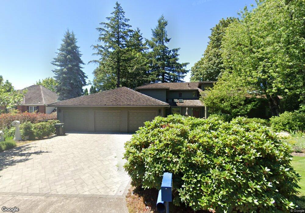
2559 Palisades Crest Dr Lake Oswego, OR 97034
Palisades NeighborhoodEstimated Value: $1,515,000 - $1,727,589
5
Beds
4
Baths
4,207
Sq Ft
$383/Sq Ft
Est. Value
About This Home
This home is located at 2559 Palisades Crest Dr, Lake Oswego, OR 97034 and is currently estimated at $1,612,147, approximately $383 per square foot. 2559 Palisades Crest Dr is a home located in Clackamas County with nearby schools including Lakeridge Middle School, Lakeridge High School, and The Children's Hour Academy.
Ownership History
Date
Name
Owned For
Owner Type
Purchase Details
Closed on
Jan 12, 2018
Sold by
Mitchell John H and Mitchell Lois J
Bought by
Mitchell John H and Cacy Georgia
Current Estimated Value
Home Financials for this Owner
Home Financials are based on the most recent Mortgage that was taken out on this home.
Original Mortgage
$300,000
Outstanding Balance
$167,015
Interest Rate
3.94%
Mortgage Type
New Conventional
Estimated Equity
$1,445,132
Purchase Details
Closed on
Feb 6, 1995
Sold by
Brault Jean D and Brault Kathryn M
Bought by
Mitchell Robert D and Mitchell Diane L
Create a Home Valuation Report for This Property
The Home Valuation Report is an in-depth analysis detailing your home's value as well as a comparison with similar homes in the area
Home Values in the Area
Average Home Value in this Area
Purchase History
| Date | Buyer | Sale Price | Title Company |
|---|---|---|---|
| Mitchell John H | $93,030 | Title Source Inc | |
| Mitchell Robert D | -- | Fidelity National Title Co |
Source: Public Records
Mortgage History
| Date | Status | Borrower | Loan Amount |
|---|---|---|---|
| Open | Mitchell John H | $300,000 |
Source: Public Records
Tax History Compared to Growth
Tax History
| Year | Tax Paid | Tax Assessment Tax Assessment Total Assessment is a certain percentage of the fair market value that is determined by local assessors to be the total taxable value of land and additions on the property. | Land | Improvement |
|---|---|---|---|---|
| 2025 | $19,453 | $1,015,163 | -- | -- |
| 2024 | $18,934 | $985,596 | -- | -- |
| 2023 | $18,934 | $956,890 | $0 | $0 |
| 2022 | $17,833 | $929,020 | $0 | $0 |
| 2021 | $16,469 | $901,962 | $0 | $0 |
| 2020 | $16,055 | $875,692 | $0 | $0 |
| 2019 | $15,572 | $845,392 | $0 | $0 |
| 2018 | $14,581 | $808,190 | $0 | $0 |
| 2017 | $14,069 | $784,650 | $0 | $0 |
| 2016 | $12,806 | $761,796 | $0 | $0 |
| 2015 | $12,372 | $739,608 | $0 | $0 |
| 2014 | $11,948 | $718,066 | $0 | $0 |
Source: Public Records
Map
Nearby Homes
- 17677 Westview Dr
- 2306 Mayors Ln
- 12 Dover Way
- 18815 Hilltop Rd
- 18300 Bryant Rd
- 2627 Park Rd
- 17035 Westview Dr
- 1799 Atherton Dr
- 3220 Southshore Blvd
- 18706 Bryant Rd
- 19229 35th Place
- 17210 Cedar Rd
- 4023 Melissa Dr
- 18100 Bryant Rd
- 4123 Chad Dr
- 17810 Sarah Hill Ln
- 17367 Canal Cir
- 16878 Canyon Dr
- 2255 Glen Haven Rd
- 1951 Greentree Rd
- 2575 Palisades Crest Dr
- 2543 Palisades Crest Dr
- 18024 Gimley Ct
- 2527 Palisades Crest Dr
- 2591 Palisades Crest Dr
- 2552 Palisades Crest Dr
- 18020 Gimley Ct
- 18068 Hobbit Ct
- 18028 Gimley Ct
- 2530 Palisades Crest Dr
- 2574 Palisades Crest Dr
- 18080 Hobbit Ct
- 2596 Palisades Crest Dr
- 2508 Palisades Crest Dr
- 2511 Palisades Crest Dr
- 2607 Palisades Crest Dr
- 18018 Gimley Ct
- 18282 Anduin Terrace
- 18034 Westview Dr
- 18322 Anduin Terrace