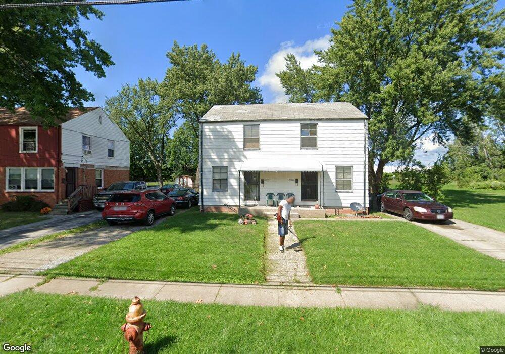
25595 Tungsten Rd Euclid, OH 44132
Estimated Value: $73,000 - $82,000
2
Beds
1
Bath
1,082
Sq Ft
$71/Sq Ft
Est. Value
About This Home
This home is located at 25595 Tungsten Rd, Euclid, OH 44132 and is currently estimated at $76,561, approximately $70 per square foot. 25595 Tungsten Rd is a home located in Cuyahoga County with nearby schools including Bluestone Elementary School, Euclid High School, and Pinnacle Academy.
Ownership History
Date
Name
Owned For
Owner Type
Purchase Details
Closed on
Feb 15, 1989
Sold by
Divoky Laurence J
Bought by
Williams Darneace D
Current Estimated Value
Purchase Details
Closed on
Sep 3, 1976
Sold by
Jones Dawn A
Bought by
Divoky Laurence J
Purchase Details
Closed on
Jul 25, 1975
Sold by
Cooper John R and Cooper Patricia A
Bought by
Jones Dawn A
Purchase Details
Closed on
Jan 1, 1975
Bought by
Cooper John R and Cooper Patricia A
Create a Home Valuation Report for This Property
The Home Valuation Report is an in-depth analysis detailing your home's value as well as a comparison with similar homes in the area
Home Values in the Area
Average Home Value in this Area
Purchase History
| Date | Buyer | Sale Price | Title Company |
|---|---|---|---|
| Williams Darneace D | $61,000 | -- | |
| Divoky Laurence J | $26,900 | -- | |
| Jones Dawn A | $24,500 | -- | |
| Cooper John R | -- | -- |
Source: Public Records
Tax History Compared to Growth
Tax History
| Year | Tax Paid | Tax Assessment Tax Assessment Total Assessment is a certain percentage of the fair market value that is determined by local assessors to be the total taxable value of land and additions on the property. | Land | Improvement |
|---|---|---|---|---|
| 2024 | $1,137 | $24,850 | $4,760 | $20,090 |
| 2023 | $844 | $17,610 | $4,030 | $13,580 |
| 2022 | $1,552 | $17,610 | $4,030 | $13,580 |
| 2021 | $1,719 | $17,610 | $4,030 | $13,580 |
| 2020 | $1,453 | $13,340 | $3,050 | $10,290 |
| 2019 | $1,301 | $38,100 | $8,700 | $29,400 |
| 2018 | $1,294 | $13,340 | $3,050 | $10,290 |
| 2017 | $1,374 | $11,690 | $2,520 | $9,170 |
| 2016 | $1,377 | $11,690 | $2,520 | $9,170 |
| 2015 | $1,463 | $11,690 | $2,520 | $9,170 |
| 2014 | $1,463 | $13,760 | $2,980 | $10,780 |
Source: Public Records
Map
Nearby Homes
- 25550 Tungsten Rd
- 1507 E 256th St
- 1507 Babbitt Rd
- 1523 Babbitt Rd
- 1530 E 254th St
- 1552 E 254th St
- 1468 E 252nd St
- 1467 E 250th St
- 1501 E 248th St
- 1498 E 248th St
- 25151 Euclid Ave
- 24971 Euclid Ave
- 860 E 245th St
- 833 E 250th St
- 820 E 250th St
- 24691 Hawthorne Dr
- 164 Richmond Rd
- 24690 Hawthorne Dr
- 23050 Tracy Ave
- 1670 Hillandale Dr
- 25591 Tungsten Rd
- 25585 Tungsten Rd
- 25581 Tungsten Rd
- 25575 Tungsten Rd
- 25580 Tungsten Rd
- 25611 Tungsten Rd
- 25571 Tungsten Rd
- 25565 Tungsten Rd
- 25615 Tungsten Rd
- 25574 Tungsten Rd
- 25606 Tungsten Rd
- 1466 E 256th St
- 25570 Tungsten Rd
- 25561 Tungsten Rd
- 1461 E 256th St
- 1468 E 256th St
- 25564 Tungsten Rd
- 1463 E 256th St
- 1463 E 256th St Unit E
- 25555 Tungsten Rd