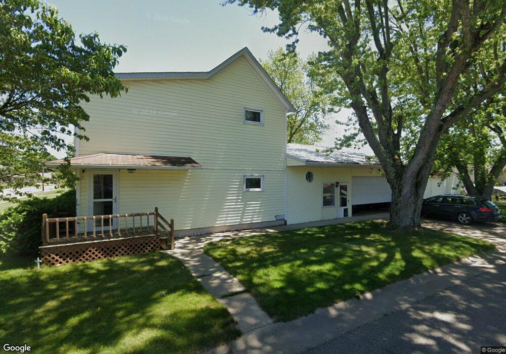
256 9th St SW Strasburg, OH 44680
Estimated Value: $223,000 - $280,000
3
Beds
2
Baths
1,680
Sq Ft
$142/Sq Ft
Est. Value
About This Home
This home is located at 256 9th St SW, Strasburg, OH 44680 and is currently estimated at $238,956, approximately $142 per square foot. 256 9th St SW is a home located in Tuscarawas County with nearby schools including Strasburg-Franklin Elementary School and Strasburg-Franklin High School.
Ownership History
Date
Name
Owned For
Owner Type
Purchase Details
Closed on
May 4, 2022
Sold by
Ruthann Fuhrer
Bought by
Ninth Street Investments Llc
Current Estimated Value
Home Financials for this Owner
Home Financials are based on the most recent Mortgage that was taken out on this home.
Original Mortgage
$337,737
Outstanding Balance
$299,893
Interest Rate
4.4%
Mortgage Type
New Conventional
Estimated Equity
-$60,937
Purchase Details
Closed on
Feb 13, 1991
Sold by
Fuhrer Ruthann
Bought by
Fuhrer Ruthann
Purchase Details
Closed on
Jun 6, 1990
Sold by
Fuhrer Jack F and Fuhrer Ruthann
Bought by
Fuhrer Ruthann
Create a Home Valuation Report for This Property
The Home Valuation Report is an in-depth analysis detailing your home's value as well as a comparison with similar homes in the area
Home Values in the Area
Average Home Value in this Area
Purchase History
| Date | Buyer | Sale Price | Title Company |
|---|---|---|---|
| Ninth Street Investments Llc | $126,245 | Hanhart David M | |
| Fuhrer Ruthann | -- | -- | |
| Fuhrer Ruthann | $101,000 | -- |
Source: Public Records
Mortgage History
| Date | Status | Borrower | Loan Amount |
|---|---|---|---|
| Open | Ninth Street Investments Llc | $337,737 |
Source: Public Records
Tax History Compared to Growth
Tax History
| Year | Tax Paid | Tax Assessment Tax Assessment Total Assessment is a certain percentage of the fair market value that is determined by local assessors to be the total taxable value of land and additions on the property. | Land | Improvement |
|---|---|---|---|---|
| 2024 | $2,146 | $52,830 | $11,400 | $41,430 |
| 2023 | $2,146 | $150,950 | $32,580 | $118,370 |
| 2022 | $1,689 | $52,833 | $11,403 | $41,430 |
| 2021 | $1,444 | $44,142 | $9,331 | $34,811 |
| 2020 | $1,363 | $44,142 | $9,331 | $34,811 |
| 2019 | $1,369 | $44,142 | $9,331 | $34,811 |
| 2018 | $1,164 | $37,250 | $7,880 | $29,370 |
| 2017 | $1,169 | $37,250 | $7,880 | $29,370 |
| 2016 | $1,163 | $37,250 | $7,880 | $29,370 |
| 2014 | $1,115 | $35,140 | $7,880 | $27,260 |
| 2013 | $1,096 | $35,140 | $7,880 | $27,260 |
Source: Public Records
Map
Nearby Homes
- 433 9th St SW
- 602 S Bodmer Ave
- 143 2nd St SE
- 3203 Mount Pleasant Rd
- 7500 Central Rd NW
- 0 Dundee Strasburg Rd NW
- 0 7th St NW
- 6269 Columbia Rd NW
- 0 Cherry Run Rd NW
- 6650 Saint Peters Church Rd NW
- 0 State Route 250 NW Unit 5161477
- 6238 Saint Peters Church Rd NW
- 1296 Russell Dr NW
- 5181 State Route 516 NW
- 4029 Minard Rd NW
- 0 Swonger Rd Unit 5161456
- 0 Swonger Rd Unit 5161457
- 0 Bair Rd NW Unit 5124469
- 0 Bair Rd NW Unit 5124477
- 0 Bair Rd NW Unit 5124464