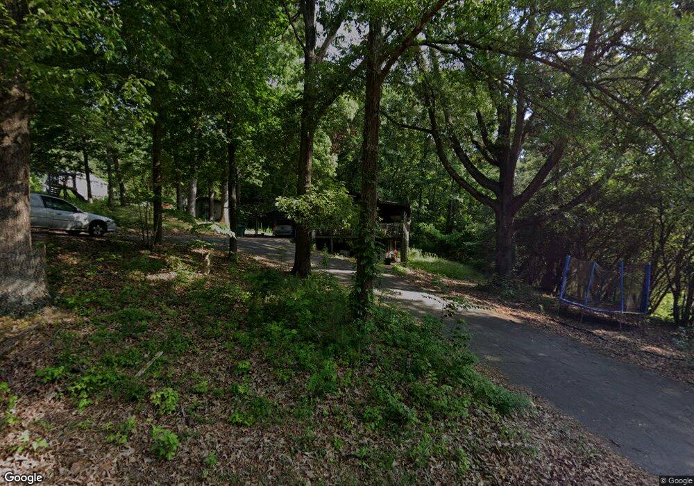
256 Blevins Dr Ringgold, GA 30736
Westside NeighborhoodEstimated Value: $235,000 - $373,000
--
Bed
2
Baths
2,320
Sq Ft
$128/Sq Ft
Est. Value
About This Home
This home is located at 256 Blevins Dr, Ringgold, GA 30736 and is currently estimated at $296,763, approximately $127 per square foot. 256 Blevins Dr is a home located in Catoosa County with nearby schools including Battlefield Primary School, Battlefield Elementary School, and Lakeview Middle School.
Ownership History
Date
Name
Owned For
Owner Type
Purchase Details
Closed on
Jan 8, 2007
Sold by
Cds Properties Llc
Bought by
Welch Amy
Current Estimated Value
Home Financials for this Owner
Home Financials are based on the most recent Mortgage that was taken out on this home.
Original Mortgage
$115,000
Outstanding Balance
$68,110
Interest Rate
6.05%
Mortgage Type
New Conventional
Estimated Equity
$228,653
Purchase Details
Closed on
Aug 1, 2006
Sold by
Not Provided
Bought by
Welch Amy
Create a Home Valuation Report for This Property
The Home Valuation Report is an in-depth analysis detailing your home's value as well as a comparison with similar homes in the area
Home Values in the Area
Average Home Value in this Area
Purchase History
| Date | Buyer | Sale Price | Title Company |
|---|---|---|---|
| Welch Amy | $115,000 | -- | |
| Welch Amy | -- | -- |
Source: Public Records
Mortgage History
| Date | Status | Borrower | Loan Amount |
|---|---|---|---|
| Open | Welch Amy | $115,000 |
Source: Public Records
Tax History Compared to Growth
Tax History
| Year | Tax Paid | Tax Assessment Tax Assessment Total Assessment is a certain percentage of the fair market value that is determined by local assessors to be the total taxable value of land and additions on the property. | Land | Improvement |
|---|---|---|---|---|
| 2024 | $1,415 | $68,332 | $9,926 | $58,406 |
| 2023 | $1,253 | $57,958 | $9,926 | $48,032 |
| 2022 | $1,109 | $51,536 | $9,926 | $41,610 |
| 2021 | $1,036 | $51,536 | $9,926 | $41,610 |
| 2020 | $1,092 | $47,176 | $9,926 | $37,250 |
| 2019 | $999 | $44,695 | $7,445 | $37,250 |
| 2018 | $1,104 | $44,695 | $7,445 | $37,250 |
| 2017 | $1,012 | $42,971 | $7,445 | $35,526 |
| 2016 | $958 | $38,866 | $7,445 | $31,421 |
| 2015 | -- | $38,866 | $7,445 | $31,421 |
| 2014 | -- | $38,866 | $7,445 | $31,421 |
| 2013 | -- | $38,865 | $7,444 | $31,420 |
Source: Public Records
Map
Nearby Homes
- 224 N Brent Dr
- 137 Elm Ave
- 325 Cindy Cir
- 0 Pine Grove Rd Unit 1522542
- 27 Templin Hills Ln
- 0 Old Mill Rd Unit 1507874
- 618 Larry Dr
- 615 Larry Dr
- 394 Pierce Dr
- 102 Water Mill Trace
- 51 Poppy Ln
- 376 Water Mill Trace
- 382 Foster Rd
- 224 Foster Rd
- 184 Bridlewood Dr
- 85 Deer Ln
- 35 Karen Dr
- 354 Karen Dr
- 255 Willow Grove Ct
- 2298 Pine Grove Rd
- 68 Gracie Ave
- 285 Blevins Dr
- 253 Blevins Dr
- 209 Blevins Dr
- 313 Blevins Dr
- 273 Blevins Dr
- 293 Gracie Ave
- 184 Blevins Dr
- 7 Gracie Ave
- 2 Gracie Ave
- 20 Janie Ave
- 72 Janie Ave
- 0 Gracie Ave
- 0 Gracie Ave Unit 953420
- 0 Gracie Ave Unit 1158824
- 141 Gracie Ave
- 49 Janie Ave
- 170 Gracie Ave
- 1 Gracie Ave
- 0 Blevins Dr Unit 964869
