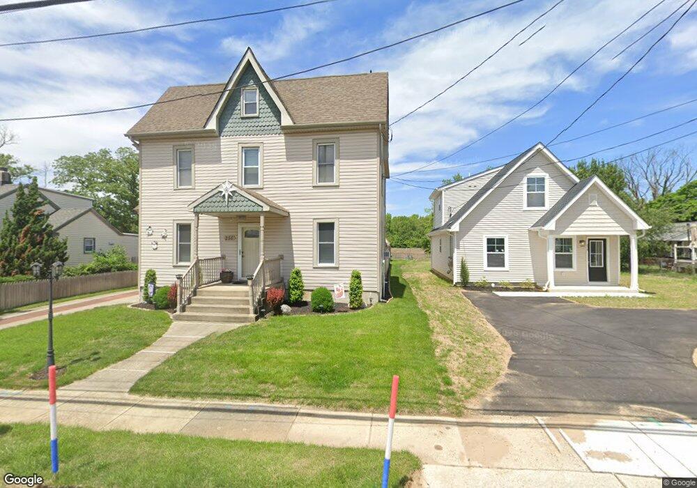
256 Crown Point Rd West Deptford, NJ 08086
West Deptford Township NeighborhoodEstimated Value: $276,416 - $409,000
--
Bed
--
Bath
1,728
Sq Ft
$195/Sq Ft
Est. Value
About This Home
This home is located at 256 Crown Point Rd, West Deptford, NJ 08086 and is currently estimated at $337,104, approximately $195 per square foot. 256 Crown Point Rd is a home located in Gloucester County with nearby schools including Red Bank Elementary School, Green-Fields Elementary School, and Oakview Elementary School.
Ownership History
Date
Name
Owned For
Owner Type
Purchase Details
Closed on
Aug 7, 2003
Sold by
Boucher Joan F
Bought by
Matelyan Paul and Matelyan Bonnie
Current Estimated Value
Home Financials for this Owner
Home Financials are based on the most recent Mortgage that was taken out on this home.
Original Mortgage
$76,000
Outstanding Balance
$33,077
Interest Rate
5.46%
Mortgage Type
Purchase Money Mortgage
Estimated Equity
$304,027
Create a Home Valuation Report for This Property
The Home Valuation Report is an in-depth analysis detailing your home's value as well as a comparison with similar homes in the area
Home Values in the Area
Average Home Value in this Area
Purchase History
| Date | Buyer | Sale Price | Title Company |
|---|---|---|---|
| Matelyan Paul | $80,000 | Lenders Edge Title Ag |
Source: Public Records
Mortgage History
| Date | Status | Borrower | Loan Amount |
|---|---|---|---|
| Open | Matelyan Paul | $76,000 |
Source: Public Records
Tax History Compared to Growth
Tax History
| Year | Tax Paid | Tax Assessment Tax Assessment Total Assessment is a certain percentage of the fair market value that is determined by local assessors to be the total taxable value of land and additions on the property. | Land | Improvement |
|---|---|---|---|---|
| 2025 | $6,226 | $178,300 | $38,600 | $139,700 |
| 2024 | $6,146 | $178,300 | $38,600 | $139,700 |
| 2023 | $6,146 | $178,300 | $38,600 | $139,700 |
| 2022 | $6,117 | $178,300 | $38,600 | $139,700 |
| 2021 | $6,096 | $178,300 | $38,600 | $139,700 |
| 2020 | $6,082 | $178,300 | $38,600 | $139,700 |
| 2019 | $5,912 | $178,300 | $38,600 | $139,700 |
| 2018 | $5,752 | $178,300 | $38,600 | $139,700 |
| 2017 | $5,618 | $178,300 | $38,600 | $139,700 |
| 2016 | $5,461 | $178,300 | $38,600 | $139,700 |
| 2015 | $5,203 | $178,300 | $38,600 | $139,700 |
| 2014 | $4,944 | $178,300 | $38,600 | $139,700 |
Source: Public Records
Map
Nearby Homes
- 247 Crown Point Rd
- 97 Church St
- 232 Snowy Egret Ln
- 433 Crown Point Rd
- 253 Snowy Egret Ln
- 439 Crown Point Rd
- 47 Pelican Place Unit 47
- 67 Pelican Place
- 64 Tilden Rd
- 10 Kennedy Ct
- 124 Brent Ct
- 121 Cape May Ave
- 740 Carter Hill Dr
- 400 Audubon Ave
- 107 Audubon Ave
- 640 Worcester Dr
- 1810 Fernwood Dr
- 266 Passaic Ave
- 863 Doncaster Dr
- 1311 Barnesdale Rd
- 254 Crown Point Rd
- 260 Crown Point Rd
- 252 Crown Point Rd
- 250 Crown Point Rd
- 262 Crown Point Rd
- 262 Crown Point Rd Unit A
- 262 Crown Point Rd Unit 2
- 257 Crown Point Rd
- 255 Crown Point Rd
- 259 Crown Point Rd
- 263 Crown Point Rd
- 253 Crown Point Rd
- 265 Crown Point Rd
- 261 Crown Point Rd
- 251 Crown Point Rd
- 249 Crown Point Rd
- 267 Crown Point Rd
- 0 Church St Unit 1002524116
- 245 Crown Point Rd
- 64 Church St