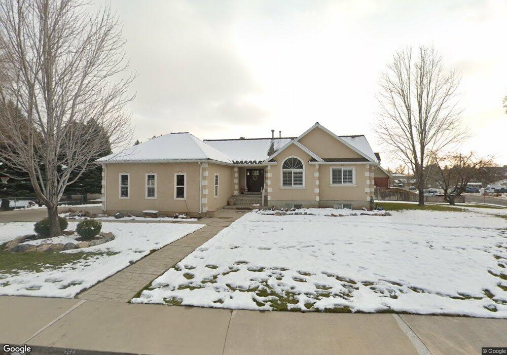
256 E 350 N Alpine, UT 84004
Estimated Value: $636,000 - $832,000
7
Beds
3
Baths
2,986
Sq Ft
$240/Sq Ft
Est. Value
About This Home
This home is located at 256 E 350 N, Alpine, UT 84004 and is currently estimated at $716,159, approximately $239 per square foot. 256 E 350 N is a home located in Utah County with nearby schools including Alpine School, Timberline Middle School, and Lone Peak High School.
Ownership History
Date
Name
Owned For
Owner Type
Purchase Details
Closed on
Nov 25, 2002
Sold by
Wells Fargo Bank Northwest Na
Bought by
Bergquist Peter J and Bergquist Rebecca L
Current Estimated Value
Home Financials for this Owner
Home Financials are based on the most recent Mortgage that was taken out on this home.
Original Mortgage
$155,040
Outstanding Balance
$66,022
Interest Rate
6.12%
Estimated Equity
$650,137
Purchase Details
Closed on
Jul 10, 2002
Sold by
Shepherd Todd A
Bought by
Wells Fargo Bank Northwest Na
Purchase Details
Closed on
Feb 25, 2002
Sold by
Blackmore Lance and Shepherd Todd A
Bought by
Shepherd Todd A
Purchase Details
Closed on
Jan 14, 2002
Sold by
Blackmore Lance
Bought by
Blackmore Lance and Shepherd Todd A
Purchase Details
Closed on
Dec 5, 2001
Sold by
Shepherd Todd A
Bought by
Blackmore Lance
Create a Home Valuation Report for This Property
The Home Valuation Report is an in-depth analysis detailing your home's value as well as a comparison with similar homes in the area
Home Values in the Area
Average Home Value in this Area
Purchase History
| Date | Buyer | Sale Price | Title Company |
|---|---|---|---|
| Bergquist Peter J | -- | Title West Title Co | |
| Wells Fargo Bank Northwest Na | $227,050 | -- | |
| Shepherd Todd A | -- | Timp Title Insurance Agency | |
| Blackmore Lance | -- | Timp Title Insurance Agency | |
| Blackmore Lance | -- | Timp Title Insurance Agency |
Source: Public Records
Mortgage History
| Date | Status | Borrower | Loan Amount |
|---|---|---|---|
| Open | Bergquist Peter J | $155,040 | |
| Closed | Bergquist Peter J | $29,070 |
Source: Public Records
Tax History
| Year | Tax Paid | Tax Assessment Tax Assessment Total Assessment is a certain percentage of the fair market value that is determined by local assessors to be the total taxable value of land and additions on the property. | Land | Improvement |
|---|---|---|---|---|
| 2025 | $3,083 | $359,700 | -- | -- |
| 2024 | $3,083 | $359,370 | $0 | $0 |
| 2023 | $2,864 | $358,380 | $0 | $0 |
| 2022 | $3,146 | $382,250 | $0 | $0 |
| 2021 | $2,569 | $485,000 | $209,600 | $275,400 |
| 2020 | $2,407 | $444,600 | $182,300 | $262,300 |
| 2019 | $2,131 | $410,900 | $182,300 | $228,600 |
| 2018 | $1,933 | $368,300 | $167,700 | $200,600 |
| 2017 | $1,737 | $176,110 | $0 | $0 |
| 2016 | $1,549 | $146,410 | $0 | $0 |
| 2015 | $1,592 | $142,395 | $0 | $0 |
| 2014 | $1,509 | $133,540 | $0 | $0 |
Source: Public Records
Map
Nearby Homes
- 475 Grove Dr
- 499 E 300 N
- 48 N 100 E
- 151 Glacier Lily Dr
- 30 S Main St
- 248 Deerfield Dr
- 512 Eastridge Cir
- 250 S Main St Unit 25
- 250 S Main St Unit 9
- 250 S Main St Unit 7
- 887 E Village Way
- 353 International Way
- 259 Twin River Loop
- 202 E Alpine Dr
- 381 E Watkins Cir Unit 28
- 501 W Devey Dr
- 19 E Elk Ct
- 382 E Heritage Hills Dr
- 463 Heritage Hills Dr
- 287 Heritage Hills Dr
Your Personal Tour Guide
Ask me questions while you tour the home.