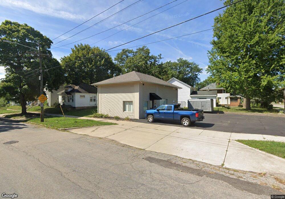
256 Knapp St NE Grand Rapids, MI 49505
Creston NeighborhoodEstimated Value: $140,490
--
Bed
--
Bath
1,000
Sq Ft
$140/Sq Ft
Est. Value
About This Home
This home is located at 256 Knapp St NE, Grand Rapids, MI 49505 and is currently estimated at $140,490, approximately $140 per square foot. 256 Knapp St NE is a home located in Kent County with nearby schools including Palmer School, Riverside Middle School, and Union High School.
Ownership History
Date
Name
Owned For
Owner Type
Purchase Details
Closed on
Apr 1, 2013
Sold by
Properties Of A & J Llc
Bought by
M Squared Llc
Current Estimated Value
Purchase Details
Closed on
Nov 9, 2005
Sold by
Mackay James and Mackay Angela
Bought by
A & J Llc
Purchase Details
Closed on
Jun 8, 2000
Sold by
Sf Inv and Sf Mackay J
Bought by
Mackay J and M Squared Llc
Purchase Details
Closed on
Sep 11, 1997
Sold by
Sf Grp and Sf Ii Grp
Bought by
Sf Ii Grp and M Squared Llc
Purchase Details
Closed on
Mar 30, 1983
Create a Home Valuation Report for This Property
The Home Valuation Report is an in-depth analysis detailing your home's value as well as a comparison with similar homes in the area
Home Values in the Area
Average Home Value in this Area
Purchase History
| Date | Buyer | Sale Price | Title Company |
|---|---|---|---|
| M Squared Llc | $49,000 | Midstate Title Agency Llc | |
| A & J Llc | -- | -- | |
| A & J Llc | -- | -- | |
| Mackay J | $44,000 | -- | |
| Sf Ii Grp | -- | -- | |
| -- | $14,000 | -- |
Source: Public Records
Tax History Compared to Growth
Tax History
| Year | Tax Paid | Tax Assessment Tax Assessment Total Assessment is a certain percentage of the fair market value that is determined by local assessors to be the total taxable value of land and additions on the property. | Land | Improvement |
|---|---|---|---|---|
| 2025 | $2,859 | $98,300 | $0 | $0 |
| 2024 | $2,859 | $103,100 | $0 | $0 |
| 2023 | $2,836 | $89,700 | $0 | $0 |
| 2022 | $2,695 | $81,000 | $0 | $0 |
| 2021 | $2,626 | $70,200 | $0 | $0 |
| 2020 | $2,538 | $60,700 | $0 | $0 |
| 2019 | $2,599 | $54,800 | $0 | $0 |
| 2018 | $2,519 | $53,100 | $0 | $0 |
| 2017 | $2,457 | $50,900 | $0 | $0 |
| 2016 | $2,469 | $46,300 | $0 | $0 |
| 2015 | $2,353 | $46,300 | $0 | $0 |
| 2013 | -- | $44,900 | $0 | $0 |
Source: Public Records
Map
Nearby Homes
- 225 Burr Oak St NE
- 1922 Coit Ave NE
- 2060 Swensberg Ave NE
- 2107 Prospect Ave NE
- 142 Burr Oak St NE
- 143 Dean St NE
- 240 Eleanor St NE
- 155 Palmer St NE
- 22 Elmwood St NE
- 465 Kenwood St NE
- 122 Bowne St NE
- 483 Kenwood St NE
- 68 Bowne St NE
- 16 Graceland St NE
- 2033 Melita Ave NE
- 310 Sweet St NE
- 30 Palmer St NW
- 741 Knapp St NE
- 212 Saunders Ct NE
- 1516 Cole Ave NE
- 1947 Lafayette Ave NE
- 250 Knapp St NE
- 1943 Lafayette Ave NE
- 1950 Lafayette Ave NE
- 1946 Lafayette Ave NE
- 1956 Lafayette Ave NE
- 1939 Lafayette Ave NE
- 242 Knapp St NE
- 249 Elmwood St NE
- 1935 Lafayette Ave NE
- 1940 Lafayette Ave NE
- 310 Knapp St NE
- 238 Knapp St NE
- 239 Elmwood St NE
- 253 Knapp St NE
- 1936 Lafayette Ave NE
- 314 Knapp St NE
- 234 Knapp St NE
- 2000 Swensberg Ave NE
- 301 Knapp St NE