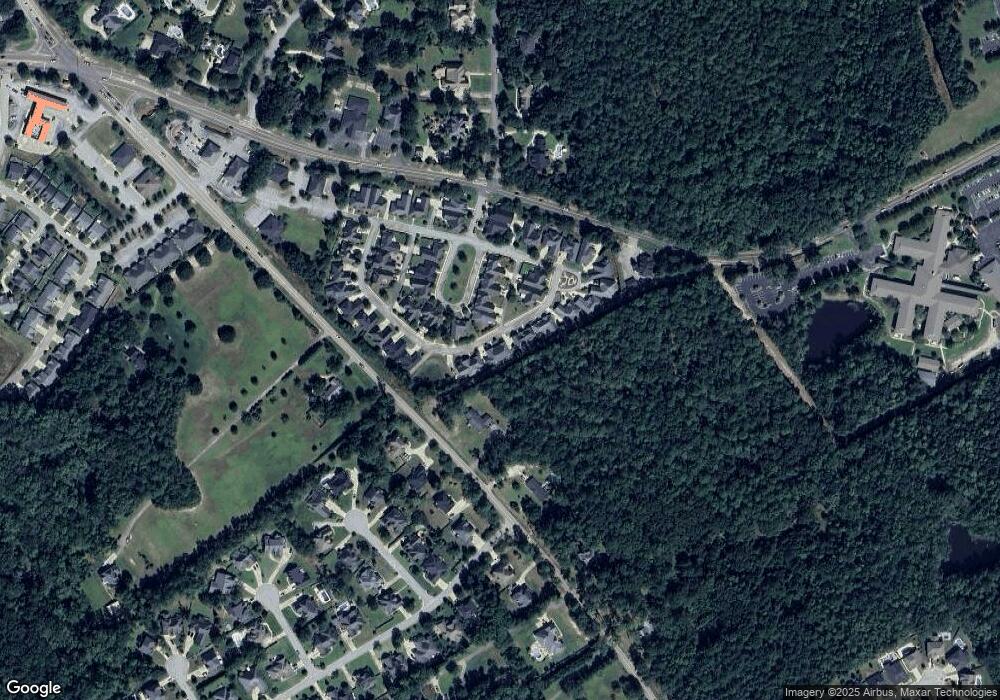
256 Mcgregor Cir Lexington, SC 29072
Estimated Value: $441,855 - $482,000
4
Beds
2
Baths
2,600
Sq Ft
$174/Sq Ft
Est. Value
About This Home
This home is located at 256 Mcgregor Cir, Lexington, SC 29072 and is currently estimated at $452,964, approximately $174 per square foot. 256 Mcgregor Cir is a home located in Lexington County with nearby schools including New Providence Elementary School, River Bluff High School, and American Leadership Academy South Carolina-Lexington Campus.
Ownership History
Date
Name
Owned For
Owner Type
Purchase Details
Closed on
Oct 24, 2024
Sold by
Wray Mary Ann
Bought by
Wray Mary Ann and Wray Harold W
Current Estimated Value
Purchase Details
Closed on
Sep 5, 2014
Sold by
Mickelson Lora R and Shealy Lora R
Bought by
Wray Mary Ann
Home Financials for this Owner
Home Financials are based on the most recent Mortgage that was taken out on this home.
Original Mortgage
$252,000
Interest Rate
4.2%
Mortgage Type
Future Advance Clause Open End Mortgage
Create a Home Valuation Report for This Property
The Home Valuation Report is an in-depth analysis detailing your home's value as well as a comparison with similar homes in the area
Home Values in the Area
Average Home Value in this Area
Purchase History
| Date | Buyer | Sale Price | Title Company |
|---|---|---|---|
| Wray Mary Ann | -- | None Listed On Document | |
| Wray Mary Ann | $315,000 | -- |
Source: Public Records
Mortgage History
| Date | Status | Borrower | Loan Amount |
|---|---|---|---|
| Previous Owner | Wray Mary Ann | $252,000 |
Source: Public Records
Tax History Compared to Growth
Tax History
| Year | Tax Paid | Tax Assessment Tax Assessment Total Assessment is a certain percentage of the fair market value that is determined by local assessors to be the total taxable value of land and additions on the property. | Land | Improvement |
|---|---|---|---|---|
| 2024 | $1,545 | $13,181 | $1,520 | $11,661 |
| 2023 | $1,545 | $13,181 | $1,520 | $11,661 |
| 2022 | $1,550 | $13,181 | $1,520 | $11,661 |
| 2020 | $1,599 | $13,181 | $1,520 | $11,661 |
| 2019 | $1,540 | $12,600 | $1,120 | $11,480 |
| 2018 | $1,513 | $12,600 | $1,120 | $11,480 |
| 2017 | $1,460 | $12,600 | $1,120 | $11,480 |
| 2016 | $1,456 | $12,600 | $1,120 | $11,480 |
| 2014 | $1,422 | $10,140 | $1,080 | $9,060 |
| 2013 | -- | $10,140 | $1,080 | $9,060 |
Source: Public Records
Map
Nearby Homes
- 117 York Commons
- 101 York Commons
- Ashland Plan at Kensington Place - Townhomes
- Bristol Plan at Kensington Place - Townhomes
- 203 Rising Star Ct
- 161 Vista Oaks Dr
- 212 Rising Star Ct
- 143 Belle Chase Dr
- 346 Clarendon Ct
- 580 Rose Sharon Dr
- 227 State Road S-32-145 Unit LOT 1
- 227 State Road S-32-145 Unit LOT 2
- 227 State Road S-32-145 Unit LOT 3
- 207 Spring Creek Ct
- 807 Neighbor Ln
- 301 Cobbleview Dr
- 120 Bennock Mill Ct
- 145 Ashley Hills Dr
- 101 Bennock Mill Ct
- 221 Yachting Rd
- 260 Mcgregor Cir
- 121 York Commons
- 121 York Commons Unit Lot 18
- 125 York Commons
- 117 York Commons
- 264 Mcgregor Cir
- 267 Mcgregor Cir
- 113 York Commons
- 113 York Commons
- 510 Old Chapin Rd
- 124 York Commons
- 268 Mcgregor Cir
- 271 Mcgregor Cir
- 248 Mcgregor Cir
- 109 York Commons
- 109 York Commons
- 241 Mcgregor Cir
- 244 Mcgregor Cir
- 116 York Commons
- 272 Mcgregor Cir
