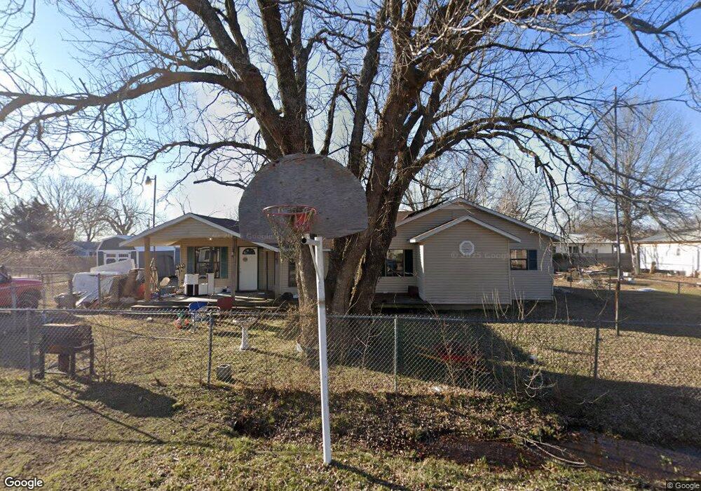
256 N 17th Ave W Sperry, OK 74073
Estimated Value: $315,000
4
Beds
3
Baths
2,993
Sq Ft
$105/Sq Ft
Est. Value
About This Home
This home is located at 256 N 17th Ave W, Sperry, OK 74073 and is currently estimated at $315,000, approximately $105 per square foot. 256 N 17th Ave W is a home with nearby schools including Sperry Elementary School, Sperry Middle School, and Sperry High School.
Ownership History
Date
Name
Owned For
Owner Type
Purchase Details
Closed on
Jan 22, 2007
Sold by
Ham Larry W
Bought by
Ham Treva R and Belt Treva R
Current Estimated Value
Purchase Details
Closed on
Jan 31, 2001
Sold by
Belt James E and Patricia June
Bought by
Ham Larry W and Ham Treva R
Purchase Details
Closed on
May 21, 1998
Sold by
Brown Rex and Brown Vonda
Bought by
Belt James E and Patricia June
Purchase Details
Closed on
Aug 1, 1995
Sold by
Parks Dusty Gene and Parks Janie
Bought by
Brown Rex and Brown Vonda
Purchase Details
Closed on
Sep 1, 1994
Sold by
Exchange Bank Of Skiatook
Bought by
Parks Dusty Gene and Parks Janie
Create a Home Valuation Report for This Property
The Home Valuation Report is an in-depth analysis detailing your home's value as well as a comparison with similar homes in the area
Home Values in the Area
Average Home Value in this Area
Purchase History
| Date | Buyer | Sale Price | Title Company |
|---|---|---|---|
| Ham Treva R | -- | -- | |
| Ham Larry W | $33,000 | -- | |
| Belt James E | $23,000 | -- | |
| Brown Rex | $11,000 | -- | |
| Parks Dusty Gene | -- | -- |
Source: Public Records
Tax History Compared to Growth
Tax History
| Year | Tax Paid | Tax Assessment Tax Assessment Total Assessment is a certain percentage of the fair market value that is determined by local assessors to be the total taxable value of land and additions on the property. | Land | Improvement |
|---|---|---|---|---|
| 2025 | $3,420 | $35,761 | $1,891 | $33,870 |
| 2024 | $3,314 | $34,719 | $1,836 | $32,883 |
| 2023 | $3,314 | $33,708 | $1,836 | $31,872 |
| 2022 | $3,103 | $31,773 | $1,836 | $29,937 |
| 2021 | $2,990 | $31,773 | $1,836 | $29,937 |
| 2020 | $2,897 | $30,764 | $1,836 | $28,928 |
| 2019 | $2,935 | $30,764 | $1,836 | $28,928 |
| 2018 | $2,933 | $30,764 | $1,836 | $28,928 |
| 2017 | $2,845 | $30,764 | $1,836 | $28,928 |
| 2016 | $2,831 | $30,764 | $1,836 | $28,928 |
| 2015 | $2,776 | $30,764 | $1,836 | $28,928 |
| 2014 | $2,792 | $30,764 | $1,836 | $28,928 |
| 2013 | $2,885 | $30,764 | $1,836 | $28,928 |
Source: Public Records
Map
Nearby Homes
- 1819 W Oak Knoll
- 9026 Crestwood Dr
- 9084 N Osage Dr
- 2781 W 88th St N
- 4812 E 76th
- 10044 N 30th West Ave
- 0 Sunset Unit 2544339
- 0 Sunset Unit 2544356
- 299 W Cherry
- 2744 W 103rd St N
- 2012 W 88th St N
- 202 W Ada St
- 308 S Cincinnati Ave
- 0 N 36th West Ave
- 9545 S Cincinnati St
- 9858 N 38 Ave W
- 10739 N 25th West Ave
- 6146 W 108th St N
- 8588 N Cincinnati Ave
- 10201 N Cincinnati Ave
- 9587 N 20th West Ave
- 9208 N Yukon
- 11500 N 17th West Ave
- 9381 N 20th West Ave
- 9516 N Yukon
- 9476 N Yukon
- 9659 N 20th West Ave
- 0 N Yukon
- 03 N 20th West Ave
- 02 N 20th West Ave
- 01 N 20th West Ave
- 9266 Crestwood Dr
- 9543 N Yukon
- 1705 W 93rd St N
- 9356 Crestwood Dr
- 9244 Crestwood Dr
- 9455 N Yukon
- 9328 Crestwood Dr
- 9394 Crestwood Dr
- 8811 N 22nd West Ave