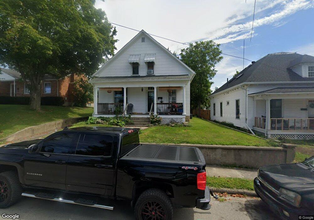
256 N Walnut St Wilmington, OH 45177
Estimated Value: $177,000 - $216,000
2
Beds
2
Baths
1,356
Sq Ft
$143/Sq Ft
Est. Value
About This Home
This home is located at 256 N Walnut St, Wilmington, OH 45177 and is currently estimated at $194,514, approximately $143 per square foot. 256 N Walnut St is a home located in Clinton County with nearby schools including East End Elementary School, Denver Place Elementary School, and Roy E. Holmes Elementary School.
Ownership History
Date
Name
Owned For
Owner Type
Purchase Details
Closed on
May 29, 2009
Sold by
Gammell Michael Shane and Gammell Heather R
Bought by
Uptown Rentals Llc
Current Estimated Value
Purchase Details
Closed on
Dec 15, 2005
Sold by
Va
Bought by
Gammell Shane and Gammell Heather
Home Financials for this Owner
Home Financials are based on the most recent Mortgage that was taken out on this home.
Original Mortgage
$68,096
Interest Rate
7.75%
Mortgage Type
Purchase Money Mortgage
Purchase Details
Closed on
Sep 1, 2005
Sold by
Inlow David E
Bought by
Va
Purchase Details
Closed on
Oct 17, 1996
Bought by
Inlow David E
Create a Home Valuation Report for This Property
The Home Valuation Report is an in-depth analysis detailing your home's value as well as a comparison with similar homes in the area
Home Values in the Area
Average Home Value in this Area
Purchase History
| Date | Buyer | Sale Price | Title Company |
|---|---|---|---|
| Uptown Rentals Llc | -- | -- | |
| Gammell Shane | -- | Fidelity Land Title Agency I | |
| Va | $50,000 | None Available | |
| Inlow David E | $74,900 | -- |
Source: Public Records
Mortgage History
| Date | Status | Borrower | Loan Amount |
|---|---|---|---|
| Previous Owner | Gammell Shane | $68,096 |
Source: Public Records
Tax History Compared to Growth
Tax History
| Year | Tax Paid | Tax Assessment Tax Assessment Total Assessment is a certain percentage of the fair market value that is determined by local assessors to be the total taxable value of land and additions on the property. | Land | Improvement |
|---|---|---|---|---|
| 2024 | $1,567 | $45,470 | $6,200 | $39,270 |
| 2023 | $1,567 | $45,470 | $6,200 | $39,270 |
| 2022 | $938 | $25,620 | $5,650 | $19,970 |
| 2021 | $949 | $25,620 | $5,650 | $19,970 |
| 2020 | $893 | $25,620 | $5,650 | $19,970 |
| 2019 | $891 | $23,340 | $6,010 | $17,330 |
| 2018 | $899 | $23,340 | $6,010 | $17,330 |
| 2017 | $437 | $23,340 | $6,010 | $17,330 |
| 2016 | $864 | $22,790 | $5,740 | $17,050 |
| 2015 | $851 | $22,790 | $5,740 | $17,050 |
| 2013 | $888 | $23,490 | $5,740 | $17,750 |
Source: Public Records
Map
Nearby Homes
- 70 Library Ave
- 442 High St
- 0 Prairie Rd Unit 1863689
- 0 Prairie Rd Unit 1835070
- 379 Virginia Cir
- 1053 Main St
- 0 Antioch Rd Unit 891198
- 170 N Wall St
- 0 St Rt 134 Unit 1607133
- 0 S US Rt 68 Unit 1527315
- 146 N Spring St
- 136 N Spring St
- 161 N Spring St
- 421 N Spring St
- 353 Hiatt Ave
- 165 Lorish Ave
- 1.458 AC Prairie Ave
- 320 Lorish Ave
- 0 N Wood St
- 15 Meadow Run Trail Unit 6A
- 248 N Walnut St
- 270 N Walnut St
- 238 N Walnut St
- 136 E Birdsall St
- 284 N Walnut St
- 249 N Walnut St
- 228 N Walnut St
- 257 N Lincoln St
- 94 E Birdsall St
- 249 N Lincoln St
- 267 N Lincoln St
- 220 N Walnut St
- 237 N Lincoln St
- 279 N Lincoln St
- 88 Library Ave
- 82 E Birdsall St
- 231 N Lincoln St
- 291 N Lincoln St
- 217 N Lincoln St
- 71 Library Ave