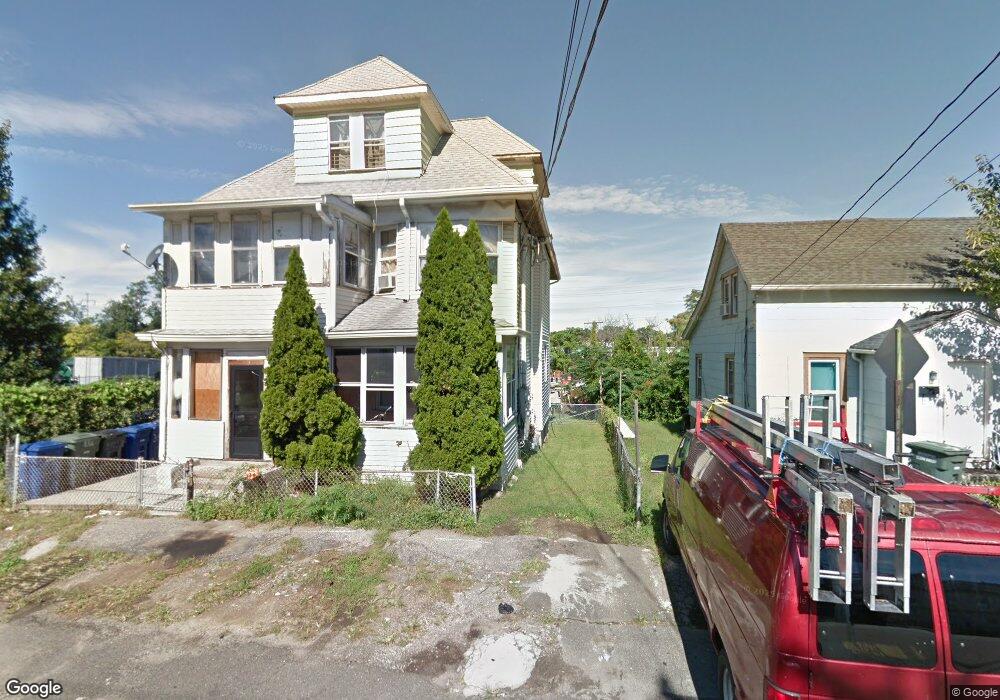
256 Orland St Unit 260 Bridgeport, CT 06605
Black Rock NeighborhoodEstimated Value: $382,902 - $707,000
6
Beds
3
Baths
3,184
Sq Ft
$174/Sq Ft
Est. Value
About This Home
This home is located at 256 Orland St Unit 260, Bridgeport, CT 06605 and is currently estimated at $555,476, approximately $174 per square foot. 256 Orland St Unit 260 is a home located in Fairfield County with nearby schools including Bassick High School, Park City Prep Charter School, and St. Ann Campus - Catholic Academy of Bridgeport.
Ownership History
Date
Name
Owned For
Owner Type
Purchase Details
Closed on
Dec 4, 2017
Sold by
Granados Nancy
Bought by
Granados German
Current Estimated Value
Purchase Details
Closed on
May 25, 2004
Sold by
Nuzzi John
Bought by
Granados German and Granados Nancy
Home Financials for this Owner
Home Financials are based on the most recent Mortgage that was taken out on this home.
Original Mortgage
$194,400
Interest Rate
5.75%
Create a Home Valuation Report for This Property
The Home Valuation Report is an in-depth analysis detailing your home's value as well as a comparison with similar homes in the area
Home Values in the Area
Average Home Value in this Area
Purchase History
| Date | Buyer | Sale Price | Title Company |
|---|---|---|---|
| Granados German | -- | -- | |
| Granados German | -- | -- | |
| Granados German | $230,000 | -- | |
| Granados German | $230,000 | -- |
Source: Public Records
Mortgage History
| Date | Status | Borrower | Loan Amount |
|---|---|---|---|
| Previous Owner | Granados German | $281,250 | |
| Previous Owner | Granados German | $194,400 |
Source: Public Records
Tax History Compared to Growth
Tax History
| Year | Tax Paid | Tax Assessment Tax Assessment Total Assessment is a certain percentage of the fair market value that is determined by local assessors to be the total taxable value of land and additions on the property. | Land | Improvement |
|---|---|---|---|---|
| 2025 | $9,804 | $225,640 | $94,290 | $131,350 |
| 2024 | $9,804 | $225,640 | $94,290 | $131,350 |
| 2023 | $9,804 | $225,640 | $94,290 | $131,350 |
| 2022 | $9,804 | $225,640 | $94,290 | $131,350 |
| 2021 | $9,804 | $225,640 | $94,290 | $131,350 |
| 2020 | $7,709 | $142,780 | $42,530 | $100,250 |
| 2019 | $7,709 | $142,780 | $42,530 | $100,250 |
| 2018 | $7,763 | $142,780 | $42,530 | $100,250 |
| 2017 | $7,763 | $142,780 | $42,530 | $100,250 |
| 2016 | $7,763 | $142,780 | $42,530 | $100,250 |
| 2015 | $7,509 | $177,950 | $44,460 | $133,490 |
| 2014 | $7,509 | $177,950 | $44,460 | $133,490 |
Source: Public Records
Map
Nearby Homes
- 144 Whittier St
- 135 Whittier St
- 82 Waldorf Ave
- 31 Whittier St
- 25 Whittier St
- 167 Scofield Ave
- 105 Scofield Ave
- 118 Berwick Ave
- 130 Brentwood Ave
- 145 Brentwood Ave
- 166 Alfred St
- 95 Bedford Ave
- 51 Princeton St
- 855 Brewster St Unit 857
- 2773 Fairfield Ave Unit 3
- 37 Rowsley St Unit 6
- 26 Rowsley St Unit 3
- 20 Haddon St Unit 5
- 378 Castle Ave
- 222 Ellsworth St
- 254 Orland St
- 25 Hubbell St
- 39 Hubbell St
- 39 Hubbell St Unit 31
- 833 Ellsworth St
- 250 Orland St
- 823 Ellsworth St
- 231 Orland St Unit 233
- 808 Ellsworth St
- 23 Hubbell St
- 816 Ellsworth St Unit 820
- 227 Orland St Unit 229
- 229 Orland St Unit 3
- 227 Orland St Unit 1
- 801 Ellsworth St
- 27 Hubbell St
- 219 Orland St Unit 221
- 29 Hubbell St Unit 1
- 29 Hubbell St
- 29 Hubbell St Unit 2