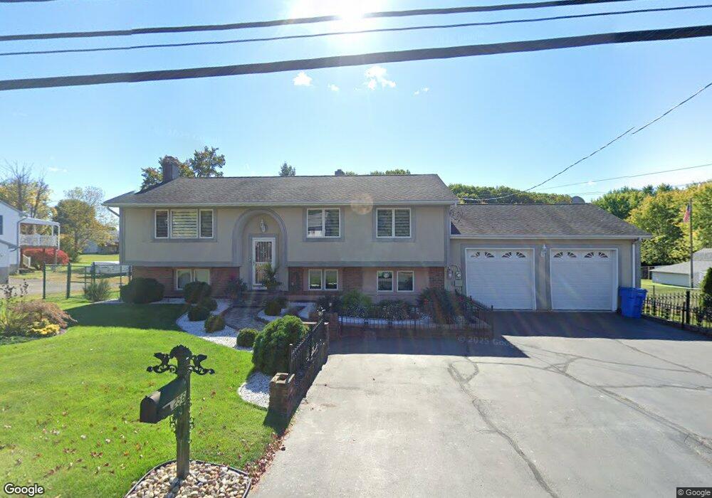
256 Robertson St Bristol, CT 06010
Forestville NeighborhoodEstimated Value: $366,000 - $437,000
3
Beds
3
Baths
1,132
Sq Ft
$347/Sq Ft
Est. Value
About This Home
This home is located at 256 Robertson St, Bristol, CT 06010 and is currently estimated at $392,278, approximately $346 per square foot. 256 Robertson St is a home located in Hartford County with nearby schools including Northeast Middle School, Bristol Eastern High School, and St Matthew School.
Ownership History
Date
Name
Owned For
Owner Type
Purchase Details
Closed on
Nov 18, 2003
Sold by
Skurski Agustyn J and Stachurska Marianna
Bought by
Wowk Marek
Current Estimated Value
Home Financials for this Owner
Home Financials are based on the most recent Mortgage that was taken out on this home.
Original Mortgage
$135,000
Interest Rate
5.81%
Purchase Details
Closed on
Jul 21, 1997
Sold by
Pace Stanley F
Bought by
Stachurska Marianna
Home Financials for this Owner
Home Financials are based on the most recent Mortgage that was taken out on this home.
Original Mortgage
$106,300
Interest Rate
7.79%
Mortgage Type
Unknown
Create a Home Valuation Report for This Property
The Home Valuation Report is an in-depth analysis detailing your home's value as well as a comparison with similar homes in the area
Home Values in the Area
Average Home Value in this Area
Purchase History
| Date | Buyer | Sale Price | Title Company |
|---|---|---|---|
| Wowk Marek | $235,000 | -- | |
| Stachurska Marianna | $114,000 | -- |
Source: Public Records
Mortgage History
| Date | Status | Borrower | Loan Amount |
|---|---|---|---|
| Closed | Stachurska Marianna | $135,000 | |
| Previous Owner | Stachurska Marianna | $23,850 | |
| Previous Owner | Stachurska Marianna | $106,300 | |
| Previous Owner | Stachurska Marianna | $80,000 |
Source: Public Records
Tax History
| Year | Tax Paid | Tax Assessment Tax Assessment Total Assessment is a certain percentage of the fair market value that is determined by local assessors to be the total taxable value of land and additions on the property. | Land | Improvement |
|---|---|---|---|---|
| 2025 | $6,632 | $196,490 | $38,780 | $157,710 |
| 2024 | $6,258 | $196,490 | $38,780 | $157,710 |
| 2023 | $5,963 | $196,490 | $38,780 | $157,710 |
| 2022 | $5,447 | $142,030 | $31,500 | $110,530 |
| 2021 | $5,447 | $142,030 | $31,500 | $110,530 |
| 2020 | $5,447 | $142,030 | $31,500 | $110,530 |
| 2019 | $5,404 | $142,030 | $31,500 | $110,530 |
| 2018 | $5,238 | $142,030 | $31,500 | $110,530 |
| 2017 | $5,054 | $140,280 | $39,130 | $101,150 |
| 2016 | $5,054 | $140,280 | $39,130 | $101,150 |
| 2015 | $4,855 | $140,280 | $39,130 | $101,150 |
| 2014 | $4,855 | $140,280 | $39,130 | $101,150 |
Source: Public Records
Map
Nearby Homes
- 262 Westwoods Terrace
- 201 Westwoods Terrace
- 89 Nicholas Dr Unit 89
- 160 Fair St
- 0 Overlook Dr Unit Lots 3 and 4
- 0 Overlook Dr Unit Lot 3 24092446
- 0 Overlook Dr Unit Lot 4 24092448
- 206 Burton St
- 179 Mark St
- 0 Oakwood Cir
- 135 E Main St
- 158 E Main St
- 133 Central St
- 29 Bingham St
- 44 Curtiss Ave
- 131 Mountain View Ave
- 169 Morningside Dr E
- 33 Kenney St
- 50 Forestville Ave
- 36 Maxine Rd
- 266 Robertson St
- 255 Robertson St
- 246 Robertson St
- 265 Robertson St
- 276 Robertson St
- 275 Robertson St
- 236 Robertson St
- 245 Robertson St
- 280 Robertson St
- 235 Robertson St
- 290 Robertson St
- 226 Robertson St
- 299 Robertson St
- 171 Camp St
- 104 Hotchkiss Dr
- 225 Robertson St
- 96 Hotchkiss Dr
- 159 Camp St
- 88 Hotchkiss Dr
- 86 Carolina Rd
Your Personal Tour Guide
Ask me questions while you tour the home.