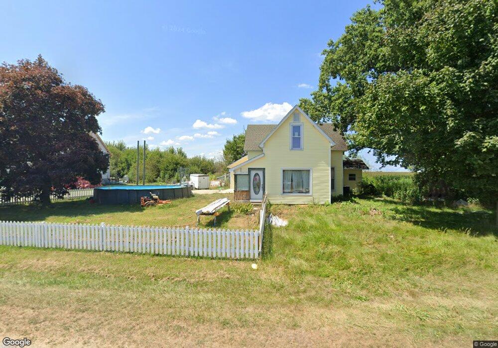
256 S 650 W Delphi, IN 46923
Estimated Value: $357,000 - $454,915
3
Beds
3
Baths
4,914
Sq Ft
$81/Sq Ft
Est. Value
About This Home
This home is located at 256 S 650 W, Delphi, IN 46923 and is currently estimated at $400,479, approximately $81 per square foot. 256 S 650 W is a home located in Carroll County with nearby schools including Delphi Community Elementary School, Delphi Community Middle School, and Delphi Community High School.
Ownership History
Date
Name
Owned For
Owner Type
Purchase Details
Closed on
May 26, 2020
Sold by
Carbaugh Charles L and Estate Of Pauline H Carbaugh
Bought by
Carr Darren
Current Estimated Value
Purchase Details
Closed on
Aug 30, 2018
Sold by
Gbc Farms Llc
Bought by
Wise Jeff A and Wise Arlene S
Purchase Details
Closed on
Aug 7, 2018
Sold by
Carbaugh William H
Bought by
Gbc Farms Llc
Purchase Details
Closed on
Jul 27, 2016
Sold by
Carbaugh Charles L
Bought by
Carbaugh Charles L and Carbaugh Sharon S
Purchase Details
Closed on
Oct 26, 2011
Sold by
Carr Darren L
Bought by
Carr Darren L and Carr Cinaka M
Purchase Details
Closed on
Apr 8, 2009
Sold by
Carbaugh Pauline and Carbaugh Charles L
Bought by
Carr Darren
Create a Home Valuation Report for This Property
The Home Valuation Report is an in-depth analysis detailing your home's value as well as a comparison with similar homes in the area
Home Values in the Area
Average Home Value in this Area
Purchase History
| Date | Buyer | Sale Price | Title Company |
|---|---|---|---|
| Carr Darren | -- | None Available | |
| Wise Jeff A | -- | None Available | |
| Gbc Farms Llc | -- | None Available | |
| Carbaugh Charles L | -- | None Available | |
| Carr Darren L | -- | None Available | |
| Carr Darren | -- | None Available |
Source: Public Records
Tax History Compared to Growth
Tax History
| Year | Tax Paid | Tax Assessment Tax Assessment Total Assessment is a certain percentage of the fair market value that is determined by local assessors to be the total taxable value of land and additions on the property. | Land | Improvement |
|---|---|---|---|---|
| 2024 | $2,291 | $340,100 | $22,800 | $317,300 |
| 2023 | $1,366 | $317,000 | $22,800 | $294,200 |
| 2022 | $1,366 | $215,100 | $27,000 | $188,100 |
| 2021 | $714 | $130,000 | $31,100 | $98,900 |
| 2020 | $269 | $68,100 | $31,100 | $37,000 |
| 2019 | $265 | $64,800 | $31,100 | $33,700 |
| 2018 | $243 | $63,200 | $31,100 | $32,100 |
| 2017 | $363 | $89,900 | $29,500 | $60,400 |
| 2016 | $328 | $84,300 | $29,500 | $54,800 |
| 2014 | $282 | $76,700 | $27,000 | $49,700 |
Source: Public Records
Map
Nearby Homes
- 8649 W Division Line Rd
- 35 Pond View Dr
- 232 W Vine St
- 230 W Vine St
- 228 W Vine St
- 112 Williston Ct
- 116 Williston Ct
- 215 W Front St
- 205 E Franklin St
- 317 N Market St
- 409 N Wilson St
- 610 N Wilson St
- 2075 N 925 W
- 1158 N Brewer Ave
- 7640 N 1000 E
- 2801 N 930 W Unit 10
- 9331 W 310 N
- 4139 N 900 W
- 5239 S 800 W
- 7930 W 550 S
- 6493 W Division Line Rd
- 6547 W Division Line Rd
- 6455 W Division Line Rd
- 6427 W Division Line Rd
- 6403 W Division Line Rd
- 6377 W Division Line Rd
- 6355 W Division Line Rd
- 6335 W Division Line Rd
- 6317 W Division Line Rd
- 6303 W Division Line Rd
- 6283 W Division Line Rd
- 74 N Us Highway 421
- 572 S 650 W
- 0 U S 421 Unit 801280
- 0 S Us Highway 421 Unit 20071825
- 0 S Us 39 Unit 375445
- 4 Indiana 39
- 56 U S 421
- 56 N U S Highway 421
- 56 N Us Highway 421