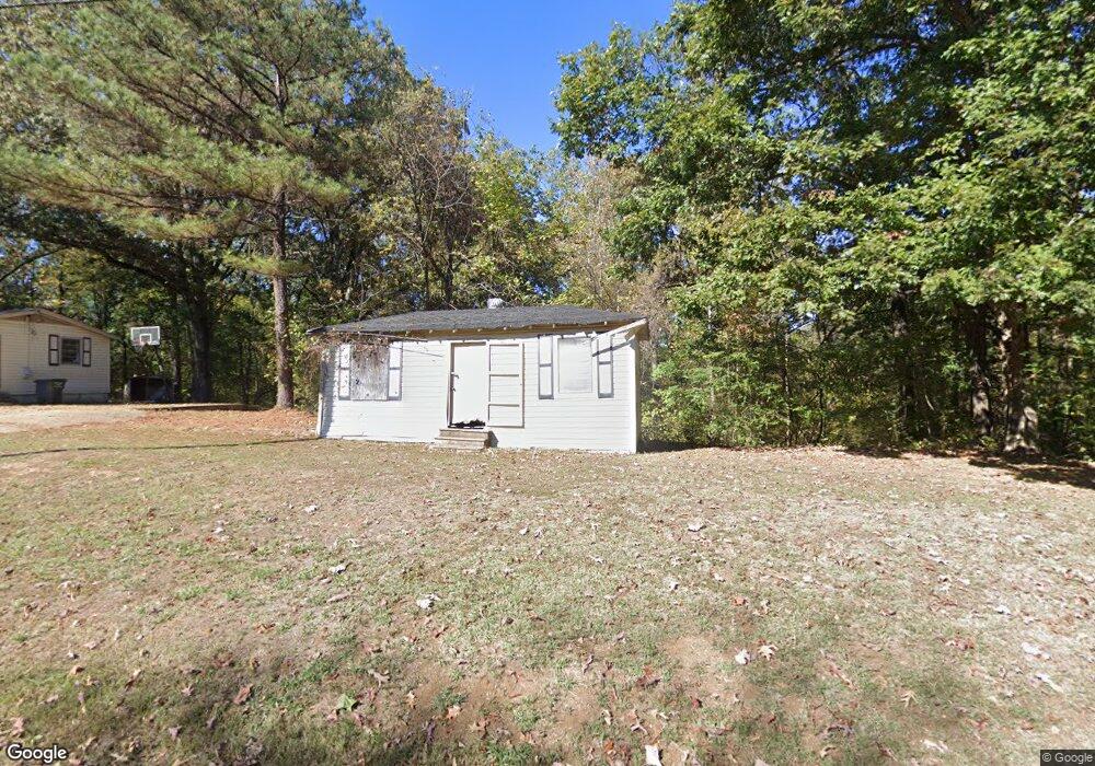
256 Sfc 300 Forrest City, AR 72335
Estimated Value: $75,536 - $112,000
--
Bed
1
Bath
1,165
Sq Ft
$80/Sq Ft
Est. Value
About This Home
This home is located at 256 Sfc 300, Forrest City, AR 72335 and is currently estimated at $92,884, approximately $79 per square foot. 256 Sfc 300 is a home located in St. Francis County with nearby schools including Central Elementary School, Stewart Elementary School, and Forrest City Junior High School.
Ownership History
Date
Name
Owned For
Owner Type
Purchase Details
Closed on
Sep 15, 2016
Sold by
Wells Fargo Bank N A
Bought by
Aldridge Sabrina Deshawn and Aldridge Nicholas Winston
Current Estimated Value
Purchase Details
Closed on
Aug 8, 2013
Sold by
Hall Emerson
Bought by
Wells Fargo Bank N A
Purchase Details
Closed on
Jan 7, 1994
Sold by
Not Provided
Bought by
Hall Emerson and Hall Jennifer
Purchase Details
Closed on
Jan 9, 1989
Bought by
Cullum
Create a Home Valuation Report for This Property
The Home Valuation Report is an in-depth analysis detailing your home's value as well as a comparison with similar homes in the area
Home Values in the Area
Average Home Value in this Area
Purchase History
| Date | Buyer | Sale Price | Title Company |
|---|---|---|---|
| Aldridge Sabrina Deshawn | $5,500 | Boston National Title | |
| Wells Fargo Bank N A | $28,806 | None Available | |
| Hall Emerson | $45,000 | -- | |
| Cullum | $5,000 | -- |
Source: Public Records
Tax History Compared to Growth
Tax History
| Year | Tax Paid | Tax Assessment Tax Assessment Total Assessment is a certain percentage of the fair market value that is determined by local assessors to be the total taxable value of land and additions on the property. | Land | Improvement |
|---|---|---|---|---|
| 2024 | $407 | $10,230 | $2,200 | $8,030 |
| 2023 | $380 | $10,230 | $2,200 | $8,030 |
| 2022 | $371 | $10,230 | $2,200 | $8,030 |
| 2021 | $337 | $8,690 | $1,850 | $6,840 |
| 2020 | $337 | $8,690 | $1,850 | $6,840 |
| 2019 | $346 | $8,690 | $1,850 | $6,840 |
| 2018 | $346 | $8,690 | $1,850 | $6,840 |
| 2017 | $346 | $8,690 | $1,850 | $6,840 |
| 2016 | $379 | $9,520 | $1,950 | $7,570 |
| 2015 | $379 | $9,520 | $1,950 | $7,570 |
| 2014 | $379 | $9,520 | $1,950 | $7,570 |
Source: Public Records
Map
Nearby Homes
- 533 Sfc 311
- 0 N Washington St
- 4.59 Acres N Washington St
- 361 Yorktown Dr
- 917 Calvert Cove
- 220 Lexington Dr
- 308 Trenton Rd
- 1255 Chestnut St
- 319 Mississippi St
- 1216 N Izard St
- 423 Laughrun Dr
- 1108 N Izard St
- 424 Beech Grove Dr
- 1030 N Izard St
- 1047 N Rosser St
- 1047 N Rosser St Unit 122 E Arkansas Avenu
- 717 Laughrun Dr
- 802 Sfc 328
- 1110 N Division St
- 30+\- Acres Sfc 328