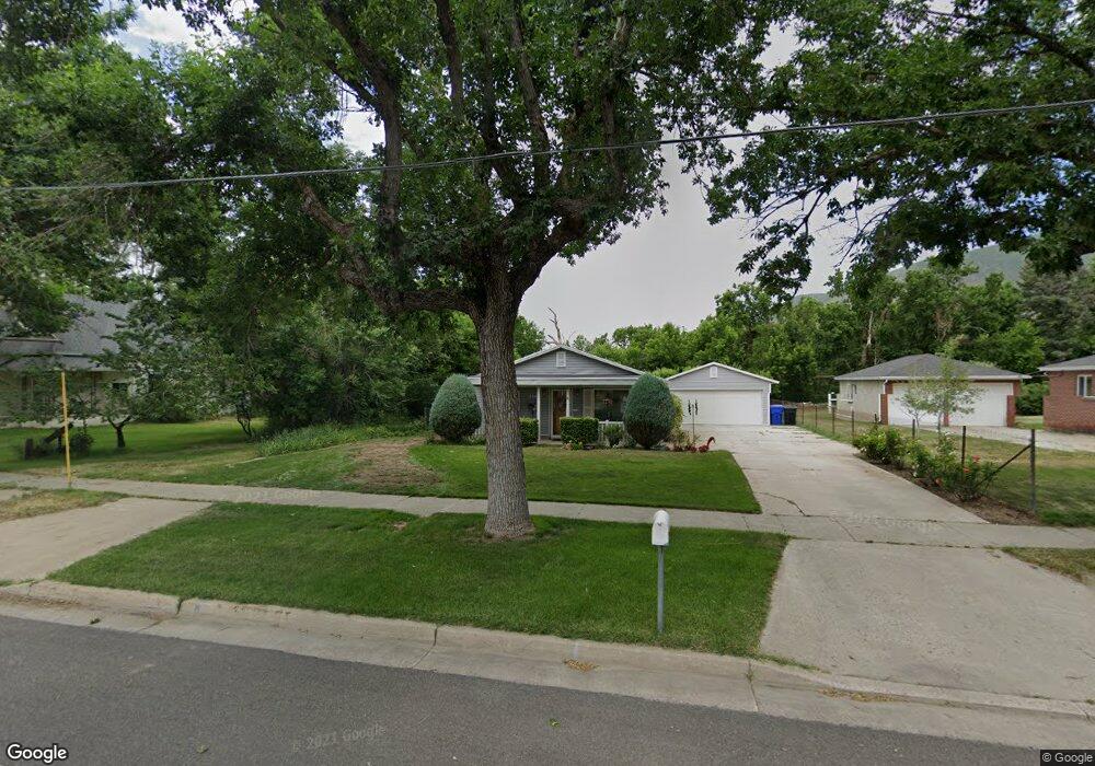
256 W State St Farmington, UT 84025
Estimated Value: $479,677 - $588,000
3
Beds
2
Baths
1,532
Sq Ft
$354/Sq Ft
Est. Value
About This Home
This home is located at 256 W State St, Farmington, UT 84025 and is currently estimated at $542,419, approximately $354 per square foot. 256 W State St is a home located in Davis County with nearby schools including Farmington Elementary School, Farmington High, and Farmington Junior High School.
Ownership History
Date
Name
Owned For
Owner Type
Purchase Details
Closed on
Jul 23, 2020
Sold by
Mcdaniel Adrienne
Bought by
Mcdaniel Adrienne and Adrienne Mcdaniel Revocable Li
Current Estimated Value
Purchase Details
Closed on
May 24, 2007
Sold by
Price Adrienne
Bought by
Mcdaniel Adrienne
Purchase Details
Closed on
Jan 28, 1999
Sold by
Mcdaniel Adrienne
Bought by
Price Adrienne
Purchase Details
Closed on
Jan 1, 1996
Sold by
Mcdaniel Eric E
Bought by
Mcdaniel Adrienne
Create a Home Valuation Report for This Property
The Home Valuation Report is an in-depth analysis detailing your home's value as well as a comparison with similar homes in the area
Home Values in the Area
Average Home Value in this Area
Purchase History
| Date | Buyer | Sale Price | Title Company |
|---|---|---|---|
| Mcdaniel Adrienne | -- | None Available | |
| Mcdaniel Adrienne | -- | None Available | |
| Price Adrienne | -- | -- | |
| Mcdaniel Adrienne | -- | -- |
Source: Public Records
Tax History Compared to Growth
Tax History
| Year | Tax Paid | Tax Assessment Tax Assessment Total Assessment is a certain percentage of the fair market value that is determined by local assessors to be the total taxable value of land and additions on the property. | Land | Improvement |
|---|---|---|---|---|
| 2024 | $2,173 | $217,250 | $145,039 | $72,211 |
| 2023 | $2,064 | $376,000 | $219,849 | $156,151 |
| 2022 | $2,089 | $216,150 | $121,498 | $94,652 |
| 2021 | $1,961 | $302,000 | $169,459 | $132,541 |
| 2020 | $1,765 | $265,000 | $142,118 | $122,882 |
| 2019 | $1,771 | $258,000 | $142,429 | $115,571 |
| 2018 | $1,644 | $236,000 | $140,675 | $95,325 |
| 2016 | $1,516 | $111,980 | $61,245 | $50,735 |
| 2015 | $1,511 | $105,930 | $61,245 | $44,685 |
| 2014 | $1,439 | $103,659 | $51,037 | $52,622 |
| 2013 | -- | $100,886 | $45,278 | $55,608 |
Source: Public Records
Map
Nearby Homes
- 38 S 300 W
- 52 N 400 W
- 372 W Clark Cir
- 21 N 100 W Unit 3
- 2 Grayson Way N Unit 11
- 1504 W Kiera Court Ct N Unit 150
- 170 N Main St
- 442 W Randys Ct Unit 808
- 69 W Grove Creek Cir
- 250 S 200 W
- 554 W Cottle Ln
- 434 W 450 S Unit 815
- 626 W Cottle Ln
- 139 E 400 N
- 1460 W 550 N Unit 166
- 79 S 300 E
- 334 E Cottrell Ln
- 514 Rigby Rd
- 292 N Flag Rock Dr
- 13 Sunset Dr