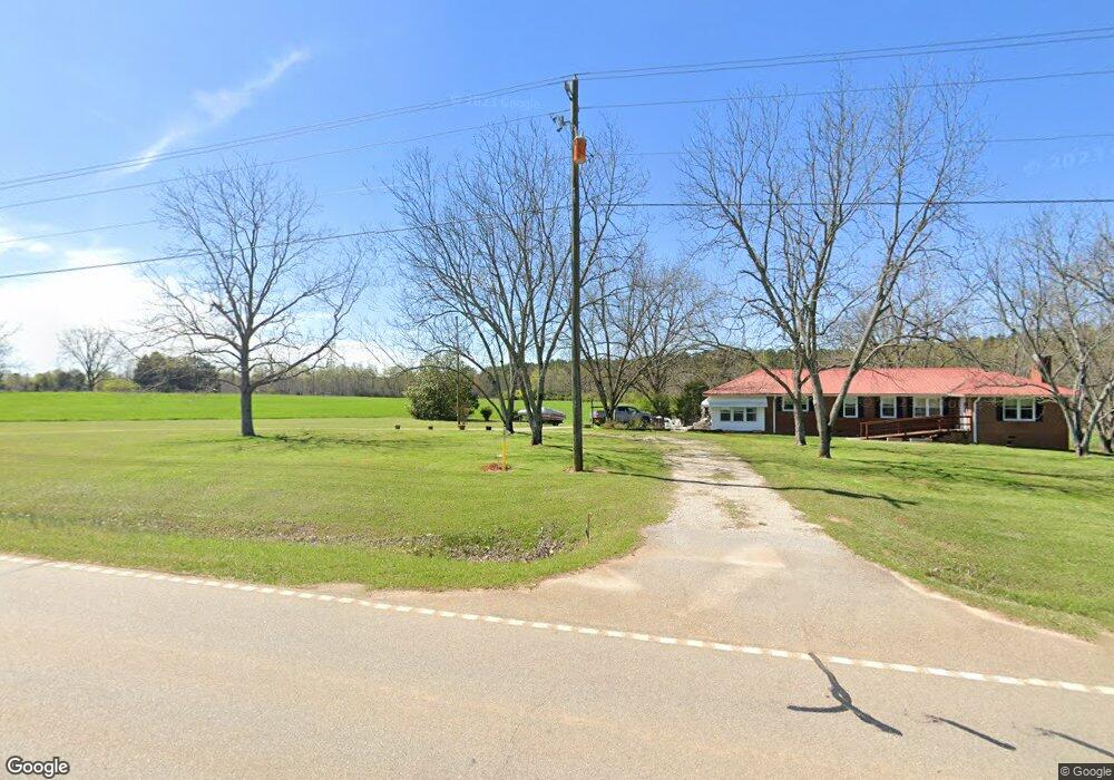
2560 Highway 77 N Union Point, GA 30669
Estimated Value: $266,000 - $371,000
3
Beds
2
Baths
1,700
Sq Ft
$189/Sq Ft
Est. Value
About This Home
This home is located at 2560 Highway 77 N, Union Point, GA 30669 and is currently estimated at $321,870, approximately $189 per square foot. 2560 Highway 77 N is a home located in Greene County with nearby schools including Greene County High School.
Ownership History
Date
Name
Owned For
Owner Type
Purchase Details
Closed on
Feb 16, 2024
Sold by
Amp Real Estate Holdings Llc
Bought by
Segrest Ragan Chrstian and Segrest Case Patrick
Current Estimated Value
Home Financials for this Owner
Home Financials are based on the most recent Mortgage that was taken out on this home.
Original Mortgage
$237,000
Outstanding Balance
$159,005
Interest Rate
6.6%
Mortgage Type
New Conventional
Estimated Equity
$162,865
Purchase Details
Closed on
Dec 2, 2023
Sold by
Mcleod Timberlands Llc
Bought by
Amp Real Estate Holdings Llc
Purchase Details
Closed on
Nov 13, 2023
Sold by
Harrison Martha S
Bought by
Mcleod Timberlands Llc
Purchase Details
Closed on
Feb 20, 2001
Sold by
Harrison Lowell G
Bought by
Harrison Lowell G and Harrison Martha S
Purchase Details
Closed on
Aug 1, 1991
Sold by
Harrison W D
Bought by
Harrison Lowell G
Purchase Details
Closed on
Jan 1, 1959
Bought by
Harrison W D
Create a Home Valuation Report for This Property
The Home Valuation Report is an in-depth analysis detailing your home's value as well as a comparison with similar homes in the area
Home Values in the Area
Average Home Value in this Area
Purchase History
| Date | Buyer | Sale Price | Title Company |
|---|---|---|---|
| Segrest Ragan Chrstian | $277,000 | -- | |
| Amp Real Estate Holdings Llc | $250,000 | -- | |
| Mcleod Timberlands Llc | $575,000 | -- | |
| Harrison Lowell G | -- | -- | |
| Harrison Lowell G | -- | -- | |
| Harrison W D | -- | -- |
Source: Public Records
Mortgage History
| Date | Status | Borrower | Loan Amount |
|---|---|---|---|
| Open | Segrest Ragan Chrstian | $237,000 |
Source: Public Records
Tax History Compared to Growth
Tax History
| Year | Tax Paid | Tax Assessment Tax Assessment Total Assessment is a certain percentage of the fair market value that is determined by local assessors to be the total taxable value of land and additions on the property. | Land | Improvement |
|---|---|---|---|---|
| 2025 | $1,760 | $106,720 | $21,080 | $85,640 |
| 2024 | $1,840 | $101,440 | $21,080 | $80,360 |
| 2023 | $485 | $162,160 | $86,240 | $75,920 |
| 2022 | $792 | $120,120 | $66,320 | $53,800 |
| 2021 | $822 | $114,000 | $66,320 | $47,680 |
| 2020 | $751 | $78,960 | $50,040 | $28,920 |
| 2019 | $755 | $78,960 | $50,040 | $28,920 |
| 2018 | $724 | $78,960 | $50,040 | $28,920 |
| 2017 | $682 | $78,976 | $50,049 | $28,927 |
| 2016 | $698 | $80,170 | $50,048 | $30,122 |
| 2015 | $617 | $80,171 | $50,049 | $30,122 |
| 2014 | $556 | $77,516 | $50,049 | $27,467 |
Source: Public Records
Map
Nearby Homes
- 1251 Adams Rd
- 0 Woodville Rd Unit 7667944
- 0 Woodville Rd Unit 10628010
- 1211 Peachtree Ave W
- 1110 Woodland Ln
- 1110 Woodland Way
- 0 Washington Hwy Unit 7276060
- 0 Dogwood Rd
- 215 Hunter St
- 5971 Penfield Rd
- 0 S Rhodes St Unit 10618488
- 324 N Rhodes St
- 0 Woodland Ct Unit 10543600
- 1860 Washington Hwy
- 202 Veazey St
- 0 Old Union Point Rd Unit 1 10557753
- 112 Hendry St
- 1241 Old Siloam Rd
- 1041 Hillcrest Dr
- 3434 Union Point Rd
- 2560 Highway 77 N
- 2600 Highway 77 N
- 2601 Highway 77 N
- 2500 Highway 77 N
- 2500 Georgia 77
- 2600 Hwy 77n
- 2661 Highway 77 N
- 1141 Test Listing - Lake Country Dr
- 1615 Georgia 77
- 2270 Highway 77 N
- 1531 Dogwood Rd S
- 1520 Dogwood Rd S
- 1510 Dogwood Rd S
- 1511 Dogwood Rd S
- 1461 Georgia 77 Unit 1461 S Dogwood Road
- S S Dogwood Rd
- 1461 Dogwood Rd S
- 3990 Hensley Rd
- 1430 Dogwood Rd S
- 3620 Hensley Rd