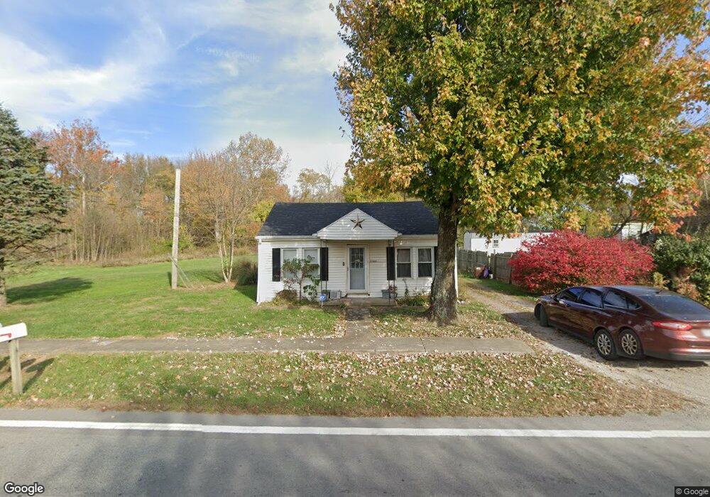
2560 State Route 134 Mount Orab, OH 45154
Estimated Value: $68,303 - $161,000
2
Beds
1
Bath
672
Sq Ft
$169/Sq Ft
Est. Value
About This Home
This home is located at 2560 State Route 134, Mount Orab, OH 45154 and is currently estimated at $113,434, approximately $168 per square foot. 2560 State Route 134 is a home located in Highland County with nearby schools including Lynchburg-Clay Elementary School, Lynchburg-Clay Middle School, and Lynchburg-Clay High School.
Ownership History
Date
Name
Owned For
Owner Type
Purchase Details
Closed on
Jun 11, 2014
Sold by
Watson Glenn and Watson Amy
Bought by
Watson Ii Glenn R
Current Estimated Value
Purchase Details
Closed on
May 31, 2007
Sold by
Herron Debhora A and Herron Hal
Bought by
Watson Glenn and Watson Amy
Home Financials for this Owner
Home Financials are based on the most recent Mortgage that was taken out on this home.
Original Mortgage
$9,085
Outstanding Balance
$5,568
Interest Rate
6.22%
Mortgage Type
Purchase Money Mortgage
Estimated Equity
$107,866
Purchase Details
Closed on
Jan 1, 1990
Bought by
Herron Debhora A
Create a Home Valuation Report for This Property
The Home Valuation Report is an in-depth analysis detailing your home's value as well as a comparison with similar homes in the area
Home Values in the Area
Average Home Value in this Area
Purchase History
| Date | Buyer | Sale Price | Title Company |
|---|---|---|---|
| Watson Ii Glenn R | -- | Attorney | |
| Watson Glenn | $9,000 | Technetitle Agency | |
| Herron Debhora A | -- | -- |
Source: Public Records
Mortgage History
| Date | Status | Borrower | Loan Amount |
|---|---|---|---|
| Open | Watson Glenn | $9,085 |
Source: Public Records
Tax History Compared to Growth
Tax History
| Year | Tax Paid | Tax Assessment Tax Assessment Total Assessment is a certain percentage of the fair market value that is determined by local assessors to be the total taxable value of land and additions on the property. | Land | Improvement |
|---|---|---|---|---|
| 2024 | $524 | $15,970 | $2,140 | $13,830 |
| 2023 | $499 | $10,890 | $1,860 | $9,030 |
| 2022 | $349 | $10,890 | $1,860 | $9,030 |
| 2021 | $372 | $10,890 | $1,860 | $9,030 |
| 2020 | $311 | $8,680 | $1,470 | $7,210 |
| 2019 | $314 | $8,680 | $1,470 | $7,210 |
| 2018 | $1,068 | $8,680 | $1,470 | $7,210 |
| 2017 | $274 | $7,840 | $1,820 | $6,020 |
| 2016 | $275 | $7,840 | $1,820 | $6,020 |
| 2015 | $1,668 | $7,840 | $1,820 | $6,020 |
| 2014 | $997 | $7,840 | $1,820 | $6,020 |
| 2013 | $771 | $7,840 | $1,820 | $6,020 |
Source: Public Records
Map
Nearby Homes
- 1982 Starr Rd
- 5176 E Greenbush Rd
- 0 Lindsey Rd Unit 1819033
- 5092 County Highway 8-C
- 3846 Hereford Rd
- 15503 Crawford-Day Rd
- 0 Duncanson Rd Unit 24555971
- 0 Duncanson Rd Unit 24557375
- 15516 Hillcrest Rd
- 3517 Bardwell Buford Rd
- AC Frye Rd
- 500 Frye Rd
- 689 Duncanson Rd
- 0 Duncanson Rd Unit 5150881
- 0 Duncanson Rd Unit 5150848
- 15422 U S 68
- 505 Linda Way
- 0 Bardwell W Unit 1854344
- 14663 Day Rd
- 13602 Robbins Rd
- 2550 State Route 134
- 2561 Ohio 134
- 2559 Ohio 134
- 2559 State Route 134
- 2561 State Route 134
- 2580 State Route 134
- 2580 State Route 134
- 2567 Sr 134
- 2567 St Rt 134
- 2567 State Route 134
- 2516 State Route 134
- 2538 State Route 134
- 2538 St Rt 134
- 2545 State Route 134
- 2577 State Route 134
- 2541 State Route 134
- 2533 State Route 134
- 2534 State Route 134
- 2532 State Route 134
- 2591 State Route 134