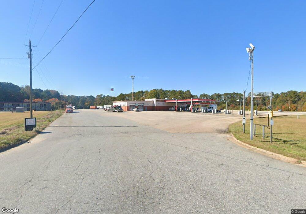
2560 Whitesville Rd Lagrange, GA 30240
Estimated Value: $3,950,165
--
Bed
1
Bath
12,566
Sq Ft
$314/Sq Ft
Est. Value
About This Home
This home is located at 2560 Whitesville Rd, Lagrange, GA 30240 and is currently estimated at $3,950,165, approximately $314 per square foot. 2560 Whitesville Rd is a home located in Troup County with nearby schools including Whitesville Road Elementary School, Berta Weathersbee Elementary School, and Rosemont Elementary School.
Ownership History
Date
Name
Owned For
Owner Type
Purchase Details
Closed on
Jun 15, 2020
Sold by
The Georgia Travel Center Inc
Bought by
Lagrange Gas N Go Llc
Current Estimated Value
Purchase Details
Closed on
May 28, 2008
Sold by
Russell E Wayne
Bought by
The Georgia Travel Center Inc
Purchase Details
Closed on
Mar 20, 1997
Sold by
June Plachy and Lynn Parker
Bought by
Wayne Russell E
Purchase Details
Closed on
Jul 31, 1996
Sold by
Leon Perlis
Bought by
June Plachy and Lynn Parker
Purchase Details
Closed on
Jul 30, 1996
Sold by
Bridges Duwayne
Bought by
Leon Perlis
Purchase Details
Closed on
Mar 21, 1996
Sold by
Usa - Samll Business Adm
Bought by
Bridges Duwayne
Purchase Details
Closed on
Jan 2, 1996
Sold by
Adkins Adkins and Adkins Dkins
Bought by
Usa - Samll Business Adm
Purchase Details
Closed on
Dec 29, 1992
Sold by
Union Oil
Bought by
Adkins Adkins and Adkins Dkins
Purchase Details
Closed on
Jan 1, 1966
Sold by
W L Summerlin Estate
Bought by
Union Oil
Create a Home Valuation Report for This Property
The Home Valuation Report is an in-depth analysis detailing your home's value as well as a comparison with similar homes in the area
Home Values in the Area
Average Home Value in this Area
Purchase History
| Date | Buyer | Sale Price | Title Company |
|---|---|---|---|
| Lagrange Gas N Go Llc | $2,400,000 | -- | |
| The Georgia Travel Center Inc | -- | -- | |
| The Georgia Travel Center Inc | $2,750,000 | -- | |
| Wayne Russell E | -- | -- | |
| June Plachy | $242,800 | -- | |
| Leon Perlis | -- | -- | |
| Bridges Duwayne | $776,000 | -- | |
| Usa - Samll Business Adm | $543,300 | -- | |
| Adkins Adkins | $1,237,500 | -- | |
| Union Oil | -- | -- |
Source: Public Records
Tax History Compared to Growth
Tax History
| Year | Tax Paid | Tax Assessment Tax Assessment Total Assessment is a certain percentage of the fair market value that is determined by local assessors to be the total taxable value of land and additions on the property. | Land | Improvement |
|---|---|---|---|---|
| 2024 | $29,493 | $1,081,408 | $600,000 | $481,408 |
| 2023 | $25,682 | $3,480 | $0 | $3,480 |
| 2022 | $26,281 | $941,648 | $600,000 | $341,648 |
| 2021 | $26,798 | $888,532 | $600,000 | $288,532 |
| 2020 | $18,192 | $603,172 | $400,000 | $203,172 |
| 2019 | $16,872 | $559,408 | $400,000 | $159,408 |
| 2018 | $16,872 | $559,408 | $400,000 | $159,408 |
| 2017 | $16,872 | $559,408 | $400,000 | $159,408 |
Source: Public Records
Map
Nearby Homes
- 0 Whitesville Rd Unit 10578327
- 0 Whitesville Rd Unit 10496838
- 2222 Whitesville Rd
- 620 Old Hutchinson Mill Rd
- 2964 Whitesville Rd
- 702 Old Hutchinson Mill Rd
- 530 New Hutchinson Mill Rd
- Marshall Plan at Hamilton Estates
- Malcolm Plan at Hamilton Estates
- 231 Rooker Dr
- 235 Rooker Dr
- 243 Rooker Dr
- 241 Rooker Dr
- 233 Rooker Dr
- 239 Rooker Dr
- Bradford Plan at Bryant Lake - Silverton Townhomes at Bryant Lake
- Willow Plan at Bryant Lake - Silverton Townhomes at Bryant Lake
- Dogwood Plan at Bryant Lake - Silverton Townhomes at Bryant Lake
- Cypress Plan at Bryant Lake - Silverton Townhomes at Bryant Lake
- Maple Plan at Bryant Lake - Silverton Townhomes at Bryant Lake
- 2555 Whitesville Rd
- 2575 Whitesville Rd
- 40 New Hutchinson Mill Rd
- 56 New Hutchinson Mill Rd
- 1071 &1061 New Hutchinson Mill Rd
- 0 New Hutchinson Mill Rd Unit 10227998
- 0 New Hutchinson Mill Rd Unit 20007291
- 0 New Hutchinson Mill Rd Unit 7367568
- 0 New Hutchinson Mill Rd Unit 7087645
- 0 New Hutchinson Mill Rd Unit 7070009
- 0 New Hutchinson Mill Rd Unit 3270891
- 0 New Hutchinson Mill Rd Unit 3158369
- 0 New Hutchinson Mill Rd Unit 8821352
- 0 New Hutchinson Mill Rd Unit 8769368
- 0 New Hutchinson Mill Rd Unit 8710607
- 0 New Hutchinson Mill Rd Unit 8567215
- 0 New Hutchinson Mill Rd Unit 8559904
- 0 New Hutchinson Mill Rd Unit 8538258
- 0 New Hutchinson Mill Rd Unit 8218970
- 0 New Hutchinson Mill Rd Unit 8209723