Estimated Value: $315,000 - $379,000
4
Beds
3
Baths
2,140
Sq Ft
$162/Sq Ft
Est. Value
About This Home
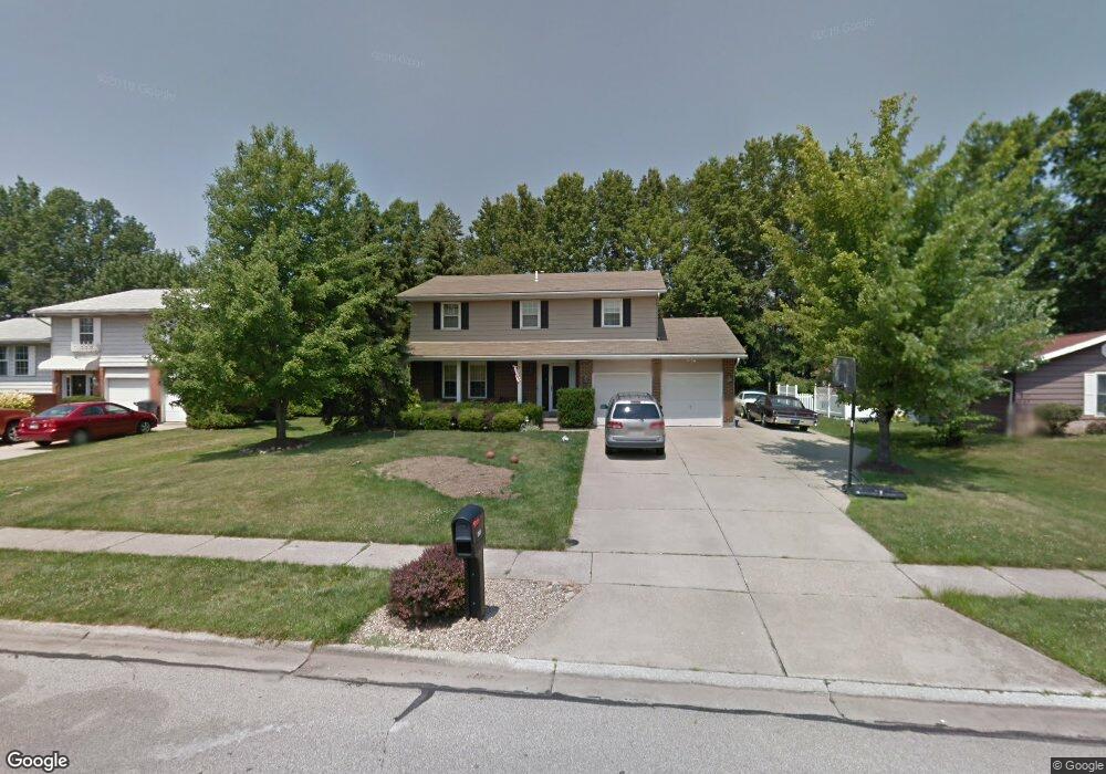
This home is located at 2561 Valleydale Rd, Stow, OH 44224 and is currently estimated at $346,255, approximately $161 per square foot. 2561 Valleydale Rd is a home located in Summit County with nearby schools including Stow-Munroe Falls High School, Primrose School of Hudson, and Holy Family Elementary School.
Ownership History
Date
Name
Owned For
Owner Type
Purchase Details
Closed on
Jul 25, 2014
Sold by
Schneider Lisa M
Bought by
Schneider Christopher M
Current Estimated Value
Purchase Details
Closed on
Sep 15, 1997
Sold by
Conti Lawrence S
Bought by
Schneider Christopher and Schneider Lisa M
Home Financials for this Owner
Home Financials are based on the most recent Mortgage that was taken out on this home.
Original Mortgage
$100,000
Outstanding Balance
$15,456
Interest Rate
7.44%
Mortgage Type
New Conventional
Estimated Equity
$330,799
Create a Home Valuation Report for This Property
The Home Valuation Report is an in-depth analysis detailing your home's value as well as a comparison with similar homes in the area
Home Values in the Area
Average Home Value in this Area
Purchase History
| Date | Buyer | Sale Price | Title Company |
|---|---|---|---|
| Schneider Christopher M | -- | None Available | |
| Schneider Christopher | $150,000 | -- |
Source: Public Records
Mortgage History
| Date | Status | Borrower | Loan Amount |
|---|---|---|---|
| Open | Schneider Christopher | $100,000 |
Source: Public Records
Tax History Compared to Growth
Tax History
| Year | Tax Paid | Tax Assessment Tax Assessment Total Assessment is a certain percentage of the fair market value that is determined by local assessors to be the total taxable value of land and additions on the property. | Land | Improvement |
|---|---|---|---|---|
| 2025 | $5,105 | $90,587 | $14,518 | $76,069 |
| 2024 | $5,105 | $90,587 | $14,518 | $76,069 |
| 2023 | $5,105 | $90,587 | $14,518 | $76,069 |
| 2022 | $4,740 | $74,253 | $11,900 | $62,353 |
| 2021 | $4,243 | $74,253 | $11,900 | $62,353 |
| 2020 | $4,170 | $74,250 | $11,900 | $62,350 |
| 2019 | $3,928 | $65,330 | $11,660 | $53,670 |
| 2018 | $3,864 | $65,330 | $11,660 | $53,670 |
| 2017 | $3,592 | $65,330 | $11,660 | $53,670 |
| 2016 | $3,697 | $58,980 | $11,660 | $47,320 |
| 2015 | $3,592 | $58,980 | $11,660 | $47,320 |
| 2014 | $3,596 | $58,980 | $11,660 | $47,320 |
| 2013 | $3,690 | $60,950 | $11,660 | $49,290 |
Source: Public Records
Map
Nearby Homes
- 4901 Independence Cir Unit B
- 4621 Graford Ln
- 4917 Independence Cir Unit B
- 2418 Wrens Dr S Unit G
- 2444 Port Charles Dr
- 4903 Fishcreek Rd Unit 11B
- 2380 Port Williams Dr Unit 2380
- 0 Stow Rd Unit 5102979
- 4731 Haughton Ct
- 4901 Pebblehurst Dr
- 2327 Crockett Cir
- 2140 Woodlawn Cir Unit 2144
- 4227 Baird Rd
- 4131 Burton Dr
- 2755 Laurel Woods Blvd
- 4120 Klein Ave
- 2028 Willowdale Dr
- 1995 Willowdale Dr
- 1627 Cypress Ct
- 2410 Liberty Rd
- 2553 Valleydale Rd
- 2569 Valleydale Rd
- 2545 Valleydale Rd
- 2577 Valleydale Rd
- 4649 Tudor Ln
- 4666 Friar Rd
- 2540 Mallory Ln
- 2537 Valleydale Rd
- 4641 Tudor Ln
- 3044 Westview Ln
- 4685 Hilary Cir
- 4648 Tudor Ln
- 4658 Friar Rd
- 3038 Westview Ln
- 2591 Valleydale Rd
- 3032 Westview Ln
- 3026 Westview Ln
- 2529 Valleydale Rd
- 4633 Tudor Ln
- 4640 Tudor Ln