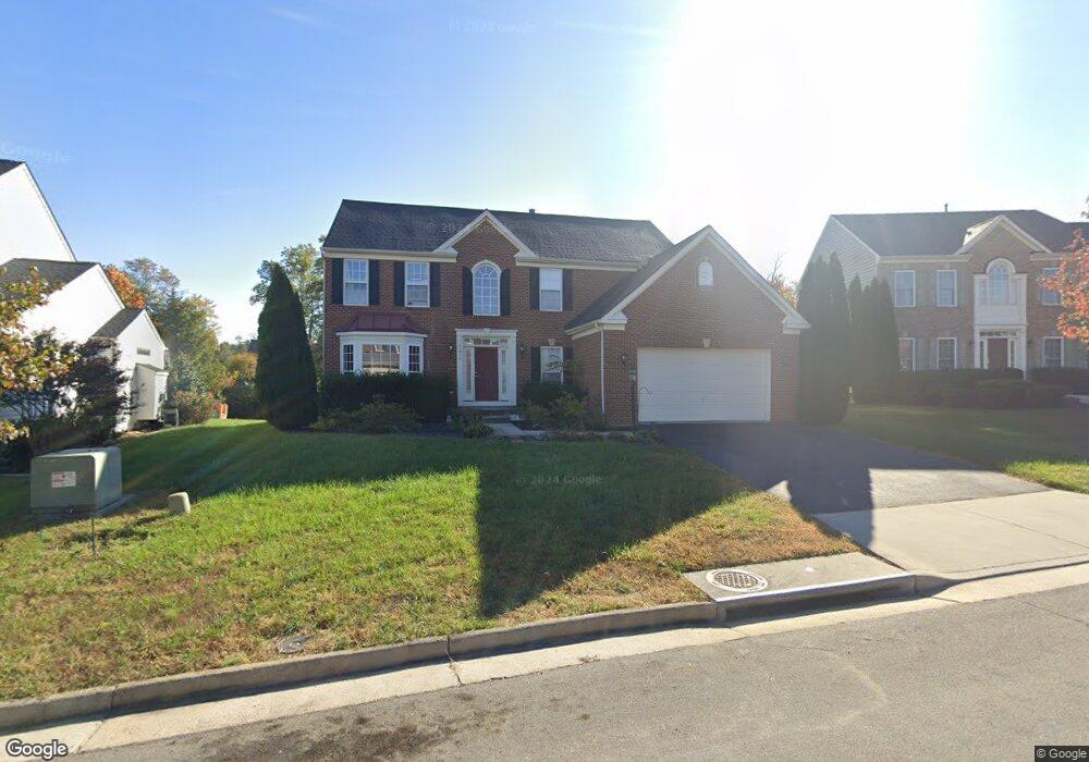
25618 Balint Park Ct Aldie, VA 20105
Kirkpatrick Farms NeighborhoodEstimated Value: $972,000 - $1,000,000
4
Beds
3
Baths
2,865
Sq Ft
$343/Sq Ft
Est. Value
About This Home
This home is located at 25618 Balint Park Ct, Aldie, VA 20105 and is currently estimated at $982,609, approximately $342 per square foot. 25618 Balint Park Ct is a home located in Loudoun County with nearby schools including Pinebrook Elementary School, Willard Middle School, and Lightridge High School.
Ownership History
Date
Name
Owned For
Owner Type
Purchase Details
Closed on
Feb 21, 2007
Sold by
Nvr Inc
Bought by
Buford Kenneth
Current Estimated Value
Home Financials for this Owner
Home Financials are based on the most recent Mortgage that was taken out on this home.
Original Mortgage
$493,300
Outstanding Balance
$296,614
Interest Rate
6.23%
Mortgage Type
New Conventional
Estimated Equity
$685,996
Create a Home Valuation Report for This Property
The Home Valuation Report is an in-depth analysis detailing your home's value as well as a comparison with similar homes in the area
Home Values in the Area
Average Home Value in this Area
Purchase History
| Date | Buyer | Sale Price | Title Company |
|---|---|---|---|
| Buford Kenneth | $616,670 | -- |
Source: Public Records
Mortgage History
| Date | Status | Borrower | Loan Amount |
|---|---|---|---|
| Open | Buford Kenneth | $493,300 |
Source: Public Records
Tax History Compared to Growth
Tax History
| Year | Tax Paid | Tax Assessment Tax Assessment Total Assessment is a certain percentage of the fair market value that is determined by local assessors to be the total taxable value of land and additions on the property. | Land | Improvement |
|---|---|---|---|---|
| 2025 | $6,911 | $858,510 | $298,500 | $560,010 |
| 2024 | $7,138 | $825,210 | $273,500 | $551,710 |
| 2023 | $6,805 | $777,720 | $273,500 | $504,220 |
| 2022 | $6,751 | $758,560 | $243,500 | $515,060 |
| 2021 | $6,176 | $630,200 | $208,500 | $421,700 |
| 2020 | $5,907 | $570,700 | $198,500 | $372,200 |
| 2019 | $5,874 | $562,060 | $198,500 | $363,560 |
| 2018 | $5,811 | $535,560 | $178,500 | $357,060 |
| 2017 | $5,816 | $516,950 | $178,500 | $338,450 |
| 2016 | $5,843 | $510,340 | $0 | $0 |
| 2015 | $5,740 | $327,190 | $0 | $327,190 |
| 2014 | $5,937 | $335,500 | $0 | $335,500 |
Source: Public Records
Map
Nearby Homes
- 25685 Arborshade Pass Place
- 25648 Red Cherry Dr
- 25628 Red Cherry Dr
- 25591 Red Cherry Dr
- 41992 Holder Hill Ct
- 0 Ambrose Tree Place
- 25362 Vacation Place
- 25771 Double Bridle Terrace
- 42143 Piebald Square
- 25184 Crested Wheat Dr
- 41925 Moreland Mine Terrace
- 25108 Cypress Mill Terrace
- 25111 Hummocky Terrace
- 25151 Cutgrass Terrace
- 25174 Coats Square
- 41221 Blue Oat Ct
- 41597 Hoffman Dr
- 25293 Lightridge Farm Rd
- 25202 Justice Dr
- 24876 Helms Terrace
- 25614 Balint Park Ct
- 25622 Balint Park Ct
- 25627 Balint Park Ct
- 25615 Balint Park Ct
- 25626 Balint Park Ct
- 25611 Balint Park Ct
- 25635 Balint Park Ct
- 25603 Balint Park Ct
- 25607 Balint Park Ct
- 25606 Balint Park Ct
- 25634 Balint Park Ct
- 25595 Mindful Ct
- 25639 Balint Park Ct
- 25599 Balint Park Ct
- 25598 Balint Park Ct
- 25638 Balint Park Ct
- 25595 Balint Park Ct
- 25590 Mindful Ct
- 41781 Purpose Way
- 25594 Mindful Ct