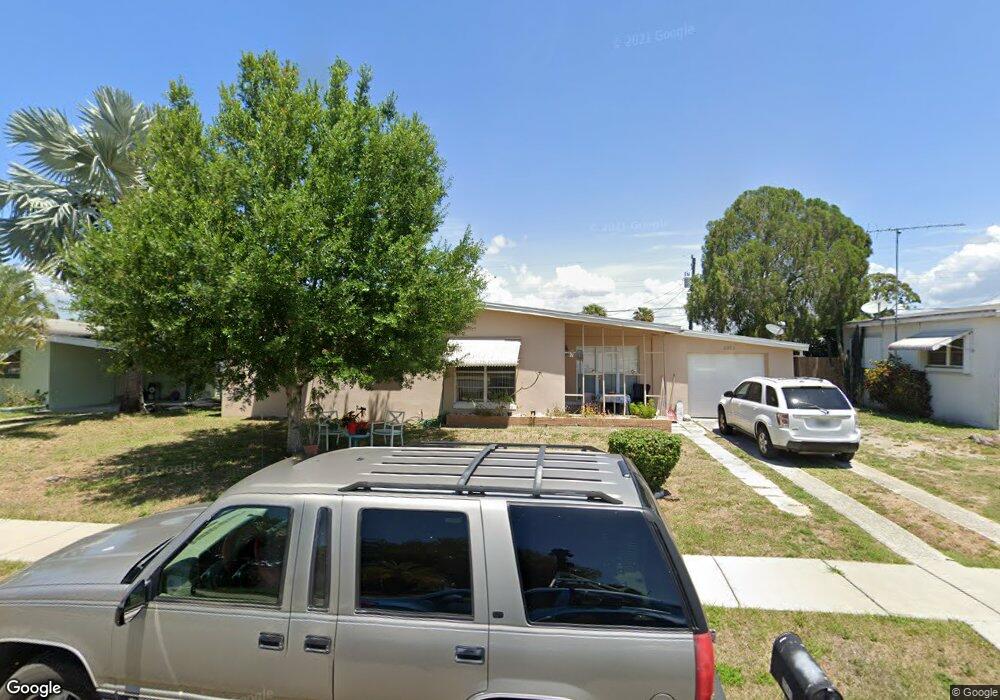
2562 Ambrose Ln Port Charlotte, FL 33952
Estimated Value: $128,000 - $175,000
2
Beds
1
Bath
962
Sq Ft
$163/Sq Ft
Est. Value
About This Home
This home is located at 2562 Ambrose Ln, Port Charlotte, FL 33952 and is currently estimated at $156,851, approximately $163 per square foot. 2562 Ambrose Ln is a home located in Charlotte County with nearby schools including Peace River Elementary School, Port Charlotte Middle School, and Port Charlotte High School.
Ownership History
Date
Name
Owned For
Owner Type
Purchase Details
Closed on
Jan 9, 2006
Sold by
Parsons G C and Parsons Susan
Bought by
Parsons Gerald Chandler and Parsons Susan E
Current Estimated Value
Purchase Details
Closed on
Nov 18, 2002
Sold by
Hackett Robert and Hackett Michelle
Bought by
Parsons G C and Parsons Susan
Purchase Details
Closed on
Oct 19, 2002
Sold by
Richardson Gary and Richardson Carol Sue
Bought by
Hackett Robert and Hackett Michelle
Purchase Details
Closed on
Nov 6, 2000
Sold by
Richardson Clifford S and Richardson Elsie M Scott
Bought by
Richardson Gary and Richardson Carol Sue
Home Financials for this Owner
Home Financials are based on the most recent Mortgage that was taken out on this home.
Original Mortgage
$39,000
Interest Rate
7.94%
Purchase Details
Closed on
Mar 24, 1995
Sold by
Dugan Patrick and Dugan Vicki L
Bought by
Richardson Clifford S and Richardson Elsie M Scott
Create a Home Valuation Report for This Property
The Home Valuation Report is an in-depth analysis detailing your home's value as well as a comparison with similar homes in the area
Home Values in the Area
Average Home Value in this Area
Purchase History
| Date | Buyer | Sale Price | Title Company |
|---|---|---|---|
| Parsons Gerald Chandler | -- | None Available | |
| Parsons G C | $55,300 | -- | |
| Hackett Robert | $45,000 | -- | |
| Richardson Gary | $40,000 | -- | |
| Richardson Clifford S | $46,900 | -- |
Source: Public Records
Mortgage History
| Date | Status | Borrower | Loan Amount |
|---|---|---|---|
| Previous Owner | Richardson Gary | $39,000 |
Source: Public Records
Tax History Compared to Growth
Tax History
| Year | Tax Paid | Tax Assessment Tax Assessment Total Assessment is a certain percentage of the fair market value that is determined by local assessors to be the total taxable value of land and additions on the property. | Land | Improvement |
|---|---|---|---|---|
| 2023 | $2,180 | $64,631 | $0 | $0 |
| 2022 | $1,983 | $115,981 | $13,600 | $102,381 |
| 2021 | $1,685 | $73,604 | $5,950 | $67,654 |
| 2020 | $1,475 | $53,425 | $4,505 | $48,920 |
| 2019 | $1,368 | $51,796 | $5,015 | $46,781 |
| 2018 | $1,219 | $48,893 | $4,505 | $44,388 |
| 2017 | $1,139 | $41,197 | $3,953 | $37,244 |
| 2016 | $1,073 | $33,166 | $0 | $0 |
| 2015 | $1,036 | $30,151 | $0 | $0 |
| 2014 | $969 | $27,410 | $0 | $0 |
Source: Public Records
Map
Nearby Homes
- 2554 Ambrose Ln
- 2433 Ednor St
- 2513 Ambrose Ln
- 2440 Elkcam Blvd
- 2321 Dallas St
- 2507 Linton Ln
- 21150 Gertrude Ave Unit G3
- 21150 Gertrude Ave Unit 4
- 21150 Gertrude Ave Unit S4
- 21150 Gertrude Ave Unit 1
- 21150 Gertrude Ave Unit O3
- 21150 Gertrude Ave Unit A3
- 2486 Caring Way Unit 14A
- 2486 Caring Way Unit 17A
- 2420 Linton Ln
- 3331 Elkcam Blvd
- 3188 Elkcam Blvd
- 2554 Lakeshore Cir
- 2290 Aaron St Unit 210
- 2290 Aaron St Unit 312
- 2570 Ambrose Ln
- 21047 Gertrude Ave
- 21029 Gertrude Ave
- 21030 Gertrude Ave
- 21055 Gertrude Ave
- 21039 Gertrude Ave
- 2578 Ambrose Ln
- 2425 Deedra St
- 2424 Deedra St
- 21063 Gertrude Ave
- 2424 Ednor St
- 2425 Ednor St
- 2586 Ambrose Ln
- 2433 Deedra St
- 2425 Warne St
- 2432 Deedra St
- 21069 Gertrude Ave
- 21048 Gertrude Ave
- 21056 Gertrude Ave
- 21040 Gertrude Ave