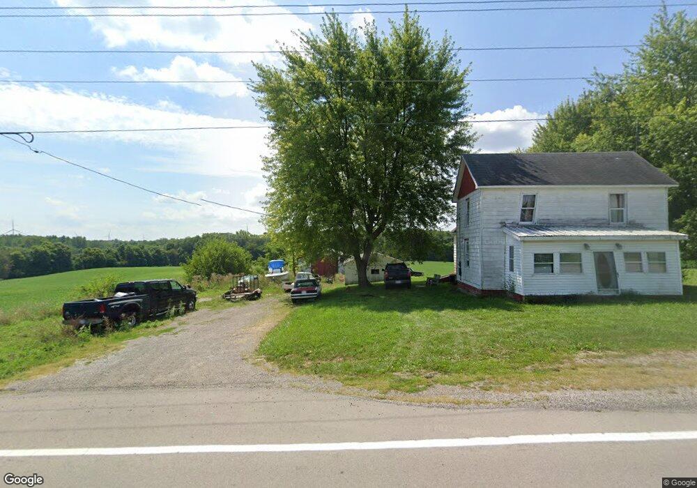
2562 State Route 67 Belle Center, OH 43310
Estimated Value: $142,000 - $190,000
3
Beds
1
Bath
1,424
Sq Ft
$112/Sq Ft
Est. Value
About This Home
This home is located at 2562 State Route 67, Belle Center, OH 43310 and is currently estimated at $159,604, approximately $112 per square foot. 2562 State Route 67 is a home located in Hardin County with nearby schools including Upper Scioto Valley Elementary School, Upper Scioto Valley Middle School, and Upper Scioto Valley High School.
Ownership History
Date
Name
Owned For
Owner Type
Purchase Details
Closed on
Sep 4, 2013
Sold by
Roof William R
Bought by
Roof William R
Current Estimated Value
Purchase Details
Closed on
Sep 29, 2011
Sold by
Champ James W
Bought by
Roof Mary R and The James W Champ Principal Proection Tr
Purchase Details
Closed on
Apr 5, 2004
Bought by
Young Lester D
Create a Home Valuation Report for This Property
The Home Valuation Report is an in-depth analysis detailing your home's value as well as a comparison with similar homes in the area
Home Values in the Area
Average Home Value in this Area
Purchase History
| Date | Buyer | Sale Price | Title Company |
|---|---|---|---|
| Roof William R | $73,400 | None Available | |
| Roof Mary R | -- | None Available | |
| Champ James W | -- | None Available | |
| Young Lester D | -- | -- |
Source: Public Records
Tax History Compared to Growth
Tax History
| Year | Tax Paid | Tax Assessment Tax Assessment Total Assessment is a certain percentage of the fair market value that is determined by local assessors to be the total taxable value of land and additions on the property. | Land | Improvement |
|---|---|---|---|---|
| 2024 | $1,134 | $30,220 | $5,930 | $24,290 |
| 2023 | $1,134 | $30,220 | $5,930 | $24,290 |
| 2022 | $1,054 | $25,650 | $4,780 | $20,870 |
| 2021 | $1,111 | $25,650 | $4,780 | $20,870 |
| 2020 | $1,126 | $25,650 | $4,780 | $20,870 |
| 2019 | $928 | $22,880 | $4,780 | $18,100 |
| 2018 | $932 | $22,880 | $4,780 | $18,100 |
| 2017 | $921 | $22,880 | $4,780 | $18,100 |
| 2016 | $905 | $24,630 | $4,440 | $20,190 |
| 2015 | $873 | $24,630 | $4,440 | $20,190 |
| 2014 | $567 | $25,910 | $5,720 | $20,190 |
| 2013 | $1,391 | $25,120 | $4,040 | $21,080 |
Source: Public Records
Map
Nearby Homes
- 16949 Township Road 39
- 14918 Township Road 55
- 2444 County Road 200
- 16161 Ash Ave
- 16235 Maple Ave
- 16074 Buckeye Ave
- 15527 State Route 235
- 15858 Hickory Ave
- 15848 Barnes Dr
- 11262 Northlake Dr
- 10998 Township Road 293
- 11455 Oak St
- 11377 Township Rd 266 Unit 66
- 11377 Township Rd 266 Unit 30
- 11377 Township Rd 266 Unit 59
- 11377 Township Road 266 Unit 3
- 11377 Township Road 266 Unit 59
- 11377 Township Road 266 Unit 99
- 11377 Township Road 266 Unit 77
- 11377 Township Road 266 Unit 34
- 2474 State Route 67
- 2551 St Route
- 2551 State Route 67
- 2384 State Route 67
- 2784 State Route 67
- 2308 State Route 67
- 2818 State Route 67
- 2809 State Route 67
- 2855 Ohio 67
- 2855 State Route 67
- 2855 Sr
- 2899 State Route 67
- 2926 State Route 67
- 16098 Sr 235 N #3 Unit 3
- 16108 State Route 235
- 3018 State Route 67
- 16250 State Route 235
- 3048 State Route 67