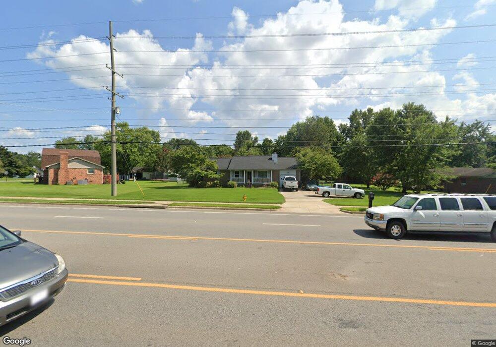
2562 Winchester Rd NE Huntsville, AL 35811
Estimated Value: $188,973 - $214,000
--
Bed
--
Bath
1,159
Sq Ft
$174/Sq Ft
Est. Value
About This Home
This home is located at 2562 Winchester Rd NE, Huntsville, AL 35811 and is currently estimated at $201,743, approximately $174 per square foot. 2562 Winchester Rd NE is a home with nearby schools including Riverton Elementary School, Riverton Intermediate School, and Buckhorn Middle School.
Ownership History
Date
Name
Owned For
Owner Type
Purchase Details
Closed on
Jul 29, 2022
Sold by
Carswell Randy K and Carswell Elaine Sharon
Bought by
Carswell Nathan James
Current Estimated Value
Home Financials for this Owner
Home Financials are based on the most recent Mortgage that was taken out on this home.
Original Mortgage
$128,000
Outstanding Balance
$122,557
Interest Rate
5.7%
Mortgage Type
New Conventional
Estimated Equity
$79,186
Create a Home Valuation Report for This Property
The Home Valuation Report is an in-depth analysis detailing your home's value as well as a comparison with similar homes in the area
Home Values in the Area
Average Home Value in this Area
Purchase History
| Date | Buyer | Sale Price | Title Company |
|---|---|---|---|
| Carswell Nathan James | $160,000 | Todd R Howard Attorney At Law |
Source: Public Records
Mortgage History
| Date | Status | Borrower | Loan Amount |
|---|---|---|---|
| Open | Carswell Nathan James | $128,000 |
Source: Public Records
Tax History Compared to Growth
Tax History
| Year | Tax Paid | Tax Assessment Tax Assessment Total Assessment is a certain percentage of the fair market value that is determined by local assessors to be the total taxable value of land and additions on the property. | Land | Improvement |
|---|---|---|---|---|
| 2024 | $988 | $26,740 | $2,700 | $24,040 |
| 2023 | $973 | $24,660 | $2,700 | $21,960 |
| 2022 | $360 | $11,300 | $1,360 | $9,940 |
| 2021 | $355 | $11,140 | $1,360 | $9,780 |
| 2020 | $314 | $10,020 | $1,350 | $8,670 |
| 2019 | $300 | $9,620 | $1,350 | $8,270 |
| 2018 | $279 | $9,080 | $0 | $0 |
| 2017 | $271 | $8,860 | $0 | $0 |
| 2016 | $271 | $8,860 | $0 | $0 |
| 2015 | $276 | $9,000 | $0 | $0 |
| 2014 | $273 | $8,920 | $0 | $0 |
Source: Public Records
Map
Nearby Homes
- 119 River Downs Dr
- 211 Water Ridge Ln
- 107 Mill Springs Ln
- 110 Mill Springs Ln
- 109 Mill Springs Ln
- 117 Mill Springs Ln
- 128 Mill Springs Ln
- 145 Bridge Arbor Ln
- 101 Riverway Ln
- 313 Merrydale Dr
- 301 Merrydale Dr
- 311 Merrydale Dr
- 314 Merrydale Dr
- The Finleigh Plan at Riverton Preserve
- The Harrison Plan at Riverton Preserve
- The Oxford Plan at Riverton Preserve
- The Rockford Plan at Riverton Preserve
- The Madison A Plan at Riverton Preserve
- 226 Twin Lakes Dr
- 221 Applewood Ct
- 5031 Shaun Cir
- 5001 Shaun Cir
- 5029 Shaun Cir
- 5003 Shaun Cir
- 2575 Winchester Rd NE
- 5027 Shaun Cir
- 5005 Shaun Cir
- 5030 Shaun Cir
- 5000 Shaun Cir
- 5002 Shaun Cir
- 5028 Shaun Cir
- 110 Finlen Rd
- 5007 Shaun Cir
- 5026 Shaun Cir
- 5006 Shaun Cir
- 2522 Winchester Rd NE
- 122 Finlen Rd
- 127 Finlen Rd
- 5024 Shaun Cir
- 2551 Winchester Rd NE