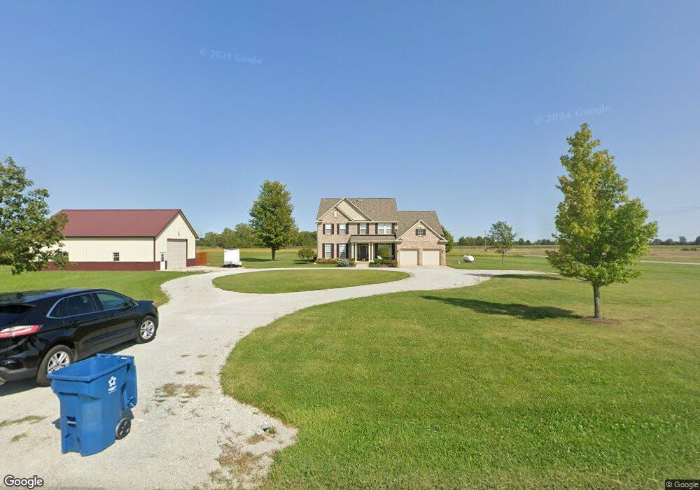
25629 Dunbar Rd Sheridan, IN 46069
Estimated Value: $494,000 - $603,000
3
Beds
3
Baths
3,282
Sq Ft
$163/Sq Ft
Est. Value
About This Home
This home is located at 25629 Dunbar Rd, Sheridan, IN 46069 and is currently estimated at $536,290, approximately $163 per square foot. 25629 Dunbar Rd is a home located in Hamilton County with nearby schools including Sheridan Elementary School, Sheridan Middle School, and Sheridan High School.
Ownership History
Date
Name
Owned For
Owner Type
Purchase Details
Closed on
Nov 21, 2012
Sold by
Harts Lonny D
Bought by
Frey Eric M and Frey Julia E
Current Estimated Value
Home Financials for this Owner
Home Financials are based on the most recent Mortgage that was taken out on this home.
Original Mortgage
$161,600
Outstanding Balance
$28,636
Interest Rate
3.35%
Mortgage Type
New Conventional
Estimated Equity
$507,654
Create a Home Valuation Report for This Property
The Home Valuation Report is an in-depth analysis detailing your home's value as well as a comparison with similar homes in the area
Home Values in the Area
Average Home Value in this Area
Purchase History
| Date | Buyer | Sale Price | Title Company |
|---|---|---|---|
| Frey Eric M | -- | None Available |
Source: Public Records
Mortgage History
| Date | Status | Borrower | Loan Amount |
|---|---|---|---|
| Open | Frey Eric M | $161,600 |
Source: Public Records
Tax History Compared to Growth
Tax History
| Year | Tax Paid | Tax Assessment Tax Assessment Total Assessment is a certain percentage of the fair market value that is determined by local assessors to be the total taxable value of land and additions on the property. | Land | Improvement |
|---|---|---|---|---|
| 2024 | $4,018 | $383,700 | $83,700 | $300,000 |
| 2023 | $4,033 | $371,900 | $83,700 | $288,200 |
| 2022 | $4,074 | $347,200 | $83,700 | $263,500 |
| 2021 | $3,896 | $326,300 | $83,700 | $242,600 |
| 2020 | $3,627 | $309,400 | $83,700 | $225,700 |
| 2019 | $3,510 | $311,900 | $54,400 | $257,500 |
| 2018 | $3,504 | $304,600 | $54,400 | $250,200 |
| 2017 | $3,267 | $294,200 | $54,400 | $239,800 |
| 2016 | $3,168 | $293,500 | $54,400 | $239,100 |
| 2014 | $3,132 | $276,600 | $50,200 | $226,400 |
| 2013 | $3,132 | $258,800 | $50,200 | $208,600 |
Source: Public Records
Map
Nearby Homes
- 606 E 256th St
- 526 W 256th St
- 24995 Anthony Rd
- 1592 E 236th St
- 45 E 276th St
- 23650 Anthony Rd
- 26735 Six Points Rd
- 23755 Six Points Rd
- 27440 Six Points Rd
- 4180 E 236th St
- 27015 Ditch Rd
- 0 W 246th St Unit MBR22071181
- 5009 E 246th St
- 5029 E 246th St
- 0 Oak Ridge Rd
- 23518 Oak Ridge Rd
- 21993 Oak Ridge Rd
- 21749 Oak Ridge Rd
- 0 E State Rd Unit MBR22023396
- 721 E State Road 38
- 24900 Dunbar Rd
- 24200 Dunbar Rd
- 22600 Dunbar Rd
- 25500 Dunbar Rd
- 25645 Dunbar Rd
- 25525 Dunbar Rd
- 939 E 256th St
- 1002 E 256th St
- 992 E 256th St
- 888 E 256th St
- 860 E 256th St
- 849 E 256th St
- 25540 Dunbar Rd
- 821 E 256th St
- 1698 E 256th St
- 771 E 256th St
- 25720 Us Highway 31
- 25760 Us Highway 31
- 25910 Dunbar Rd
- 25810 U S 31