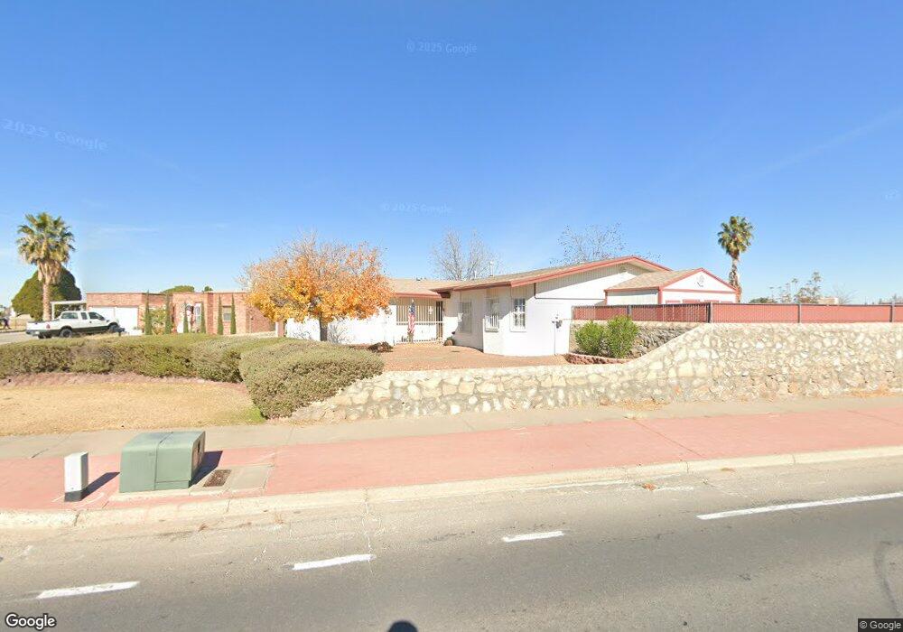
2563 Trawood Dr El Paso, TX 79936
Vista Del Sol NeighborhoodEstimated Value: $254,000 - $283,000
3
Beds
2
Baths
1,722
Sq Ft
$156/Sq Ft
Est. Value
About This Home
This home is located at 2563 Trawood Dr, El Paso, TX 79936 and is currently estimated at $267,933, approximately $155 per square foot. 2563 Trawood Dr is a home located in El Paso County with nearby schools including Tierra Del Sol Elementary School, J M Hanks High School, and EL PASO LEADERSHIP ACADEMY - MIDDLE EAST.
Ownership History
Date
Name
Owned For
Owner Type
Purchase Details
Closed on
Jun 26, 2014
Sold by
Apodaca Richard C and Apodaca Lydia G
Bought by
Apodaca Richard T and Apodaca Lilia M
Current Estimated Value
Purchase Details
Closed on
Jul 27, 2001
Sold by
Apodaca Richard T
Bought by
Apodaca Richard C and Apodaca Lydia G
Home Financials for this Owner
Home Financials are based on the most recent Mortgage that was taken out on this home.
Original Mortgage
$55,100
Interest Rate
7.16%
Create a Home Valuation Report for This Property
The Home Valuation Report is an in-depth analysis detailing your home's value as well as a comparison with similar homes in the area
Home Values in the Area
Average Home Value in this Area
Purchase History
| Date | Buyer | Sale Price | Title Company |
|---|---|---|---|
| Apodaca Richard T | -- | None Available | |
| Apodaca Richard C | -- | -- |
Source: Public Records
Mortgage History
| Date | Status | Borrower | Loan Amount |
|---|---|---|---|
| Closed | Apodaca Richard C | $55,100 |
Source: Public Records
Tax History Compared to Growth
Tax History
| Year | Tax Paid | Tax Assessment Tax Assessment Total Assessment is a certain percentage of the fair market value that is determined by local assessors to be the total taxable value of land and additions on the property. | Land | Improvement |
|---|---|---|---|---|
| 2025 | $3,040 | $252,088 | $48,816 | $203,272 |
| 2024 | $3,040 | $232,287 | -- | -- |
| 2023 | $2,925 | $211,170 | $0 | $0 |
| 2022 | $5,961 | $191,973 | $0 | $0 |
| 2021 | $5,673 | $174,521 | $33,756 | $140,765 |
| 2020 | $5,352 | $169,451 | $30,640 | $138,811 |
| 2018 | $5,162 | $166,001 | $30,640 | $135,361 |
| 2017 | $4,778 | $156,319 | $30,640 | $125,679 |
| 2016 | $4,351 | $142,354 | $30,640 | $111,714 |
| 2015 | $4,097 | $142,354 | $30,640 | $111,714 |
| 2014 | $4,097 | $143,197 | $30,640 | $112,557 |
Source: Public Records
Map
Nearby Homes
- 1817 Hugh Royer Place
- 1868 Tom Bolt Dr
- 1901 Bobby Jones Dr
- 11204 Bob Mitchell Dr
- 11157 Leo Collins Dr
- 2001 Bobby Jones Dr Unit A
- 2009 Bobby Jones Dr Unit B
- 1739 Jerry Abbott St
- 1913 Seagull Dr
- 1617 Tommy Aaron Dr
- 1844 Jack Nicklaus Dr Unit 1846
- 1804 Jerry Abbott St
- 1703 Robert Wynn St
- 11016 Bob Stone Dr
- 11012 Bob Stone Dr
- 1607 Tommy Aaron Dr
- 11013 Bob Stone Dr
- 11262 Enid Wilson Ln
- 11268 Enid Wilson Ln
- 1700 Jerry Abbott St
- 1801 Pete Brown Dr
- 1809 Pete Brown Dr
- 2559 Trawood Dr
- 1813 Pete Brown Dr
- 2562 Trawood Dr
- 2555 Trawood Dr
- 1709 Pete Brown Dr
- 2551 Trawood Dr
- 1709 Pete Brown Place
- 1819 Pete Brown Dr
- 1804 Pete Brown Dr
- 2558 Trawood Dr
- 1808 Pete Brown Dr
- 1800 Pete Brown Dr
- 1846 Billy Casper Dr
- 1846 Billy Casper Dr Unit 1
- 1846 Billy Casper Dr
- 1812 Pete Brown Dr
- 2550 Trawood Dr
- 1705 Pete Brown Dr