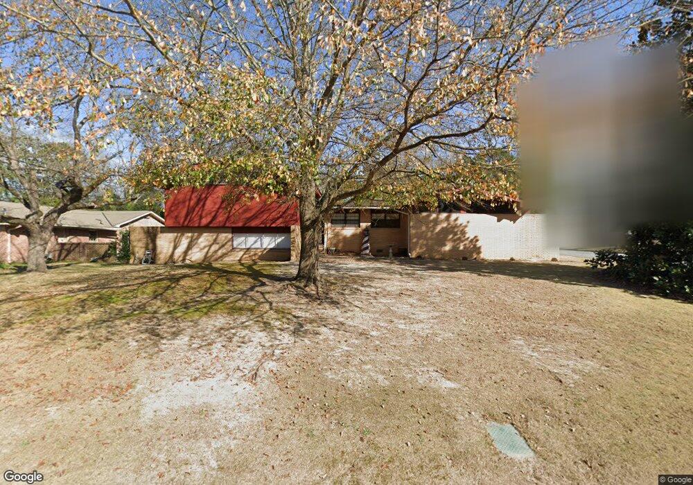
2564 Auburn Ave Columbus, GA 31906
Hilton Heights-Clubview Heights NeighborhoodEstimated Value: $320,000 - $336,000
4
Beds
4
Baths
2,302
Sq Ft
$143/Sq Ft
Est. Value
About This Home
This home is located at 2564 Auburn Ave, Columbus, GA 31906 and is currently estimated at $328,164, approximately $142 per square foot. 2564 Auburn Ave is a home located in Muscogee County with nearby schools including Clubview Elementary School, Richards Middle School, and Hardaway High School.
Ownership History
Date
Name
Owned For
Owner Type
Purchase Details
Closed on
Aug 31, 2007
Sold by
Williams Howard L
Bought by
Williams Howard L and Williams Tasheena G
Current Estimated Value
Home Financials for this Owner
Home Financials are based on the most recent Mortgage that was taken out on this home.
Original Mortgage
$215,000
Outstanding Balance
$136,680
Interest Rate
6.65%
Mortgage Type
VA
Estimated Equity
$191,484
Create a Home Valuation Report for This Property
The Home Valuation Report is an in-depth analysis detailing your home's value as well as a comparison with similar homes in the area
Home Values in the Area
Average Home Value in this Area
Purchase History
| Date | Buyer | Sale Price | Title Company |
|---|---|---|---|
| Williams Howard L | $215,000 | None Available | |
| Williams Howard L | -- | None Available |
Source: Public Records
Mortgage History
| Date | Status | Borrower | Loan Amount |
|---|---|---|---|
| Open | Williams Howard L | $215,000 |
Source: Public Records
Tax History Compared to Growth
Tax History
| Year | Tax Paid | Tax Assessment Tax Assessment Total Assessment is a certain percentage of the fair market value that is determined by local assessors to be the total taxable value of land and additions on the property. | Land | Improvement |
|---|---|---|---|---|
| 2025 | -- | $109,284 | $28,876 | $80,408 |
| 2024 | -- | $109,284 | $28,876 | $80,408 |
| 2023 | $0 | $109,284 | $28,876 | $80,408 |
| 2022 | $0 | $94,720 | $28,876 | $65,844 |
| 2021 | $0 | $89,652 | $28,876 | $60,776 |
| 2020 | $0 | $89,652 | $28,876 | $60,776 |
| 2019 | $14 | $89,652 | $28,876 | $60,776 |
| 2018 | $201 | $89,652 | $28,876 | $60,776 |
| 2017 | $2,266 | $89,652 | $28,876 | $60,776 |
| 2016 | $775 | $85,998 | $14,575 | $71,423 |
| 2015 | $776 | $85,998 | $14,575 | $71,423 |
| 2014 | $777 | $85,998 | $14,575 | $71,423 |
| 2013 | -- | $85,998 | $14,575 | $71,423 |
Source: Public Records
Map
Nearby Homes
- 2604 Sue MacK Dr
- 2940 Birchfield Dr
- 2576 Habersham Ave
- 2637 Sue MacK Dr
- 1903 Marilon Dr
- 2817 Carson Dr
- 1712 Marilon Dr
- 2010 Wells Dr
- 1714 Iris Dr
- 2722 E Lindsay Dr
- 2820 Nancy St
- 2930 Sue MacK Dr
- 2525 Norris Rd Unit 36
- 2525 Norris Rd Unit 73
- 2525 Norris Rd Unit 91
- 1500 Preston Dr
- 2917 Edgewood Rd
- 2911 Gardenia St
- 2916 Gardenia St
- 2609 Hilton Ave
- 2572 Auburn Ave
- 2565 Habersham Ave
- 2580 Auburn Ave
- 2922 Birchfield Dr
- 2550 Auburn Ave
- 2573 Habersham Ave
- 2559 Auburn Ave
- 2928 Birchfield Dr
- 2571 Auburn Ave
- 2555 Auburn Ave
- 2600 Auburn Ave
- 2581 Habersham Ave
- 2579 Auburn Ave
- 2932 Birchfield Dr
- 2547 Auburn Ave
- 2608 Auburn Ave
- 2568 Habersham Ave
- 2607 Habersham Ave
- 2607 Auburn Ave
- 2214 Downing Dr