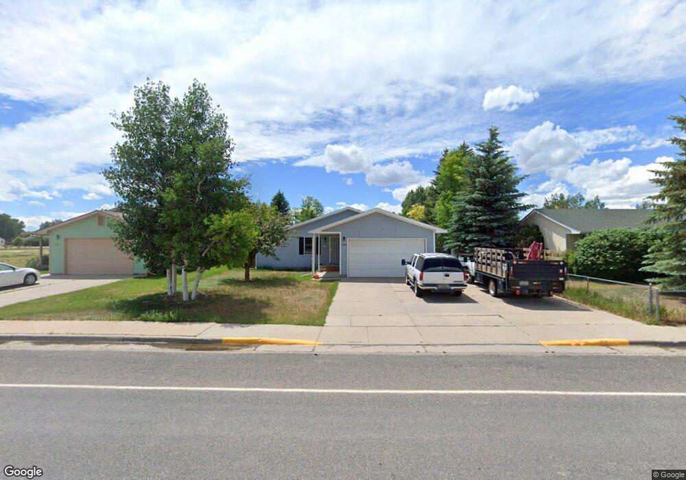
2564 Snowy Range Rd Laramie, WY 82070
Estimated Value: $328,000 - $369,336
3
Beds
2
Baths
1,394
Sq Ft
$250/Sq Ft
Est. Value
About This Home
This home is located at 2564 Snowy Range Rd, Laramie, WY 82070 and is currently estimated at $348,668, approximately $250 per square foot. 2564 Snowy Range Rd is a home located in Albany County with nearby schools including Velma Linford Elementary School, Laramie Middle School, and Laramie High School.
Ownership History
Date
Name
Owned For
Owner Type
Purchase Details
Closed on
Dec 30, 2021
Sold by
Atkinson and Amber
Bought by
Royal Vernon and Royal Teresa
Current Estimated Value
Home Financials for this Owner
Home Financials are based on the most recent Mortgage that was taken out on this home.
Original Mortgage
$324,915
Outstanding Balance
$299,450
Interest Rate
3.11%
Mortgage Type
VA
Estimated Equity
$49,218
Purchase Details
Closed on
Jun 3, 2011
Sold by
Carpenter Eric J and Carpenter Leann A
Bought by
Atkinson Casey
Home Financials for this Owner
Home Financials are based on the most recent Mortgage that was taken out on this home.
Original Mortgage
$196,879
Interest Rate
4.85%
Mortgage Type
FHA
Create a Home Valuation Report for This Property
The Home Valuation Report is an in-depth analysis detailing your home's value as well as a comparison with similar homes in the area
Home Values in the Area
Average Home Value in this Area
Purchase History
| Date | Buyer | Sale Price | Title Company |
|---|---|---|---|
| Royal Vernon | $318,416 | None Listed On Document | |
| Atkinson Casey | -- | -- |
Source: Public Records
Mortgage History
| Date | Status | Borrower | Loan Amount |
|---|---|---|---|
| Open | Royal Vernon | $324,915 | |
| Previous Owner | Atkinson Casey | $196,879 |
Source: Public Records
Tax History Compared to Growth
Tax History
| Year | Tax Paid | Tax Assessment Tax Assessment Total Assessment is a certain percentage of the fair market value that is determined by local assessors to be the total taxable value of land and additions on the property. | Land | Improvement |
|---|---|---|---|---|
| 2021 | $1,466 | $20,079 | $4,610 | $15,469 |
| 2020 | $1,437 | $19,682 | $4,177 | $15,505 |
| 2019 | $1,362 | $18,655 | $4,177 | $14,478 |
| 2018 | $1,267 | $17,359 | $3,515 | $13,844 |
| 2017 | $1,301 | $17,828 | $3,515 | $14,313 |
| 2016 | $1,262 | $17,293 | $3,232 | $14,061 |
| 2015 | $1,241 | $17,004 | $4,401 | $12,603 |
| 2014 | $1,244 | $17,041 | $0 | $0 |
Source: Public Records
Map
Nearby Homes
- 2166 W Wyoming Ave Unit 29
- 2166 W Wyoming Ave Unit 25
- 416 Arthur St
- 2075 Jefferson St
- 174 N Colorado Ave
- 541 S Johnson St
- 370 S Buchanan St
- 1012 A-B S Colorado Ave
- 627 S Colorado Ave
- 427 S Pierce St
- 1990 Truman St
- 2260 Franklin St Unit 27
- 2260 Franklin St Unit 38
- 8 Star Struck Ln
- 529 S Pierce St
- 1416 S Colorado Ave
- 1414 S Colorado Ave
- 1412 S Colorado Ave
- 1410 S Colorado Ave
- 1866 Truman St
- 2558 Snowy Range Rd
- 2462 Jefferson St
- 2468 Jefferson St
- 2570 Snowy Range Rd
- 219 S Cleveland St
- 2474 Jefferson St
- 2463 Jefferson St
- 2467 Jefferson St
- 231 Cleveland St
- 2756 Snowy Range Rd
- 2373 Jefferson St
- 2367 Jefferson St
- 2557 Kennedy St
- 2558 Jefferson St
- 127 Cleveland St
- 2558 Kennedy St
- 2766 Snowy Range Rd
- 2363 Jefferson St
- 2358 Jefferson St
- 2557 Monroe St