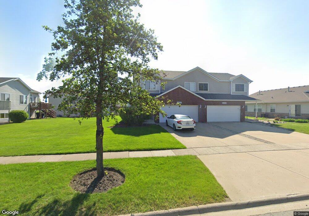
25643 S Red Stable Ln Unit 1 Channahon, IL 60410
Estimated Value: $268,088 - $285,000
2
Beds
2
Baths
989
Sq Ft
$280/Sq Ft
Est. Value
About This Home
This home is located at 25643 S Red Stable Ln Unit 1, Channahon, IL 60410 and is currently estimated at $276,522, approximately $279 per square foot. 25643 S Red Stable Ln Unit 1 is a home located in Grundy County with nearby schools including Minooka Primary Center, Aux Sable Elementary School, and Minooka Junior High School.
Ownership History
Date
Name
Owned For
Owner Type
Purchase Details
Closed on
May 16, 2022
Sold by
Williams Joseph W
Bought by
Garcia Andrew T
Current Estimated Value
Home Financials for this Owner
Home Financials are based on the most recent Mortgage that was taken out on this home.
Original Mortgage
$228,000
Outstanding Balance
$216,692
Interest Rate
5.3%
Mortgage Type
New Conventional
Estimated Equity
$59,830
Create a Home Valuation Report for This Property
The Home Valuation Report is an in-depth analysis detailing your home's value as well as a comparison with similar homes in the area
Home Values in the Area
Average Home Value in this Area
Purchase History
| Date | Buyer | Sale Price | Title Company |
|---|---|---|---|
| Garcia Andrew T | $240,000 | Cortina Mueller & Frobish Pc |
Source: Public Records
Mortgage History
| Date | Status | Borrower | Loan Amount |
|---|---|---|---|
| Open | Garcia Andrew T | $228,000 |
Source: Public Records
Tax History Compared to Growth
Tax History
| Year | Tax Paid | Tax Assessment Tax Assessment Total Assessment is a certain percentage of the fair market value that is determined by local assessors to be the total taxable value of land and additions on the property. | Land | Improvement |
|---|---|---|---|---|
| 2024 | $5,337 | $63,794 | $15,468 | $48,326 |
| 2023 | $4,865 | $58,148 | $14,099 | $44,049 |
| 2022 | $4,021 | $54,066 | $13,109 | $40,957 |
| 2021 | $3,817 | $51,179 | $12,409 | $38,770 |
| 2020 | $3,704 | $48,957 | $11,870 | $37,087 |
| 2019 | $3,466 | $45,331 | $10,991 | $34,340 |
| 2018 | $3,544 | $45,409 | $10,868 | $34,541 |
| 2017 | $3,435 | $43,362 | $10,378 | $32,984 |
| 2016 | $3,192 | $40,704 | $9,742 | $30,962 |
| 2015 | $2,709 | $37,001 | $8,856 | $28,145 |
| 2014 | $2,487 | $34,959 | $8,367 | $26,592 |
| 2013 | $2,544 | $35,430 | $8,480 | $26,950 |
Source: Public Records
Map
Nearby Homes
- 25638 S Fieldstone Ct
- 25624 S Fieldstone Ct
- 26518 W Deer Path
- 25724 S Bridle Path
- 25815 S Bell Rd
- 25441 S Mallard Dr
- 26314 W Silver Stream Dr
- 428 E Frontier Dr
- 25226 S Mallard Dr
- 26201 W Winding Oak Ct Unit 11
- 25204 Westwind Dr
- 26124 S Bell Rd
- 25765 S Yellow Pine Dr
- 25710 S Parkside Dr
- 25641 S Oakview Ct
- 1448 Sedge Pass
- 25610 S Parkside Dr
- 1468 Sedge Pass
- 26560 Old Kerry Grove
- 1413 Sedge Pass
- 25645 S Red Stable Ln
- 26447 W Fox Trail
- 26445 Fox Trail
- 26435 W Fox Trail Unit B
- 26448 W Spur Ct
- 26433 W Fox Trail
- 26433 W Fox Trail Unit A
- 26446 W Spur Ct
- 26438 W Spur Ct
- 25634 S Red Stable Ln Unit 2
- 25634 S Red Stable Ln
- 26436 W Spur Ct
- 26429 W Fox Trail
- 26427 W Fox Trail
- 25636 S Red Stable Ln
- 25648 S Red Stable Ln
- 25632 S Red Stable Ln
- 26432 W Spur Ct
- 26421 W Fox Trail
- 25662 S Red Stable Ln