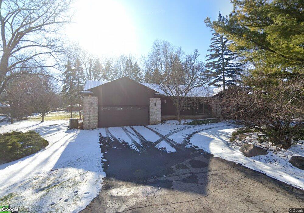
2565 Comfort St West Bloomfield, MI 48323
Estimated Value: $457,000 - $590,000
3
Beds
2
Baths
2,073
Sq Ft
$245/Sq Ft
Est. Value
About This Home
This home is located at 2565 Comfort St, West Bloomfield, MI 48323 and is currently estimated at $508,518, approximately $245 per square foot. 2565 Comfort St is a home located in Oakland County with nearby schools including Wylie E. Groves High School, West Maple Elementary School, and Berkshire Middle School.
Ownership History
Date
Name
Owned For
Owner Type
Purchase Details
Closed on
Sep 24, 2024
Sold by
Salinger Michael S and Salinger Laurene A
Bought by
Salinger Laurene A and Salinger Michael S
Current Estimated Value
Purchase Details
Closed on
Jun 20, 1997
Sold by
Raslan Abdul Hassib
Bought by
Salinger Michael S
Home Financials for this Owner
Home Financials are based on the most recent Mortgage that was taken out on this home.
Original Mortgage
$232,000
Interest Rate
8%
Create a Home Valuation Report for This Property
The Home Valuation Report is an in-depth analysis detailing your home's value as well as a comparison with similar homes in the area
Home Values in the Area
Average Home Value in this Area
Purchase History
| Date | Buyer | Sale Price | Title Company |
|---|---|---|---|
| Salinger Laurene A | -- | None Listed On Document | |
| Salinger Michael S | $290,000 | -- |
Source: Public Records
Mortgage History
| Date | Status | Borrower | Loan Amount |
|---|---|---|---|
| Previous Owner | Salinger Michael S | $232,000 |
Source: Public Records
Tax History Compared to Growth
Tax History
| Year | Tax Paid | Tax Assessment Tax Assessment Total Assessment is a certain percentage of the fair market value that is determined by local assessors to be the total taxable value of land and additions on the property. | Land | Improvement |
|---|---|---|---|---|
| 2024 | $4,013 | $219,560 | $0 | $0 |
| 2022 | $3,851 | $194,210 | $106,650 | $87,560 |
| 2021 | $6,497 | $190,280 | $0 | $0 |
| 2020 | $3,699 | $193,370 | $106,650 | $86,720 |
| 2018 | $6,407 | $200,640 | $107,250 | $93,390 |
| 2015 | -- | $178,970 | $0 | $0 |
| 2014 | -- | $160,770 | $0 | $0 |
| 2011 | -- | $148,130 | $0 | $0 |
Source: Public Records
Map
Nearby Homes
- 0000 Putnam Dr
- 5881 Naneva Ct
- 5815 Bloomfield Glens Rd
- 2149 Sunnycrest Dr
- 5620 Eastman Blvd
- 5620 Inkster Rd
- 3104 Spring St
- 3035 Parkland Dr
- 4724 Tara Ct
- 4768 Wendrick Dr
- 5415 Fairway Ln
- 5622 Powder Horn Dr
- 5321 Fairway Ln Unit 7
- 4710 Cove Rd
- 4670 Cove Rd
- 4776 Walnut Lake Rd
- 5118 Vincennes Ct
- 5605 Woodwind Dr
- 4641 Cove Rd
- 5780 Swan Lake Ct
- 2554 Comfort St
- 5685 Rawnsley St
- 5680 Euclid Dr
- 5665 Rawnsley St
- 5720 Euclid Dr
- 2580 Walnut Lake Rd
- 2514 Comfort St Unit Bldg-Unit
- 2514 Comfort St
- 2590 Walnut Lake Rd
- 5675 Euclid Dr
- 2526 Comfort St
- 2625 Comfort St
- 5690 Rawnsley St
- 5689 Euclid Dr
- 2502 Comfort St
- 2490 Comfort Ct
- 5750 Euclid Dr
- 2500 Comfort Ct
- 2620 Walnut Lake Rd
- 5735 Euclid Dr