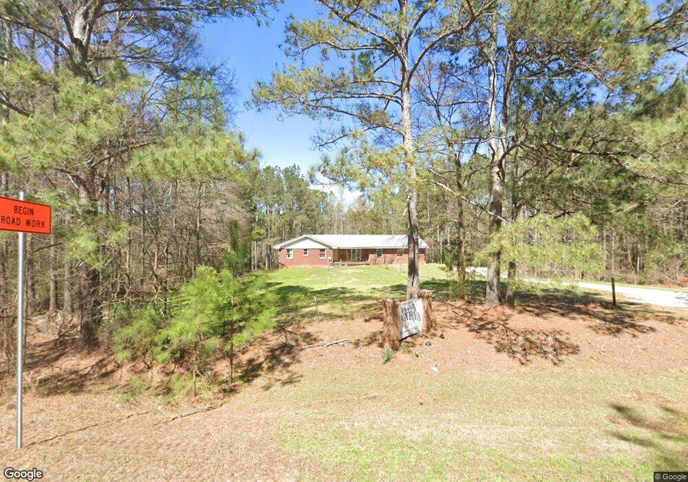
2565 Union Point Rd Union Point, GA 30669
Estimated Value: $139,000 - $346,000
3
Beds
2
Baths
1,678
Sq Ft
$130/Sq Ft
Est. Value
About This Home
This home is located at 2565 Union Point Rd, Union Point, GA 30669 and is currently estimated at $217,991, approximately $129 per square foot. 2565 Union Point Rd is a home located in Oglethorpe County with nearby schools including Oglethorpe County Primary School, Oglethorpe County Elementary School, and Oglethorpe County Middle School.
Ownership History
Date
Name
Owned For
Owner Type
Purchase Details
Closed on
Apr 18, 2021
Sold by
Swenson Ann
Bought by
Yalls Properties Llc
Current Estimated Value
Purchase Details
Closed on
Mar 5, 2010
Sold by
Taylor Bean & Whitaker Mortgage Corp
Bought by
Swenson Ann and Roberts Thomas B
Purchase Details
Closed on
Sep 5, 2008
Sold by
Fhlm Corp
Bought by
Taylor Bean and Taylor Whitaker Mortg
Purchase Details
Closed on
Feb 5, 2008
Sold by
Taylor Bean and Taylor Whitaker Mor
Bought by
Federal Home Loan Mortgage Corporation
Create a Home Valuation Report for This Property
The Home Valuation Report is an in-depth analysis detailing your home's value as well as a comparison with similar homes in the area
Purchase History
| Date | Buyer | Sale Price | Title Company |
|---|---|---|---|
| Yalls Properties Llc | -- | -- | |
| Swenson Ann | $38,000 | -- | |
| Taylor Bean | -- | -- | |
| Federal Home Loan Mortgage Corporation | $133,474 | -- | |
| Taylor Bean | $133,470 | -- |
Source: Public Records
Tax History
| Year | Tax Paid | Tax Assessment Tax Assessment Total Assessment is a certain percentage of the fair market value that is determined by local assessors to be the total taxable value of land and additions on the property. | Land | Improvement |
|---|---|---|---|---|
| 2025 | $965 | $40,272 | $1,755 | $38,517 |
| 2023 | $741 | $31,080 | $1,686 | $29,394 |
| 2022 | $796 | $31,080 | $1,686 | $29,394 |
| 2021 | $916 | $37,680 | $2,560 | $35,120 |
| 2020 | $699 | $37,680 | $2,560 | $35,120 |
| 2019 | $990 | $40,400 | $2,560 | $37,840 |
| 2018 | $704 | $23,300 | $1,500 | $21,800 |
| 2017 | $704 | $23,300 | $1,500 | $21,800 |
| 2016 | $688 | $23,300 | $1,500 | $21,800 |
| 2015 | -- | $23,300 | $1,500 | $21,800 |
| 2014 | -- | $23,300 | $1,500 | $21,800 |
| 2013 | -- | $39,066 | $1,499 | $37,566 |
Source: Public Records
Map
Nearby Homes
- 0 Lovers Ln Unit 10690740
- 0 Lovers Ln Unit CL349036
- 290 Poplar Creek Rd
- 181 Lower Wirebridge Rd
- 0 Lower Wirebridge Rd
- 0 Union Point Rd Unit 10734480
- 1774 Union Point Rd
- 125 Walker Gresham Rd
- 1 Union Point Rd
- 2 Union Point Rd
- 000 Union Point Rd
- 1500 Churchwell Rd
- Whitney Farm
- 0 Bull Bray Rd
- 5011 Penfield Rd
- 5971 Penfield Rd
- 0 Woodville Rd Unit 7667944
- 0 Woodville Rd Unit 10628010
- 1091 Peachtree Ave E
- 0 Crawfordville Rd Unit 10674081
- 2552 Union Point Rd
- 2570 Union Point Rd
- 855 S Main St
- 847 S Main St
- 2605 Union Point Rd
- 2598 Union Point Rd
- 839 S Main St
- 230 Brookwood Dr
- 855 Main St S
- 215 Willow St
- 200 Po Box
- 208 Willow St
- 200 Brookwood Dr
- 2624 Union Point Rd
- 793 S Main St
- 743 S Main St
- 187 Willow St
- 0 Cherry St Unit CM359159
- 373 Cherry St
- 450 Mcwhorter Rd
Your Personal Tour Guide
Ask me questions while you tour the home.