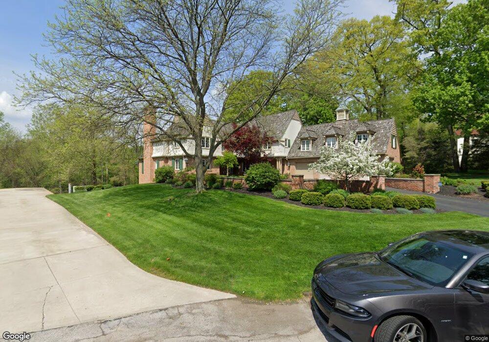
2567 Forestvale Rd Ottawa Hills, OH 43615
Estimated Value: $986,000 - $1,127,000
3
Beds
7
Baths
4,596
Sq Ft
$230/Sq Ft
Est. Value
About This Home
This home is located at 2567 Forestvale Rd, Ottawa Hills, OH 43615 and is currently estimated at $1,057,563, approximately $230 per square foot. 2567 Forestvale Rd is a home located in Lucas County with nearby schools including Ottawa Hills Elementary School, Ottawa Hills High School, and Central Academy Of Ohio.
Ownership History
Date
Name
Owned For
Owner Type
Purchase Details
Closed on
Aug 8, 2003
Sold by
Gerber Arthur M and Gerber Ruth
Bought by
Lemieux Craig J and Lemieux Kimberly A
Current Estimated Value
Home Financials for this Owner
Home Financials are based on the most recent Mortgage that was taken out on this home.
Original Mortgage
$100,000
Outstanding Balance
$44,036
Interest Rate
5.62%
Mortgage Type
Purchase Money Mortgage
Estimated Equity
$1,013,527
Purchase Details
Closed on
Jan 21, 1993
Purchase Details
Closed on
May 15, 1992
Sold by
Richard Carl V and Richard Cathleen
Create a Home Valuation Report for This Property
The Home Valuation Report is an in-depth analysis detailing your home's value as well as a comparison with similar homes in the area
Home Values in the Area
Average Home Value in this Area
Purchase History
| Date | Buyer | Sale Price | Title Company |
|---|---|---|---|
| Lemieux Craig J | $650,000 | Louisville Title Agency For | |
| -- | -- | -- | |
| -- | $595,000 | -- |
Source: Public Records
Mortgage History
| Date | Status | Borrower | Loan Amount |
|---|---|---|---|
| Open | Lemieux Craig J | $100,000 |
Source: Public Records
Tax History Compared to Growth
Tax History
| Year | Tax Paid | Tax Assessment Tax Assessment Total Assessment is a certain percentage of the fair market value that is determined by local assessors to be the total taxable value of land and additions on the property. | Land | Improvement |
|---|---|---|---|---|
| 2024 | $12,271 | $281,295 | $53,235 | $228,060 |
| 2023 | $22,947 | $240,485 | $61,495 | $178,990 |
| 2022 | $23,175 | $240,485 | $61,495 | $178,990 |
| 2021 | $23,485 | $240,485 | $61,495 | $178,990 |
| 2020 | $25,289 | $233,030 | $59,535 | $173,495 |
| 2019 | $22,989 | $233,030 | $59,535 | $173,495 |
| 2018 | $21,188 | $233,030 | $59,535 | $173,495 |
| 2017 | $19,568 | $185,500 | $36,540 | $148,960 |
| 2016 | $19,389 | $530,000 | $104,400 | $425,600 |
| 2015 | $19,463 | $530,000 | $104,400 | $425,600 |
| 2014 | $25,713 | $250,810 | $36,540 | $214,270 |
| 2013 | $25,713 | $250,810 | $36,540 | $214,270 |
Source: Public Records
Map
Nearby Homes
- 2720 Derby Rd
- 4545 Indian Rd
- 4519 W Bancroft St
- 4515 W Bancroft St
- 4343 W Bancroft St
- 2222 Talmadge Rd
- 2026 Pautucket Rd
- 5212 Regency Dr
- 4239 W Central Ave
- 4028 Brookside Rd
- 2949 Secretariat Rd
- 4132 Sheraton Rd
- 4243 W Bancroft St
- 3205 Talmadge Rd
- 3221 Talmadge Rd
- 4236 S Terrace View St
- 2130 Richards Rd
- 5204 W Bancroft St
- 4057 Hillandale Rd
- 3439 Shakespeare Ln
- 2537 Forestvale Rd
- 2557 Forestvale Rd
- 2621 Forestvale Rd
- 2554 Forestvale Rd
- 2560 Forestvale Rd
- 6537 Woodhall
- 2600 Forestvale Rd
- 2637 Forestvale Rd
- 2567 Olde Brookside Rd
- 4509 Woodhill Rd
- 2571 Olde Brookside Rd
- 2646 Forestvale Rd
- 2649 Forestvale Rd
- 2579 Olde Brookside Rd
- 4522 Woodhill Rd
- 2561 Olde Brookside Rd
- 2581 Olde Brookside Rd
- 2661 Forestvale Rd
- 2585 Olde Brookside Rd
- 2546 Underhill Rd