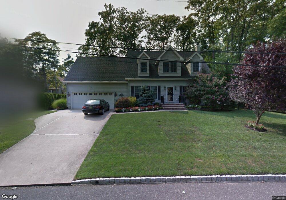
2567 High Point Rd Manasquan, NJ 08736
Estimated Value: $1,015,000 - $1,388,000
4
Beds
2
Baths
2,352
Sq Ft
$499/Sq Ft
Est. Value
About This Home
This home is located at 2567 High Point Rd, Manasquan, NJ 08736 and is currently estimated at $1,172,883, approximately $498 per square foot. 2567 High Point Rd is a home located in Monmouth County with nearby schools including Wall High School and The Brookside School.
Ownership History
Date
Name
Owned For
Owner Type
Purchase Details
Closed on
Jul 21, 2009
Sold by
Dubicki Rebecca and Dubicki Joseph
Bought by
Petrello Deborah
Current Estimated Value
Home Financials for this Owner
Home Financials are based on the most recent Mortgage that was taken out on this home.
Original Mortgage
$270,000
Outstanding Balance
$178,621
Interest Rate
5.58%
Mortgage Type
Purchase Money Mortgage
Estimated Equity
$994,262
Purchase Details
Closed on
Dec 12, 2003
Sold by
Colucci Paul
Bought by
Dubicki Rebecca and Dubicki Joseph
Home Financials for this Owner
Home Financials are based on the most recent Mortgage that was taken out on this home.
Original Mortgage
$150,000
Interest Rate
5.71%
Create a Home Valuation Report for This Property
The Home Valuation Report is an in-depth analysis detailing your home's value as well as a comparison with similar homes in the area
Home Values in the Area
Average Home Value in this Area
Purchase History
| Date | Buyer | Sale Price | Title Company |
|---|---|---|---|
| Petrello Deborah | $619,999 | None Available | |
| Dubicki Rebecca | $288,000 | -- |
Source: Public Records
Mortgage History
| Date | Status | Borrower | Loan Amount |
|---|---|---|---|
| Open | Petrello Deborah | $270,000 | |
| Previous Owner | Dubicki Rebecca | $150,000 |
Source: Public Records
Tax History Compared to Growth
Tax History
| Year | Tax Paid | Tax Assessment Tax Assessment Total Assessment is a certain percentage of the fair market value that is determined by local assessors to be the total taxable value of land and additions on the property. | Land | Improvement |
|---|---|---|---|---|
| 2025 | $11,468 | $543,500 | $250,000 | $293,500 |
| 2024 | $11,125 | $543,500 | $250,000 | $293,500 |
| 2023 | $11,125 | $543,500 | $250,000 | $293,500 |
| 2022 | $10,854 | $543,500 | $250,000 | $293,500 |
| 2021 | $10,854 | $543,500 | $250,000 | $293,500 |
| 2020 | $10,723 | $543,500 | $250,000 | $293,500 |
| 2019 | $10,593 | $543,500 | $250,000 | $293,500 |
| 2018 | $10,500 | $543,500 | $250,000 | $293,500 |
| 2017 | $10,294 | $543,500 | $250,000 | $293,500 |
| 2016 | $10,076 | $543,500 | $250,000 | $293,500 |
| 2015 | $11,844 | $401,500 | $133,900 | $267,600 |
| 2014 | $11,467 | $397,600 | $130,000 | $267,600 |
Source: Public Records
Map
Nearby Homes
- 1209 Lenape Trail
- 1207 Bayberry Rd
- 1210 Bayberry Rd
- 203 Lenape Trail
- 1307 W Union Ln Unit A4
- 14 Lebanon Dr
- 308 South St
- 142 Oval Rd
- 5 Hickory Ct Unit B
- Kensington Plan at The Monmouth - The Villas 55+
- 1422 Lakewood Rd
- 633 Agnes Ave
- 619 Park Ave
- 10 Acpoan Place
- 2573 Curriers Place
- 642 Rankin Rd
- 816 Rathjen Rd
- 41 Poplar Ct Unit C
- 610 Agnes Ave
- 2578 Collier Rd
- 2569 High Point Rd
- 2570 Crestview Rd
- 2568 Crestview Rd
- 1207 Ivy Rd
- 2574 Crestview Rd
- 2568 High Point Rd
- 2564 High Point Rd
- 2562 Crestview Rd
- 2572 High Point Rd
- 2577 High Point Rd
- 1203 Ivy Rd
- 2569 Crestview Rd
- 2567 Crestview Rd
- 2569 Algonkin Trail
- 2573 Crestview Rd
- 2573 Algonkin Trail
- 2567 Algonkin Trail
- 2565 Crestview Rd
- 2565 Algonkin Trail
- 2575 Crestview Rd